

BPSC CCE · Module 19 · Mains depth · 17 min
The Peninsular Plateau, the Thar, coasts and islands
What BPSC CCE asks from this chapter
Syllabus lines this chapter covers:
- Prelims: General Studies · General geography and geography of Bihar
- Mains: General Studies II · Indian economy and geography of India
BPSC CCE has asked 4 questions from this chapter (2025, 2024, 2023, 2022); 27 from its whole module.
Read at full depth: basics, the standard layer and the Mains analysis.
Start from zero: the oldest part of India
Stand on a hill in the Deccan and look around. Instead of sharp, snowy peaks, you see flat-topped hills, rounded rocks, wide valleys and broad tablelands. This is the Peninsular Plateau, and it tells a very different story from the young Himalaya.
The plateau is made of some of the oldest rocks on earth, many of them hundreds of millions of years old. It was once part of the great southern landmass called Gondwanaland. Over these long ages, rain, rivers and wind have slowly worn it down, rounding its hills and leaving wide, shallow valleys.
Unlike the Himalaya, the plateau has not been folded into new mountains for a very long time. It is a stable block, though it has cracked in places, and great floods of lava once poured over part of it. Because of its age and stability, it is rich in minerals.
Around this plateau lie three other divisions of India. To the north-west lies the Thar Desert, to the west and east lie the coastal plains, and far out at sea lie the islands. This chapter covers all four.
Why it matters. The plateau holds most of India's minerals and many of its forests and rivers. The coasts hold ports, fisheries and large cities, and the islands give India a strategic reach into the oceans. Together they shape much of India's economy beyond the northern plains.
Parts of the plateau
The Peninsular Plateau is shaped roughly like a triangle, with its base along the southern edge of the Northern Plains and its tip at Kanyakumari. Its edges are marked by hills: the Aravalli, Vindhya, Satpura and Rajmahal hills in the north, the Western Ghats on the west and the Eastern Ghats on the east. The land generally slopes from west to east, so most of its big rivers flow east into the Bay of Bengal.
The Narmada river divides the plateau into two parts. The Narmada and the Tapi flow west through long, narrow rift valleys, formed where the land cracked and a block sank between two faults. That is why these two rivers flow west while most others flow east.
North of the Narmada lies the Central Highlands. It includes the Malwa plateau in the west, Bundelkhand and Baghelkhand in the middle, and the Chhota Nagpur plateau in the east. The Chambal and other rivers flowing north have cut deep ravines into its northern edge.
South of the Narmada lies the Deccan Plateau, the largest part of the Peninsula. Its north-western part is covered by thick sheets of hardened lava called the Deccan Traps, formed by huge volcanic eruptions about 65 million years ago. These rocks weathered into the fertile black soil of Maharashtra and nearby areas.
The plateau also continues to the north-east. The Meghalaya or Shillong plateau, with the Garo, Khasi and Jaintia hills, is a detached part of it, separated from the main block by the Garo–Rajmahal gap, which was filled with river sediments. The Karbi Anglong hills of Assam are another such outlier.
Why it matters. The plateau's old rocks hold iron ore, manganese, coal, bauxite and mica, which feed India's steel, power and other industries. Its rivers form waterfalls that are used for hydroelectric power. The Chhota Nagpur plateau, in particular, is one of India's richest mineral regions.
The hills that frame the plateau
The Aravalli in the north-west are among the oldest fold mountains in the world. Once they may have been as high as the Himalaya, but hundreds of millions of years of erosion have worn them down to low, broken hills. They run for about 800 km from Gujarat to Delhi, and their highest peak is Guru Shikhar (1,722 m) near Mount Abu.
The Vindhya range runs along the north of the Narmada valley, and the Satpura range lies between the Narmada and the Tapi. The Satpura reach their highest point near Pachmarhi. In the east, the Maikal range holds Amarkantak, where the Narmada and the Son rise.
The Western Ghats, also called the Sahyadri, run for about 1,600 km along the west coast, from the Tapi valley to the southern tip of India. They form a high, almost continuous wall, broken only by a few passes such as the Thal Ghat, Bhor Ghat and Pal Ghat. Their height increases southwards, and their highest peak, Anaimudi (2,695 m), lies in the Anaimalai hills of Kerala.
The Eastern Ghats are very different. They are low and broken into separate hill groups, because rivers such as the Mahanadi, Godavari, Krishna and Kaveri have cut through them on their way to the Bay of Bengal. Their highest peak is Mahendragiri (1,501 m).
The two Ghats meet in the Nilgiri hills, where Doddabetta rises to over 2,600 m. Because the Western Ghats face the moist south-west monsoon winds, their western slopes receive very heavy rain, while the land to their east lies in a rain shadow.
Why it matters. The Western Ghats are one of the world's richest biodiversity hotspots and the source of many peninsular rivers. The Aravalli act as a barrier against the spread of the Thar Desert towards the east, and their mining and degradation have raised concerns about desertification. These hills also hold hill stations, forests and tribal homelands.
The Thar Desert
West of the Aravalli lies the Thar or Great Indian Desert, most of it in western Rajasthan, with parts in Gujarat, Punjab and Haryana, and a continuation into Pakistan. It is a land of sand dunes, rocky patches and dry, open plains. Rainfall is very low, generally less than about 15 cm a year in the far west.
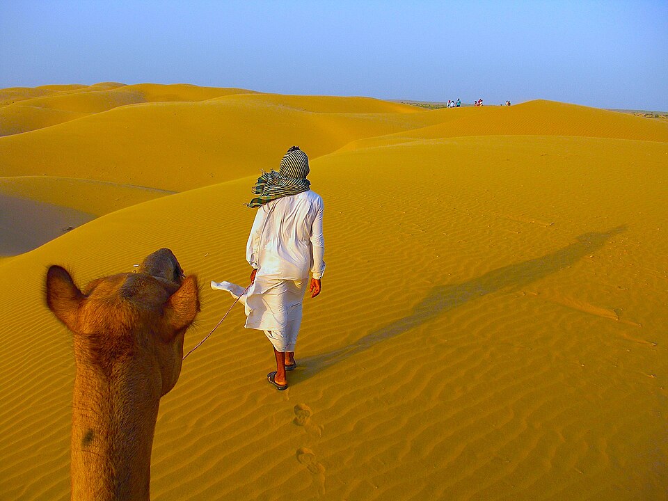
Why is the Thar so dry? The Aravalli run parallel to the south-west monsoon winds coming from the Arabian Sea, so they do not force these winds to rise and drop their rain. The winds from the Bay of Bengal have lost most of their moisture by the time they reach this far west. Hot, dry conditions and high evaporation complete the picture.
The desert has very few rivers, and most of them flow only after rain and then vanish into the sand. The Luni is the only large river of the region. Many streams end in salt lakes, such as Sambhar Lake, and do not reach the sea.
Wind shapes the land here. It builds crescent-shaped dunes called barchans and long dunes, and it carries sand over farmland. Over long periods, this region has seen wetter phases too, and some scientists link the lost Saraswati river to old dried channels in this area.
Life in the Thar has adapted to scarcity. People keep camels, goats and sheep, grow hardy crops such as bajra, and collect rainwater in tanks and step-wells. The Indira Gandhi Canal now brings water from the Himalayan rivers to parts of the desert, changing farming but also creating problems of waterlogging and salinity.
Why it matters. The Thar shows how relief and wind direction create deserts even within a monsoon country. Stopping its spread through tree belts, grazing control and water harvesting is an important environmental task. The desert is also rich in solar and wind energy, which is reshaping its economy today.
Two coasts, two characters
Between the Ghats and the sea lie India's coastal plains. The western coastal plain lies between the Western Ghats and the Arabian Sea, and it is narrow, because the Ghats rise steeply close to the coast. Short, fast rivers rush down from the Ghats and form estuaries rather than deltas.
From north to south, the west coast has three parts. The northern part is the Konkan coast, from around Mumbai to Goa. The middle part is the Kanara or Karnataka coast, and the southern part is the Malabar coast of Kerala, famous for its backwaters or kayals, shallow lagoons running parallel to the sea.
The eastern coastal plain lies between the Eastern Ghats and the Bay of Bengal, and it is much broader. Large rivers such as the Mahanadi, Godavari, Krishna and Kaveri build wide, fertile deltas here. The northern part is called the Northern Circars, and the southern part is the Coromandel coast.
The east coast also has large lagoons, formed where sand bars cut off part of the sea. Chilika Lake in Odisha is the largest saltwater lake in India, and Pulicat Lake lies on the border of Andhra Pradesh and Tamil Nadu. A long sand spit called Sriharikota, where India's main space launch centre stands, separates Pulicat from the sea.
The two coasts differ in their economic use. The west coast has more deep natural harbours, such as Mumbai, Mormugao and Kochi, while the east coast's broad deltas support intensive rice farming and dense populations. Both coasts support fishing, salt making, tourism and large port cities.
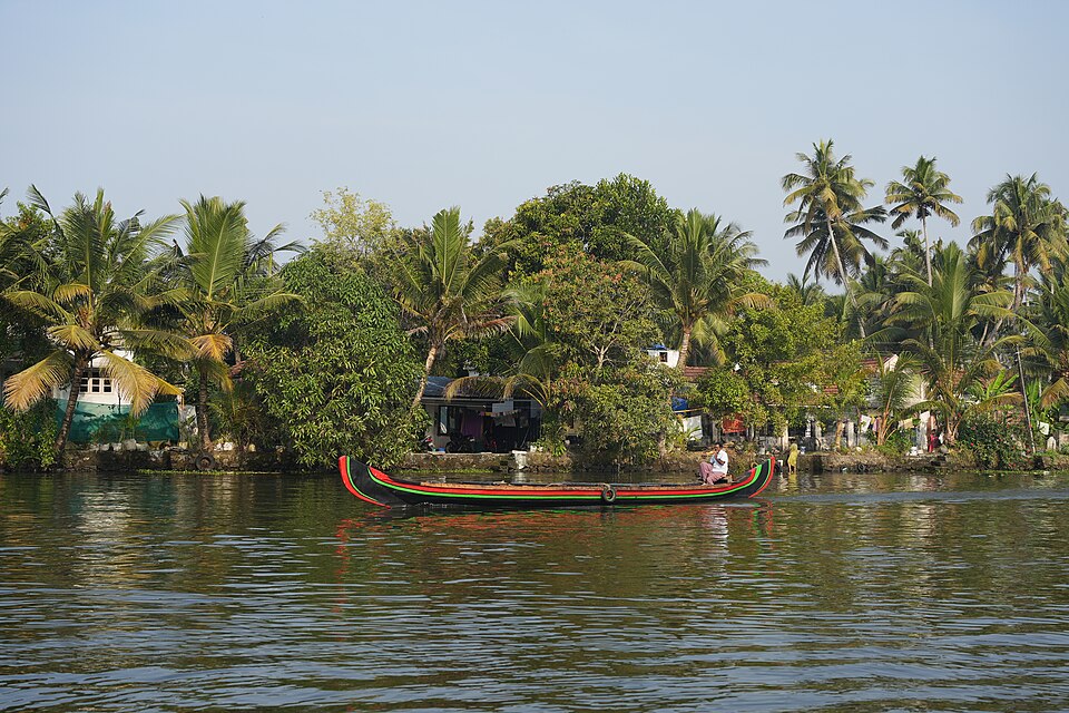
Why it matters. The coasts are India's gateways to world trade, and most of its foreign trade by volume passes through their ports. They also hold mangroves, lagoons and fisheries that support millions of people. At the same time, the low east coast faces cyclones and storm surges, while the whole coastline faces rising seas.
The islands
India has two main groups of islands, and they have very different origins. The Andaman and Nicobar Islands lie in the Bay of Bengal. They are the tops of a submerged mountain range, a continuation of the folded mountains of Myanmar, rising out of the sea.
These islands are hilly and covered with dense tropical forests, and they are home to several indigenous communities. The Andaman group lies to the north and the Nicobar group to the south, separated by the Ten Degree Channel. Great Nicobar is the largest island of the Nicobar group.
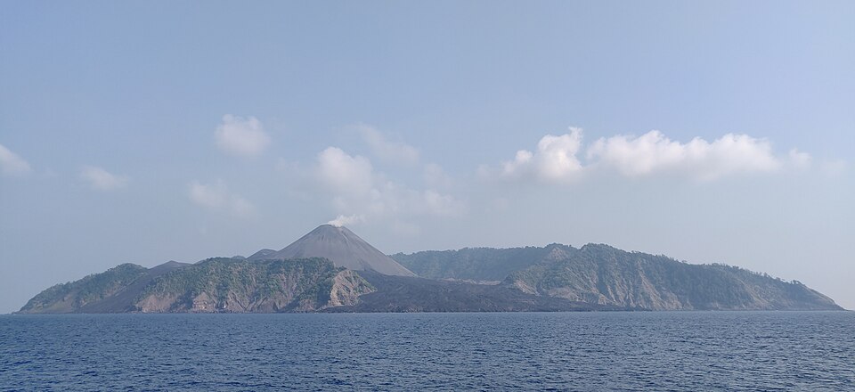
North-east of Port Blair lies Barren Island, India's only active volcano, which has erupted several times in recent decades. Nearby Narcondam is another volcanic island, now dormant. Their presence shows that this region lies on an active plate boundary, which is also why it suffers earthquakes and tsunamis.
The Lakshadweep Islands lie in the Arabian Sea, about 200 to 300 km off the coast of Kerala. They are coral islands, built by tiny sea creatures called coral polyps, and many are ring-shaped atolls around shallow lagoons. They are small, low and flat, and Minicoy is one of the larger islands in the south of the group.
Why it matters. The islands extend India's sea territory far into the ocean and lie close to key shipping lanes, giving them great strategic value. They are also ecologically fragile: coral reefs are damaged by warming seas, and the Andaman forests and their indigenous peoples need protection. Development here must be balanced with conservation and disaster safety.
Mains lens: what, why, where and so what
UPSC Mains often contrasts India's physical divisions and asks how they shape resources and risks. Here are four angles that connect this chapter to GS Papers I and III.
1. Old plateau, rich minerals. The ancient, stable rocks of the plateau explain India's mineral belts, from Chhota Nagpur's coal and iron to Karnataka's iron and gold. Answers can link geology with industry and with the displacement and environmental issues that mining brings.
2. Western Ghats versus Eastern Ghats. The continuous, high Western Ghats bring heavy rain and biodiversity, while the broken Eastern Ghats let rivers form deltas. Answers can compare their origin, relief, drainage and ecological value.
3. Contrasting coasts. A narrow west coast with estuaries and natural harbours contrasts with a broad east coast of deltas, lagoons and cyclone risk. Answers should link this to port development, fisheries and coastal disaster planning.
4. Desert and islands as frontiers. The Thar is a frontier of desertification but also of renewable energy, while the islands are strategic but ecologically fragile. Answers should balance development with conservation.
Mains lens: practice questions and answer plans
Now turn this understanding into written answers. The four questions below are written in the UPSC style, but they are our own practice questions, not previous-year questions. The real previous-year questions of your exam appear in the "Previous year questions" box once we have matched them with the official papers.
Q1. "Compare the Western Ghats and the Eastern Ghats." (150 words)
- Compare their continuity, height, peaks, rivers and rainfall.
- Then compare their biodiversity.
- Use a simple table and a sketch map.
Q2. "Why do the Narmada and the Tapi flow westward while most peninsular rivers flow east?" (150 words)
- Explain the general eastward slope of the plateau.
- Next, explain the rift valleys of the Narmada and the Tapi.
- Finally, note that they form estuaries, not deltas.
Q3. "Contrast the western and eastern coastal plains of India and their economic significance." (250 words)
- Introduction: Name the Ghats as the boundary.
- Body: Compare width, rivers, deltas versus estuaries, lagoons and backwaters, harbours, agriculture and hazards.
- Conclusion: Link the comparison to port-led development and coastal protection.
Q4. "The islands of India differ in origin and in their strategic and ecological importance. Discuss." (150 words)
- Describe the Andaman and Nicobar Islands as raised mountain tops with volcanoes, and Lakshadweep as coral.
- Then give their strategic value.
- End with the threats to their ecology.
Useful keywords: Gondwanaland, Peninsular Plateau, Central Highlands, Deccan Traps, rift valley, Aravalli, Guru Shikhar, Western Ghats, Anaimudi, Eastern Ghats, Mahendragiri, Nilgiri, Garo–Rajmahal gap, Thar, barchan, Luni, Konkan, Malabar, kayal, Northern Circars, Coromandel, Chilika, Pulicat, Barren Island, atoll.
Quick revision
- The Peninsular Plateau is a triangular block of old Gondwana rocks; the Narmada divides it into the Central Highlands (north) and the Deccan (south).
- Narmada and Tapi flow west in rift valleys; the Deccan Traps are lava sheets that formed black soil.
- Aravalli: oldest fold mountains, about 800 km, Guru Shikhar 1,722 m.
- Western Ghats: continuous, about 1,600 km, Anaimudi 2,695 m; Eastern Ghats: low, broken, Mahendragiri 1,501 m; they meet in the Nilgiris.
- Meghalaya plateau is an outlier, cut off by the Garo–Rajmahal gap.
- Thar: west of the Aravalli, very low rain, dunes, Luni river.
- West coast narrow (Konkan, Kanara, Malabar, kayals); east coast broad with deltas (Northern Circars, Coromandel), Chilika and Pulicat lagoons.
- Andaman and Nicobar: raised mountain tops, Barren Island volcano; Lakshadweep: coral atolls.
BPSC CCE questions from this chapter
The two volcanic Islands in the Indian Territory are -
- (a) Kavaratti and New Moore
- (b) Bitra and Kavaratti
- (c) Pamban and Barren
- (d) Narcondam and Barren
Show answer
(d) Narcondam and Barren · our answer; official key awaited
Which is the Scotland of North-East India ?
- (a) Nagaland
- (b) Meghalaya
- (c) Assam
- (d) Arunachal Pradesh
Show answer
(b) Meghalaya · our answer; official key awaited
On which plateau, the Tropic of Cancer and the Indian Standard Time Line intersect each other?
- (a) Bundelkhand
- (b) Baghelkhand
- (c) Malwa
- (d) None of the above
Show answer
(b) Baghelkhand · our answer; official key awaited
The rivers Damodar, Koel and Subarnarekha originate from which of the following?
- (A) Deccan Plateau
- (B) Central Highland
- (C) Chota Nagpur Plateau
- (D) Meghalaya Plateau
- (E) None of the above/More than one of the above
Show answer
(C) Chota Nagpur Plateau · our answer; official key awaited