Paper 2: General Knowledge (General Studies, General Science and Mathematics, Mental Ability) · General science: physics, chemistry, biology, geography
BPSC LDC questions from this module are being sorted into our bank.
Cut to basic depth for BPSC LDC. 22 deeper paragraphs are in the full chapter.
Start from zero: an address for every place
Your home has an address: house number, street, town, PIN code. But how do you give an address to a ship in the middle of the ocean, or a remote peak in the Himalaya? Geographers solved this long ago by drawing an imaginary grid over the Earth.
Parallels + meridians = an address
The grid has two sets of lines. Lines running east–west around the globe are parallels of latitude, and they tell how far north or south a place is. Lines running north–south from pole to pole are meridians of longitude, and they tell how far east or west a place is.
Where a parallel and a meridian cross, you get a unique point. So any place on Earth can be located by two numbers, its latitude and longitude, just as a phone's map shows your location.
Why it matters. The grid lets us locate places, draw boundaries, navigate ships and aircraft, and plan rescue operations. Latitude also tells us a lot about climate, and longitude tells us about time. Satellite navigation systems such as GPS and India's NavIC give positions in these same coordinates.
Latitude and the heat zones
Latitude is the angle, measured at the Earth's centre, between a place and the equator. The equator is 0°, and latitudes run up to 90° N at the North Pole and 90° S at the South Pole. All places with the same latitude lie on a circle called a parallel.
The grid of latitudes and longitudes
Parallels are not all the same size. The equator is the longest, and parallels become smaller towards the poles, where they shrink to a point. But the distance between two parallels one degree apart is nearly constant, about 111 km.
A few parallels are especially important. The Tropic of Cancer (23½° N) and the Tropic of Capricorn (23½° S) mark the limits where the noon Sun can be directly overhead. The Arctic Circle (66½° N) and Antarctic Circle (66½° S) mark the limits beyond which the Sun can stay above or below the horizon for a whole day.
These parallels divide the Earth into heat zones. Between the tropics lies the torrid zone, which gets the most heat. Between the tropics and the polar circles lie the two temperate zones, with moderate temperatures, and beyond the polar circles lie the two frigid zones, the coldest parts of the Earth.
India on the grid
India lies roughly between 8°4′ N and 37°6′ N, and the Tropic of Cancer divides it into a southern half in the torrid zone and a northern half in the temperate zone. Yet the whole country has a broadly tropical monsoon climate, because the Himalaya keep out cold northern winds.
Why it matters. Latitude is the first control on climate, because it decides how much sunlight a place receives. It helps explain why Kerala is warm all year while Ladakh has severe winters. Planners use latitude to estimate solar energy potential, crop seasons and heating or cooling needs.
Longitude and local time
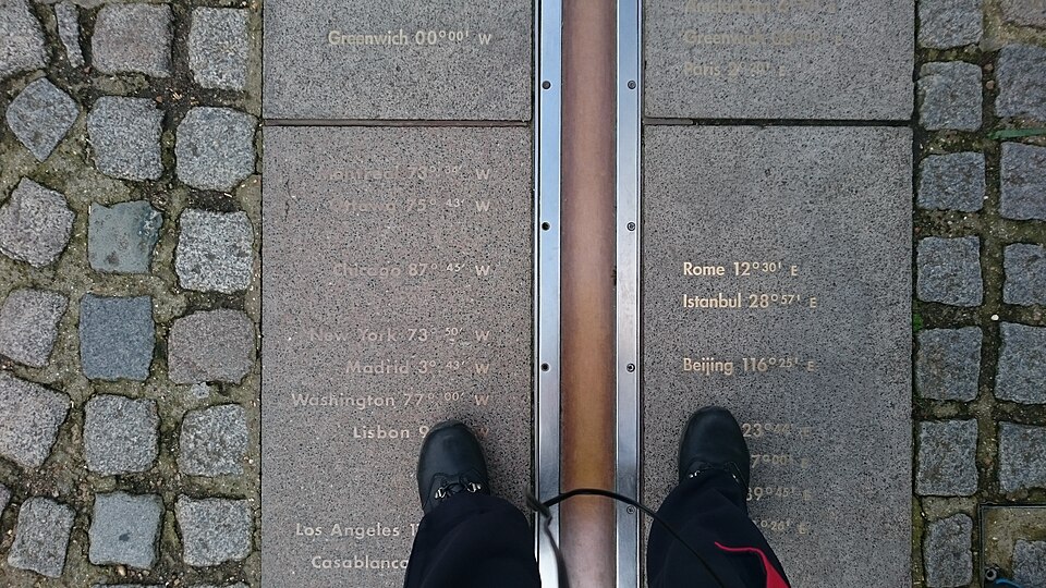
Longitude is the angle east or west of a starting meridian. Unlike the equator, there is no natural starting line, so in 1884 the world agreed to use the meridian passing through the Royal Observatory at Greenwich, near London, as the Prime Meridian (0°). Longitudes run up to 180° E and 180° W.
15 degrees = 1 hour
Each meridian is a half-circle from pole to pole, and all meridians are of equal length. They are farthest apart at the equator and meet at the poles, so the distance covered by one degree of longitude shrinks from about 111 km at the equator to zero at the poles.
Longitude is closely tied to time. The Earth turns 360° in 24 hours, so it turns 15° every hour, or 1° every 4 minutes. When it is noon at one place, it is already past noon at places to the east, which saw the Sun first, and still morning at places to the west.
The time based on the Sun's position at a place, with noon when the Sun is highest, is called its local time. Using the 4-minute rule, the difference in local time between two places can be worked out from their difference in longitude. For example, a place 15° east of another is one hour ahead.
Why it matters. The link between longitude and time solved one of history's great problems: finding a ship's position at sea using accurate clocks. Today it underpins time zones, flight schedules, financial markets that open in sequence around the world, and the timing of satellite signals.
Standard time, time zones and the Date Line
If every town kept its own local time, trains, offices and broadcasts would be chaos. So each country chooses a standard meridian, and the local time of that meridian is used everywhere in the country as standard time. Standard times are usually set a whole or half number of hours ahead of or behind Greenwich Mean Time (GMT).
Time across India and the world
India's standard meridian is 82°30′ E, which passes near Mirzapur in Uttar Pradesh. Indian Standard Time (IST) is therefore 5 hours 30 minutes ahead of GMT. India spans about 30° of longitude, so the Sun rises about two hours earlier in Arunachal Pradesh than in western Gujarat, though both keep the same clock.
This has led to a long debate. People in the North-East lose useful daylight in the evening, and some have asked for a separate time zone; tea gardens in Assam long kept their own "garden time", set an hour ahead. Others argue that one time zone is simpler and supports national integration.
Very wide countries such as Russia, the United States and Canada use several time zones. Around the world, the time zones together cover 24 hours. Where the eastward and westward counts meet, near the 180° meridian, lies the International Date Line.
Crossing the Date Line
The Date Line zigzags to avoid cutting through countries and island groups. A traveller crossing it westward, say from the United States towards Japan, adds a day. A traveller crossing it eastwardgoes back a day and lives the same date twice.
Why it matters. Time zones affect daily life, energy use and productivity, which is why the North-East time zone debate keeps returning. The Date Line matters for shipping, aviation and international business. Exam questions often test time calculation, so the 15° per hour rule is worth practising.
Quick revision
Earth: oblate spheroid (equatorial bulge, polar flattening); geoid = mean-sea-level gravity surface. Eratosthenes: circumference about 40,000 km.
Latitude: 0° to 90° N/S; parallels shrink poleward; 1° ≈ 111 km.
Exam-style questions on this chapter. Pick an answer to see the explanation. 0 of 8 answered
If it is 12 noon at Greenwich, what is the local time at a place on 90° E?
The standard meridian of India is:
Consider the following statements:
1. All parallels of latitude are of equal length.
2. All meridians of longitude are of equal length.
Which of the statements given above is/are correct?
A ship crossing the International Date Line from east to west (for example, from America towards Asia) will:
The Earth bulges at the equator and is flattened at the poles mainly because of:
The temperate zone of the Northern Hemisphere lies between:
Consider the following statements:
1. One degree of latitude covers roughly the same distance everywhere.
2. One degree of longitude covers the same distance at the equator and near the poles.
Which of the statements given above is/are correct?
India's east–west extent of about 30° of longitude means a local-time difference of about:
Previous year questions
Previous year questions for UPSC CSE will appear here once each one is checked word for word against the official question paper.
Frequently asked questions
What is the true shape of the Earth?
Earth is an oblate spheroid, slightly flattened at the poles and bulging at the equator because of rotation. Its exact gravity-based shape is called the geoid.
Which meridian is used for Indian Standard Time?
IST is based on 82°30′E, which passes near Mirzapur in Uttar Pradesh. It is 5 hours 30 minutes ahead of Greenwich Mean Time.
Why does local time change by 4 minutes per degree?
Earth turns 360° in 24 hours, which is 15° an hour or 1° every 4 minutes. Places east are ahead in time and places west are behind.
What happens when you cross the International Date Line?
The Date Line runs roughly along 180°. Crossing it westward you gain a day, and crossing it eastward you repeat a day.