

BPSSC SI · Module 28 · standard depth · 12 min
Industries, transport and location factors
What BPSSC SI asks from this chapter
Syllabus lines this chapter covers:
- Mains Paper II: GS, science, civics, history, geography, maths · Indian geography
BPSSC SI questions from this module are being sorted into our bank.
Cut to standard depth for BPSSC SI. 11 deeper paragraphs are in the full chapter.
Start from zero: why factories are where they are
Think of a sugar mill. It must crush cane within a day of cutting, so it sits in the middle of cane fields. A steel plant needs huge amounts of iron ore and coal, so it sits near the mines, while a soft-drink bottling plant sells to millions of people and so sits near big cities. Each factory chooses a spot where the total cost of getting raw materials in and products out is lowest.
These choices depend on geographical factors: raw materials, energy, water, labour, markets, transport and climate. They also depend on non-geographical factors, such as government policy, tax incentives, capital, banking and political stability. Once a few industries settle in one place, more follow to share roads, power, skilled workers and suppliers. This snowball effect is called agglomeration.
Transport is the thread that ties all of this together. Roads, railways, waterways, ports, airways and pipelines carry raw materials to factories and goods to markets, and they decide which regions can industrialise.
Why it matters. Location factors explain India's industrial map, its regional imbalances and the logic of new industrial corridors. Prelims asks about plant locations, and Mains asks why industries shift.
Raw material, market and the steel industry
A key idea in location theory is weight loss. If raw materials lose much of their weight during manufacture, it is cheaper to process them near their source and ship the lighter product. Steel is the classic case: several tonnes of iron ore, coal and limestone make one tonne of steel, so steel plants sit near ore or coal. Sugar, copper smelting and paper pulp follow the same logic.
If the product is bulkier, more fragile or more perishable than the raw material, the factory moves towards the market. Oil refineries are an example, because one pipeline of crude oil becomes many separate products such as petrol, diesel and LPG that are cheaper to make near consumers. Bread, soft drinks and many consumer goods are also market-oriented.
India's iron and steel industry shows the raw-material pull clearly. Tata Iron and Steel Company began at Jamshedpur in 1907, close to iron ore of Odisha and Jharkhand, coal of the Damodar valley and water of the Subarnarekha. After Independence, public sector plants came up at Bhilai (Chhattisgarh), Rourkela (Odisha) and Durgapur (West Bengal), and later at Bokaro (Jharkhand), all within the ore–coal belt of the Chota Nagpur plateau and its surroundings.
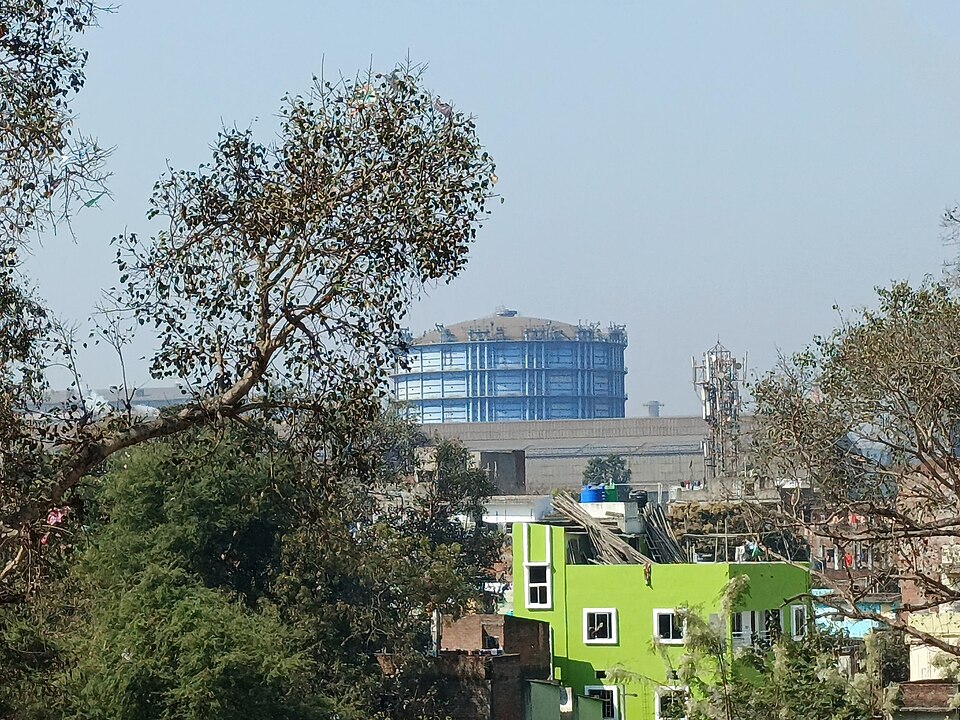
Newer plants follow a different logic. Visakhapatnam, India's first shore-based integrated steel plant, uses imported coking coal through its port, and several private plants now stand on the coasts of Odisha, Gujarat and Karnataka. As coking coal is imported, a coastal location reduces transport cost.
Why it matters. The shift of steel from inland mines to coasts shows how imports, technology and policy change location. Steel is also central to construction, defence and manufacturing growth.
Agro-based industries: textiles and sugar
The cotton textile industry was India's first large modern industry. The first successful mill opened in Mumbai in 1854, and Mumbai and Ahmedabad became the two great centres. They had raw cotton from the black-soil Deccan and Gujarat, a port for importing machinery and exporting cloth, capital from traders, and a humid climate that helps spin cotton without breaking the thread. Mumbai came to be called "Cottonopolis".
Over time, the industry spread out. Cheap hydroelectricity, local cotton and skilled labour made Coimbatore a major centre, often called the "Manchester of South India". Surat grew as a hub for synthetic fabrics, and Tiruppur for knitwear exports. Power looms and garment units in small towns now employ far more workers than the old composite mills, many of which closed in Mumbai.
The jute industry grew along the Hugli river near Kolkata in the nineteenth century, because raw jute grew in the delta, water was plentiful for processing, coal came from the Damodar valley and Kolkata port handled exports. Partition cut the mills off from most jute fields, which went to East Pakistan, and the industry now faces competition from synthetic packaging.
Sugar mills must be close to cane fields, because cane starts losing its sugar content within a day of cutting and is too bulky to carry far. The industry was first concentrated in Uttar Pradesh and Bihar, but it has shifted steadily towards Maharashtra, Karnataka and Tamil Nadu. The peninsula offers higher sugar content, a longer crushing season and well-organised cooperative mills.
Why it matters. Agro-based industries link farms to factories and provide jobs in small towns. Their shifts show how climate, cooperatives and technology redraw the industrial map.
Industrial regions, knowledge industries and corridors
Industries cluster into industrial regions. Geographers identify eight major regions in India: Mumbai–Pune, the Hugli belt around Kolkata, Bengaluru–Tamil Nadu, Gujarat (Ahmedabad–Vadodara), Chota Nagpur, Visakhapatnam–Guntur, Gurugram–Delhi–Meerut and Kollam–Thiruvananthapuram. Each grew around a mix of ports, minerals, power, capital and labour.
For example, the Mumbai–Pune region grew on cotton, a port and hydropower from the Western Ghats, and later added engineering, chemicals and vehicles. The Chota Nagpur region rests on coal and iron ore and hosts heavy industry. The Gujarat region rose with cotton and later petrochemicals and refineries at Koyali and Jamnagar, while the Gurugram–Delhi–Meerut region specialises in light industries and vehicles close to a huge market.
Knowledge-based industries, such as information technology and software services, follow a different logic. They need skilled graduates, good telecom links, airports and pleasant cities more than raw materials, so they cluster in Bengaluru, Hyderabad, Pune, Chennai, the National Capital Region and Mumbai.
To spread industry more evenly, the government plans industrial corridors along major freight routes. The Delhi–Mumbai Industrial Corridor, built along the Western Dedicated Freight Corridor, plans new smart industrial townships such as Dholera in Gujarat and Shendra–Bidkin near Aurangabad. Other corridors link Chennai–Bengaluru, Amritsar–Kolkata and the east coast.
Why it matters. Industrial regions explain why some states are richer than others. Corridors and knowledge hubs show how policy tries to spread jobs beyond the old clusters.
Roads and railways
Roads reach every corner of the country and carry most of India's passengers and goods. They are classed by who builds and maintains them: National Highways, built by the central government and linking states, ports and big cities; State Highways; district roads; rural roads, expanded greatly under rural road schemes; and border roads, built by the Border Roads Organisation (set up in 1960) in high mountains and border areas for defence and development.
Major highway projects have reshaped road travel. The Golden Quadrilateral links Delhi, Mumbai, Chennai and Kolkata, while the North–South and East–West corridors cross the country from Srinagar to Kanyakumari and from Silchar to Porbandar. The Bharatmala programme adds economic corridors, expressways and border roads.
Railways carry bulk freight such as coal, ore, cement and food grains cheaply over long distances. India's first passenger train ran from Bombay to Thane in 1853, and today Indian Railways is one of the world's largest networks, mostly on broad gauge after a long gauge-conversion drive. The network is densest on the northern plains, where flat land, fertile soil and dense population made building cheap and traffic heavy, and thinnest in the Himalaya, the Thar desert, the North-East and the hilly forests of central India.
Because passenger and goods trains share the same tracks, freight is slow. The Dedicated Freight Corridors, the Eastern one from Punjab to West Bengal and the Western one from Dadri to the Mumbai ports, give goods trains their own tracks. This frees passenger lines and cuts logistics costs.
Why it matters. Roads and railways decide which regions can reach markets. Low freight cost and good connectivity are key to manufacturing competitiveness.
Waterways, ports, airways and pipelines
Inland waterways are the cheapest and least polluting way to move bulk cargo, but India uses them little because many rivers are seasonal, shallow or blocked by dams and silt. The Inland Waterways Authority of India was set up in 1986. National Waterway 1 runs on the Ganga–Bhagirathi–Hugli from Prayagraj to Haldia, National Waterway 2 on the Brahmaputra and National Waterway 3 on the West Coast Canal in Kerala, and over a hundred rivers have now been declared national waterways.
Sea ports handle the bulk of India's foreign trade by volume. On the west coast, the major ports are Kandla (Deendayal) and the Mumbai–Jawaharlal Nehru Port pair, India's biggest container hub, along with Mormugao, New Mangalore and Kochi. On the east coast they are Tuticorin (VOC port), Chennai, Kamarajar (Ennore), Visakhapatnam, the deepest natural harbour on the east coast, Paradip and Kolkata–Haldia, a riverine port. Many private and state ports, such as Mundra, also handle large cargo.
The Sagarmala programme, launched in 2015, aims at port-led development: modernising ports, linking them to highways and rail, and building coastal economic zones. Coastal shipping between Indian ports is also being revived to cut road and rail congestion.
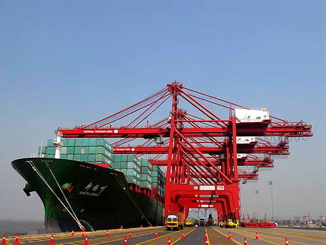
Airways are the fastest mode, vital for passengers, perishable and high-value goods, and remote areas like the North-East, Ladakh and the islands. Regional connectivity schemes have opened many small airports. Pipelines carry crude oil, petroleum products and gas cheaply and safely over long distances, linking ports, oil fields, refineries and cities, such as the Hazira–Vijaipur–Jagdishpur gas pipeline.
Why it matters. A balanced mix of modes cuts logistics costs, pollution and congestion. Ports and waterways are also central to India's maritime and trade ambitions.
Quick revision
- Location factors: raw material, energy, water, labour, market, transport, climate + policy, capital.
- Weight-losing (steel, sugar, copper) → near raw material; market-oriented (refineries, consumer goods) → near cities.
- Steel: Jamshedpur (1907), Bhilai, Rourkela, Durgapur, Bokaro in Chota Nagpur belt; Visakhapatnam first shore-based plant.
- Cotton: Mumbai (1854), Ahmedabad; later Coimbatore, Surat, Tiruppur. Jute: Hugli belt. Sugar: shifting from UP to Maharashtra–Karnataka–Tamil Nadu.
- Eight industrial regions; DMIC with Dholera and Shendra–Bidkin.
- First train 1853 Bombay–Thane; rail densest on northern plains; Eastern and Western DFCs.
- NW1 Prayagraj–Haldia (Ganga); IWAI 1986; Sagarmala 2015; Bharatmala for highways.
- Visakhapatnam deepest natural harbour on east coast; JNPT biggest container port; Kolkata–Haldia riverine.