

CSBC Special Branch · Module 12 · standard depth · 14 min
The Himalaya and the Northern Plains
What CSBC Special Branch asks from this chapter
Syllabus lines this chapter covers:
- Paper 2: GS and current affairs 50, Mathematics 30, Bihar GK 20 · General studies and current affairs
CSBC Special Branch questions from this module are being sorted into our bank.
Cut to standard depth for CSBC Special Branch. 11 deeper paragraphs are in the full chapter.
Start from zero: reading India's relief
If you could fly over India from north to south, you would see the land change dramatically. First come snowy peaks and deep valleys, then a vast flat plain with slow, winding rivers, then an old rocky plateau of hills and tablelands, and finally narrow coastal strips with beaches and lagoons. Far out at sea lie scattered islands.
Geographers call this pattern of high and low land relief or physiography. India is usually divided into five physiographic divisions: the Himalaya, the Northern Plains, the Peninsular Plateau, the coastal plains and the islands. Each has a different origin, a different landscape and a different way of life.
These divisions did not form at the same time. The Peninsular Plateau is one of the oldest landmasses on earth, while the Himalaya are among the youngest mountains. The Northern Plains are younger still, built from the soil washed down by rivers from both.
This chapter covers the two northern divisions, the Himalaya and the Northern Plains. They are closely linked, because the plains are made from material worn away from the mountains. The plateau, the desert, the coasts and the islands follow in the next part of the module.
Why it matters. Relief controls where rain falls, where rivers flow, where soil is fertile and where people can live and farm. The mountains and plains of the north hold India's biggest rivers and its most crowded farmland. Understanding them is the first step to understanding Indian agriculture, settlement and disasters.
How the Himalaya were born
About 200 million years ago, the land masses of the earth were joined together. A long, shallow sea called the Tethys lay between a northern landmass called Angaraland and a southern one called Gondwanaland, of which the Indian landmass was a part. For millions of years, rivers from both sides poured sediments into this sea, where they piled up in thick layers.
Then Gondwanaland broke apart, and the Indian landmass began to move north. As it pushed towards Angaraland, the sediments of the Tethys were caught between them, like a tablecloth pushed from both ends. They were squeezed, folded and thrust upward, rising slowly into the Himalaya.
This is why the Himalaya are called young fold mountains. Their rocks are folded, faulted and pushed over one another, and fossils of sea creatures are found high on their slopes, proof that these rocks once lay under the sea. The collision has not stopped, so the Himalaya are still rising, and the region suffers frequent earthquakes.
Today the Himalaya stretch for about 2,400 km, from Jammu and Kashmir and Ladakh in the west to Arunachal Pradesh in the east. Their width varies from about 400 km in the west to about 160 km in the east. They contain the highest peaks on earth, including Mount Everest in Nepal and Kanchenjunga, the highest peak in India.
Why it matters. The young age of the Himalaya explains their steep slopes, high peaks, deep gorges and frequent earthquakes and landslides. Their rocks are still being worn down fast, which is why Himalayan rivers carry so much silt. Building roads, dams and towns here needs great care.
Three ranges side by side
The Himalaya are not one single ridge. They are made of three parallel ranges, one behind the other, with valleys and plateaus between them. Going from north to south, the ranges become lower and younger.
The northernmost and highest range is the Great Himalaya or Himadri. Its average height is about 6,000 m, and its core is made of granite. It holds the highest peaks, such as Everest, Kanchenjunga, Nanga Parbat and Nanda Devi, and it remains under perpetual snow, feeding many glaciers.
South of the Himadri lies the Lesser Himalaya or Himachal, at about 3,500 to 4,500 m. Its main ranges are the Pir Panjal, the longest and most important, the Dhaula Dhar and the Mahabharat ranges. The famous Kashmir valley lies between the Pir Panjal and the Great Himalaya, and many hill stations such as Shimla, Mussoorie and Darjeeling are found in this range.
The outermost range is the Shiwalik, at about 600 to 1,500 m. It is made of loose sediments brought down by rivers from the higher ranges. Between the Shiwalik and the Lesser Himalaya lie flat, long valleys called duns, such as Dehra Dun, which are good for farming and settlement.
North of the Great Himalaya lie the Trans-Himalayan ranges, such as the Karakoram, Ladakh, Zanskar and Kailash ranges. Much of this area, including Ladakh, is a high, cold desert that lies in the rain shadow of the Great Himalaya. The Karakoram holds K2, the second highest peak in the world, and some of the largest glaciers outside the polar regions.
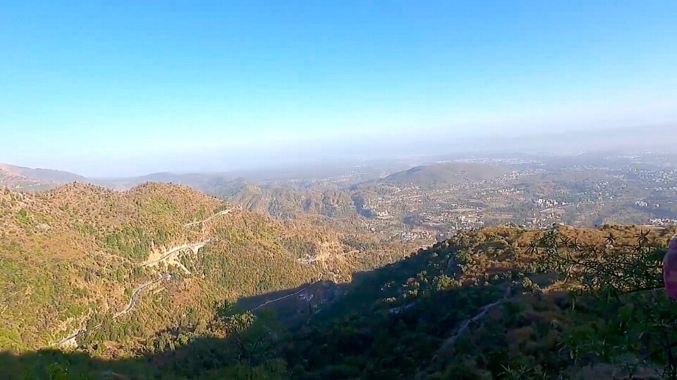
Why it matters. Each range supports a different way of life: snowy peaks feed rivers, the Lesser Himalaya hold forests, orchards and hill towns, and the duns allow farming. The ranges also act as barriers, and the passes that cross them have been routes for trade, pilgrimage and armies. Exams often ask which range or valley lies where.
The Himalaya from west to east, and why they matter
The Himalaya can also be divided from west to east, using the river valleys that cut across them. The part between the Indus and the Satluj is the Punjab or Kashmir Himalaya, and the part between the Satluj and the Kali is the Kumaon Himalaya. Between the Kali and the Teesta lies the Nepal Himalaya, and between the Teesta and the Dihang (Brahmaputra) lies the Assam Himalaya.
These parts differ in climate and vegetation. The western Himalaya are drier, with cold deserts beyond the main range, while the eastern Himalaya receive far more rain and are covered with dense forests. The snow line is also lower in the east than in the west.
Beyond the deep Dihang gorge, the mountains bend sharply to the south and form the Purvanchal or eastern hills. They include the Mishmi hills, the Patkai Bum, the Naga hills, the Manipur hills and the Mizo (Lushai) hills, along India's border with Myanmar. These hills are mostly below 2,000 m but are hard to cross because of thick forests and rough terrain.
The Himalaya matter to India in many ways. They act as a climatic wall, blocking the icy winds of Central Asia in winter and forcing the monsoon winds to rise and shed their rain over India in summer. Their glaciers feed perennial rivers such as the Ganga, the Indus and the Brahmaputra, which flow even in the dry season.
These rivers carry silt that built the fertile Northern Plains, and their steep fall gives a huge potential for hydroelectric power. The mountains also provide forests, medicinal plants, pastures and tourism. They have long served as a natural frontier, though the passes across them have always linked India with its neighbours.
Why it matters. Without the Himalaya, northern India would be colder and much drier, and the Ganga plain would not exist in its present form. At the same time, the region is fragile: deforestation, road building and glacier melt threaten its stability. Protecting the Himalaya is therefore vital for India's water, food and climate security.
The Northern Plains: a gift of the rivers
South of the Himalaya lies one of the largest and most fertile plains in the world. The Northern Plains stretch from the Rajasthan and Punjab plains in the west to the Ganga delta and the Brahmaputra valley in the east. They are built by three river systems, the Indus, the Ganga and the Brahmaputra, and their tributaries.
The plains cover about 7.8 lakh sq km. Within India they run for about 2,400 km, and they are about 150 to 300 km wide. The land is remarkably flat, sloping very gently towards the sea, so rivers here flow slowly and wind across the land in loops called meanders.
How did such a flat plain form? As the Himalaya rose, the land in front of them sank into a long, deep trough called a foredeep. Rivers flowing from the mountains, and some from the Peninsula, filled this trough with sand, silt and clay over millions of years. The sediments are hundreds of metres thick, and rivers are still adding to them.
This alluvial soil is deep, soft and fertile. Together with perennial rivers and a warm climate, it makes the plains the granary of India, where wheat, rice, sugarcane and pulses are grown on a large scale. The plains support about 40% of India's population on roughly a third of its area.
Rivers also shaped history here. Great empires, cities and centres of learning and religion grew along the Ganga and its tributaries. Even today, the plains hold many of India's largest cities and its densest rural populations.
Why it matters. The Northern Plains feed much of India and hold a large part of its people. But the same rivers that built them also flood them, and heavy use of groundwater and fertilisers is stressing the soil and water. The future of Indian agriculture depends heavily on how these plains are managed.
Belts and regions of the plains
The plains may look the same everywhere, but walking south from the foothills reveals four distinct belts. The first is the bhabar, a narrow belt about 8 to 16 km wide right at the foot of the Shiwaliks. Here rivers coming down from the hills drop pebbles and boulders, and the ground is so porous that small streams sink and disappear underground.
South of the bhabar lies the terai, a wider belt where those streams reappear at the surface. The water table is high, so the land is wet, marshy and thickly forested, and it is rich in wildlife. Much of the terai has been cleared for farming, but national parks such as Jim Corbett and Dudhwa still protect parts of it.
Beyond the terai, the plain is made of alluvium in two forms. Bhangar is the older alluvium on slightly higher ground, above the reach of floods; it often contains lime nodules called kankar. Khadar is the new alluvium of the flood plains along the rivers, renewed almost every year, and it is very fertile.
The plains are also divided into regions. In the west lies the Rajasthan plain, mostly dry and sandy. The Punjab–Haryana plain is drained by the Satluj, Beas and Ravi, and it is made of doabs, the land between two rivers, such as the Bist Doab between the Beas and the Satluj.
The Ganga plain is the largest region, stretching from Delhi to the Bengal delta, with features such as ox-bow lakes, levees and shifting river channels. In the east, the Brahmaputra plain of Assam is a long, narrow valley flooded every year. In the Brahmaputra lies Majuli, one of the largest inhabited river islands in the world.
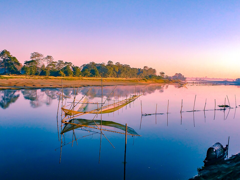
Why it matters. Each belt suits different uses: the bhabar and terai support forests and wildlife, the khadar gives rich crops but floods, and the bhangar is safer for settlement. Knowing these differences helps in planning farming, settlements and flood control. Exams regularly test the order and features of these belts.
Quick revision
- Five divisions: Himalaya, Northern Plains, Peninsular Plateau, coastal plains, islands.
- Himalaya: about 2,400 km long, 160–400 km wide; young fold mountains from the Tethys sediments; still rising.
- Himadri about 6,000 m, granite core, highest peaks; Himachal 3,500–4,500 m (Pir Panjal, Dhaula Dhar, Mahabharat); Shiwalik 600–1,500 m with duns.
- Trans-Himalaya: Karakoram, Ladakh, Zanskar, Kailash.
- West to east: Punjab/Kashmir (Indus–Satluj), Kumaon (Satluj–Kali), Nepal (Kali–Teesta), Assam (Teesta–Dihang); then Purvanchal (Mishmi, Patkai, Naga, Manipur, Mizo).
- Northern Plains: about 7.8 lakh sq km, about 2,400 km in India, 150–300 km wide; formed by filling a foredeep; about 40% of people.
- Belts: bhabar (pebbles, streams vanish), terai (marshy, forested), bhangar (old alluvium, kankar), khadar (new alluvium).