

HPSC HCS · Module 26 · Mains depth · 15 min
Grasslands, deserts and polar regions
What HPSC HCS asks from this chapter
Syllabus lines this chapter covers:
- Prelims Paper I: General Studies · Indian and world geography
- Mains · GS I: culture, modern and world history, society, geography, Haryana issues
HPSC HCS has asked 1 question from this chapter (2023); 2 from its whole module.
Read at full depth: basics, the standard layer and the Mains analysis.
Start from zero: where trees give way to grass
Trees need water all year or at least a reliable rainy season. Where rainfall is too low, too seasonal or the ground too cold, trees struggle and grasses, shrubs or small hardy plants take over. This is why vast parts of the Earth are covered not by forest but by grassland, desert or tundra.
The first of these is the tropical grassland or savanna. It lies between the equatorial rainforests and the hot deserts, roughly between 5° and 20° latitude on both sides of the equator. The climate has a hot wet summer and a long dry winter, matching Köppen's Aw type.
Savannas are covered with tall grasses, sometimes taller than a person, with scattered trees that can survive drought, such as acacia, with its umbrella shape, and baobab, which stores water in its thick trunk. In the dry season the grass turns brown and fires are common, which helps keep trees from spreading.
Savannas have regional names. They are called Llanos in Venezuela and Colombia, Campos in Brazil, and in East Africa the parklands of Kenya and Tanzania are famous for herds of zebra, wildebeest, giraffe and elephants, along with lions and cheetahs. Large parts of peninsular India once had savanna-like vegetation too.
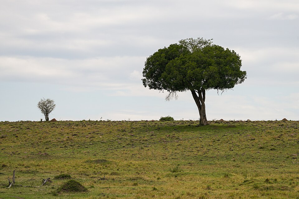
The savanna is not the same everywhere. Nearest the rainforest, where rain is heavier, lies woodland savanna with many trees. Further out comes parkland savanna, open grass with patches of trees where the soil holds water or the water table is high. Next to the desert lies open grassland savanna, where trees survive the long dry season with deep roots, and many are fire resistant.
Why it matters. Savannas support large herds of wildlife, pastoral peoples and growing farm populations. They are also among the regions most affected by droughts and land degradation.
Temperate grasslands: the world's granaries
In the interiors of continents in the mid-latitudes, far from the sea, rainfall is moderate and falls mainly in spring and early summer, while winters are cold. Trees find it hard to grow, but short, nutritious grasses thrive. These are the temperate grasslands.
They have different names in different continents. They are the Steppes of Eurasia, from Ukraine to Mongolia; the Prairies of North America; the Pampas of Argentina; the Veld of South Africa; the Downs of Australia; and the Canterbury plains of New Zealand.
For thousands of years these grasslands supported nomadic herders and huge herds of grazing animals, such as the bison of the Prairies. The dead grass roots built up deep, dark, humus-rich soils, known as chernozem in the Steppes, among the most fertile in the world.
From the 19th century, settlers ploughed these lands with machines and turned them into the world's great wheat-growing regions, earning them the name "granaries of the world". Large cattle and sheep ranches also developed, especially in the Pampas, the Downs and the Prairies, exporting meat, wool and dairy products.
Why it matters. Temperate grasslands feed much of the world through wheat and meat exports. Over-ploughing in drought years can turn them into dust bowls, as happened in the American Prairies in the 1930s.
Hot deserts: why they lie on western coasts
A desert is a region that receives very little rain, usually less than 25 cm a year, where evaporation far exceeds precipitation. The largest hot deserts are the Sahara and the Arabian desert, the Kalahari and Namib in southern Africa, the Atacama in South America, the great Australian desert, the Sonoran of North America and the Thar of India and Pakistan.
Most of them lie between about 15° and 30° latitude on the western sides of continents. The first reason is the subtropical high-pressure belt, where air sinks, warms and becomes dry, so clouds cannot form. The second is the trade winds, which blow from the east and lose their moisture over the land before reaching the west coast, or blow offshore there.
The third reason is cold ocean currents along the west coasts. The Humboldt (Peru) current off the Atacama, the Benguela off the Namib, the Canaries off the western Sahara, the West Australian current and the California current cool the air above them, making it stable and unable to rise and form rain.
Cold currents often cause coastal fog instead of rain, which some desert plants and insects use as a water source. The Atacama, beside the cold Humboldt current, is among the driest places on Earth, with some weather stations that have recorded almost no rain for years.
Why it matters. This combination of pressure belts, winds and currents is a classic Mains and Prelims theme. It explains why the west coasts of continents at these latitudes are dry while east coasts are wetter.
Life in deserts, and cold deserts
Deserts have extreme conditions. Days can be scorching, above 45 °C in the shade, while nights can be cold, because dry air and clear skies let heat escape quickly. This large daily range of temperature breaks rocks apart and shapes desert landforms.
Desert plants, called xerophytes, have special ways to survive. Some have very long roots to reach deep water, or wide shallow roots to catch brief showers. Others have small, spiny or waxy leaves to reduce water loss, or thick fleshy stems that store water, like cacti in American deserts and euphorbias in Africa and India.
People in deserts have adapted too. Traditional groups such as the Bedouin of Arabia and the Tuareg of the Sahara herd camels, goats and sheep and move between pastures and wells. The San of the Kalahari were hunter-gatherers, and many groups settle around oases, where groundwater reaches the surface and date palms and crops can be grown. Today many deserts are important for oil, gas and minerals, as in Arabia and the Sahara, and some are irrigated by canals, such as the Indira Gandhi Canal in the Thar.
Not all deserts are hot. Mid-latitude or cold deserts, such as the Gobi in Mongolia and China and the Patagonian desert of Argentina, lie in continental interiors far from the sea or in the rain shadow of mountains. In India, Ladakh is a cold desert in the rain shadow of the Himalaya, with freezing winters and very little rain.
Desertification is the degradation of land in dry areas into desert-like conditions. It is caused by a mix of droughts and human actions such as overgrazing, cutting trees for fuel, over-cultivation and poor irrigation that leaves salt in the soil. The Sahel, the semi-arid belt along the southern edge of the Sahara, is the best-known example, and the United Nations Convention to Combat Desertification of 1994 tries to coordinate action against it.
Why it matters. Desert adaptations inspire water-saving farming and architecture. Deserts are also spreading in some regions through desertification, threatening farmland and livelihoods.
The tundra: life on frozen ground
North of the taiga, around the shores of the Arctic Ocean in northern Canada, Alaska, Greenland's coasts, Scandinavia and Siberia, lies the tundra. Here the warmest month stays below 10 °C, which is too cold for trees, and winters are long, dark and bitterly cold. This matches Köppen's ET type.
Below the surface lies permafrost, ground that stays frozen all year. In the short summer only the top layer thaws, and since water cannot drain into the frozen ground, the land becomes boggy with countless shallow pools and swarms of mosquitoes.
The vegetation is low and hardy: mosses, lichens, sedges, grasses and dwarf shrubs such as dwarf willow and birch, which hug the ground to escape the wind. During the brief summer, when the Sun shines for nearly 24 hours, plants flower quickly and birds arrive to breed. Animals include reindeer (called caribou in North America), musk ox, Arctic fox, wolves and lemmings.
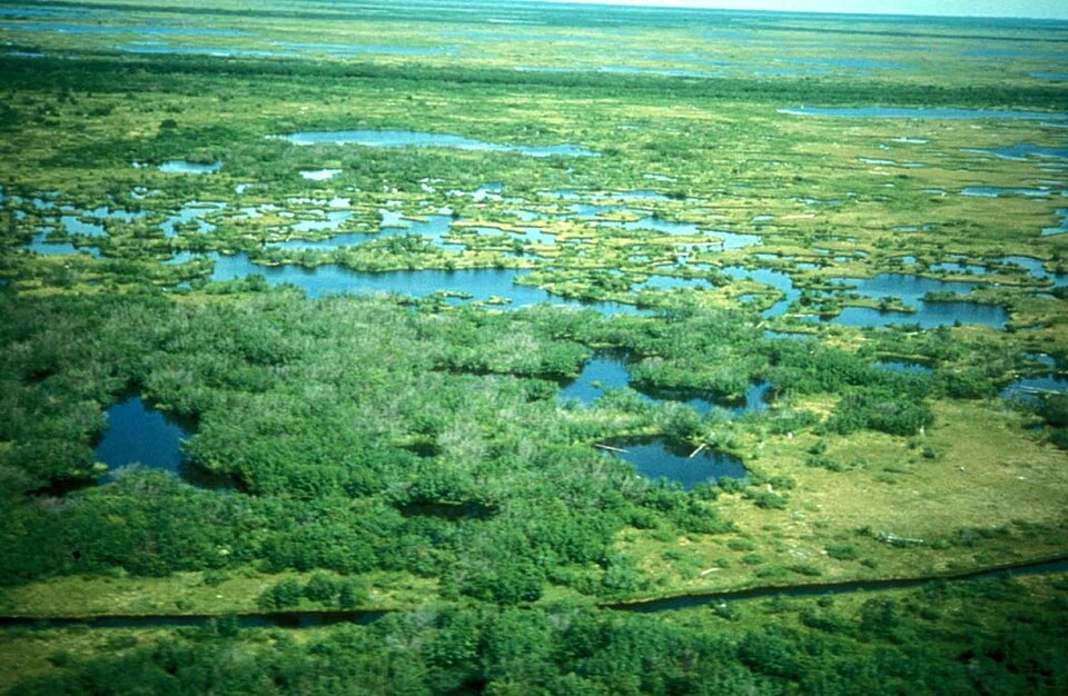
People such as the Inuit of Canada and Greenland and the Sami of northern Scandinavia traditionally lived by hunting, fishing and herding reindeer. Today oil and gas fields, mines and military bases have brought new settlements and roads to parts of the Arctic.
Why it matters. The tundra is one of the fastest-warming regions on Earth. Thawing permafrost damages buildings and pipelines and releases greenhouse gases stored for thousands of years.
The ice caps: Antarctica and the Arctic
Beyond the tundra lie the ice caps, Köppen's EF climate, where no month rises above freezing. Antarctica, the fifth-largest continent, is almost entirely buried under an ice sheet that is in places more than 4 km thick. It is the coldest, driest and windiest continent and holds most of the world's fresh water in frozen form.
Life on land in Antarctica is limited to mosses, lichens and a few insects, but the surrounding Southern Ocean is rich in plankton and krill, which feed fish, penguins, seals and whales. Antarctica has no permanent human population, only scientists at research stations.
The Antarctic Treaty of 1959 reserves the continent for peaceful scientific research, bans military activity and freezes territorial claims, and a later protocol bans mining. India joined the treaty in 1983 and runs research stations named Maitri and Bharati, after its first station, Dakshin Gangotri.
The Arctic, by contrast, is mostly a frozen ocean surrounded by land. As the climate warms, Arctic sea ice is shrinking fast, opening new shipping routes such as the Northern Sea Route along Russia's coast and making seabed oil and gas reachable. This has raised competition among Arctic countries, while threatening polar bears and the ways of life of Arctic peoples.
Why it matters. The polar regions regulate world climate and sea level. Changes there affect India's monsoon, coasts and strategic interests, which is why India has an Arctic policy and Antarctic programme.
Mains lens: what, why, where and so what
This chapter supports GS Paper I (world physical geography, distribution of resources, location factors) and links to GS Paper II (Arctic and Antarctic diplomacy) and GS Paper III (desertification, climate change). Here are four angles.
1. Location logic. Savannas, temperate grasslands and deserts follow pressure belts, winds, continentality and currents.
2. Adaptation. How plants, animals and people survive drought and cold.
3. Economy. Grasslands as granaries, deserts for oil and oases, tundra for minerals.
4. Change. Desertification, thawing permafrost and the opening Arctic.
Mains lens: practice questions and answer plans
Now turn this understanding into written answers. The four questions below are written in the UPSC style, but they are our own practice questions, not previous-year questions. The real previous-year questions of your exam appear in the "Previous year questions" box once we have matched them with the official papers.
Q1. "Why are most of the world's hot deserts located on the western margins of continents between 15° and 30° latitude?" (150 words)
- Explain subtropical highs, trade winds and cold currents.
- Give paired desert–current examples.
Q2. "Temperate grasslands have become the granaries of the world. Explain." (150 words)
- Cover climate, soils and mechanised farming.
- Name the grasslands and their exports.
Q3. "Compare the tropical savanna with the temperate grassland." (250 words)
- Introduction: Location of both.
- Body: Climate, grass type, trees, soils, wildlife, human use.
- Conclusion: Current pressures.
Q4. "Discuss the geographical and strategic significance of the melting Arctic." (250 words)
- Cover sea ice, permafrost, shipping routes and resources.
- Link to climate, indigenous peoples and India's interests.
Useful keywords: savanna, Llanos, Campos, acacia, baobab, temperate grassland, Steppes, Prairies, Pampas, Veld, Downs, Canterbury, chernozem, granaries, dust bowl, subtropical high, trade winds, cold currents, Humboldt, Benguela, Canaries, fog desert, xerophytes, oasis, rain shadow, cold desert, tundra, permafrost, Inuit, Sami, ice cap, krill, Antarctic Treaty, Maitri, Bharati, Northern Sea Route.
Quick revision
- Savanna: between rainforest and desert; wet summer, dry winter; acacia, baobab; Llanos, Campos, East African parkland.
- Temperate grasslands: Steppes, Prairies, Pampas, Veld, Downs, Canterbury; chernozem; wheat and ranching.
- Hot deserts: about 15°–30°, west coasts; subtropical highs + trade winds + cold currents.
- Pairs: Atacama–Humboldt; Namib–Benguela; Sahara–Canaries; Australian–West Australian; Sonoran–California.
- Xerophytes: long roots, small or spiny leaves, waxy skin, fleshy stems.
- Cold deserts: Gobi, Patagonia, Ladakh (rain shadow or continental interior).
- Tundra: warmest month below 10 °C, permafrost, mosses and lichens; Inuit, Sami.
- Antarctica: ice cap, no permanent people; Antarctic Treaty 1959; India: Dakshin Gangotri, Maitri, Bharati.
- Arctic: shrinking sea ice; Northern Sea Route.
HPSC HCS questions from this chapter
Match List I with List II: List I a. Veld b. Pampas c. Compos d. Prairie List II i. Brazil ii. South-Africa iii. North-America iv. South-America Choose the correct answer from the options given below:
- (a) a-ii, b-i, c-iv, d-iii
- (b) a-iii, b-iv, c-i, d-ii
- (c) a-iv, b-ii, c-iii, d-i
- (d) a-ii, b-iv, c-i, d-iii
Show answer
(d) a-ii, b-iv, c-i, d-iii · our answer; official key awaited