

MPPSC SSE (State Service) · Module 19 · Mains depth · 18 min
Seasons of India and rainfall distribution
What MPPSC SSE (State Service) asks from this chapter
Syllabus lines this chapter covers:
- Prelims Paper I: General Studies · Geography of India and Madhya Pradesh
MPPSC SSE (State Service) has asked 2 questions from this chapter (2026, 2020); 48 from its whole module.
Read at full depth: basics, the standard layer and the Mains analysis.
Start from zero: why does India have such different seasons?
Think of a year in your own town. There are weeks when you need a blanket, weeks when the afternoon sun is too hot to step out, weeks of steady rain and weeks of clear skies with cool evenings. India's calendar of festivals and crops follows this rhythm closely.
In the chapter on how the monsoon works, we saw that the winds over India reverse with the seasons. That reversal does not just bring rain; it organises the whole year. When the winds blow from the land, the weather is dry, and when they blow from the sea, it is wet.
On this basis, the year in India is commonly divided into four seasons. They are the cold weather season, the hot weather season, the season of the south-west monsoon, also called the advancing monsoon, and the season of the retreating monsoon.
The dates of each season shift a little from place to place. Winter in Kerala hardly feels like winter at all, while in Ladakh it is bitterly cold. But the same broad rhythm runs through the whole country, which is why the monsoon is said to give India a unity of climate.
Why it matters. The seasons set India's farming calendar. Kharif crops are sown with the monsoon, and rabi crops grow through the cool winter. Planning for water, power, health and disasters also follows this seasonal pattern, so understanding the seasons is the base for understanding Indian life.
The cold weather season
The cold weather season lasts roughly from December to February. During these months the sun shines more directly over the southern hemisphere, so northern India receives slanting rays and short days. Temperatures fall from south to north: the southern peninsula stays mild, while the northern plains and the Himalaya become cold.
A high-pressure area builds over north-western India and Central Asia, and north-east winds blow over the country from land to sea. Because they come from land, they are mostly dry. The days are usually clear and sunny, while nights can be very cold, with fog in the plains and frost on clear, calm nights.
Winter in the north is not completely dry, though. Western disturbances, which are low-pressure systems that start over the Mediterranean region, travel east with the westerly winds. They bring light rain to the north-western plains and snow to the western Himalaya.
This winter rain is small in amount but very valuable. It comes at the right time for rabi crops such as wheat, mustard and gram. The snow also builds up on the mountains and later melts to feed the rivers in summer.
In the far south, the picture is different. The north-east winds cross the Bay of Bengal, pick up moisture and give rain to the Tamil Nadu coast. So while much of India is dry in early winter, this coast is in its wet season.
Why it matters. The cold season supports India's rabi harvest, but it also brings hazards. Cold waves can harm the poor and the homeless, while dense fog disrupts trains, flights and roads in the northern plains. Winter is also when smog and air pollution are worst in many north Indian cities, because calm, cold air traps smoke near the ground.
The hot weather season
From March to May, the sun moves north, and the belt of greatest heat moves north with it. In March the highest temperatures are found on the Deccan plateau, and by May they shift to the north-western plains, where afternoon temperatures can cross 45°C. Coastal areas stay milder, because the sea keeps them from getting too hot.
As the land heats, pressure over the north-west falls and a low-pressure area starts to build. This is the same low that will later help draw in the monsoon. Meanwhile, the north-western plains face strong, hot, dry winds in the afternoon, known as the loo, which can cause heatstroke.
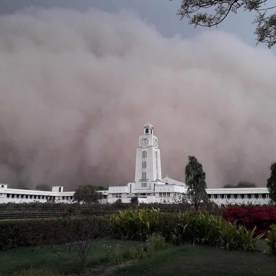
Dust storms are also common in the north-west in May. Strong winds lift dust from the dry ground and carry it for long distances. These storms, sometimes called andhi, can bring a short drop in temperature but also damage crops and homes.
In other parts of India, the hot season brings welcome pre-monsoon showers, each with a local name. In Kerala and coastal Karnataka, showers known as mango showers help mangoes ripen. In the coffee-growing areas of Karnataka and Kerala, blossom showers help coffee plants flower.
In West Bengal and Assam, violent evening thunderstorms called Kalbaisakhi, or nor'westers, arrive with strong winds and heavy rain. They can damage homes and crops, but their rain also helps tea, jute and rice in the region.
Why it matters. The hot season is now one of India's most dangerous times because of heatwaves. Outdoor workers, the elderly and people in crowded city housing suffer most. Pre-monsoon storms also bring lightning, which kills many people every year in rural India, so early warnings and safe shelter matter.
The rainy season and the retreating monsoon
From June to September, the south-west monsoon covers India. This is the main rainy season for most of the country. Temperatures drop after the first rains, humidity rises sharply and rivers swell.
Rain in this season does not fall evenly. It comes in spells, linked with low-pressure systems moving in from the Bay of Bengal, and with dry breaks in between. Some places get floods while others nearby may face a dry spell, which makes the season both a blessing and a risk.
In October and November, the monsoon retreats. The skies clear, the rain stops over most of north India and day temperatures rise for a while. The combination of heat and leftover humidity makes the weather oppressive, a condition often called "October heat".
As temperatures fall over the north by November, a high-pressure area forms over the land, and the winds turn north-easterly. Over the warm Bay of Bengal, the low-pressure area shifts south, and this is the main season for tropical cyclones on the eastern coast. These storms can bring very heavy rain and storm surges to coastal Odisha, Andhra Pradesh and Tamil Nadu.
The north-east winds that blow at this time also give rain to the Tamil Nadu coast, as we saw in winter. So for that coast, the retreating monsoon is the main rainy season of the year.
Why it matters. The retreating monsoon season is the busiest time for disaster managers on the eastern coast. Cyclone shelters, early warning and evacuation have greatly reduced deaths in recent decades. It is also the time when kharif crops are harvested, so late rain or a cyclone can destroy a whole season's work.
Where the rain falls: the rainfall map of India
India's average annual rainfall hides huge differences from place to place. Some parts get more than 200 cm of rain a year, while others get less than 50 cm. These differences come from two simple facts: where the moist winds strike, and how far they have to travel.
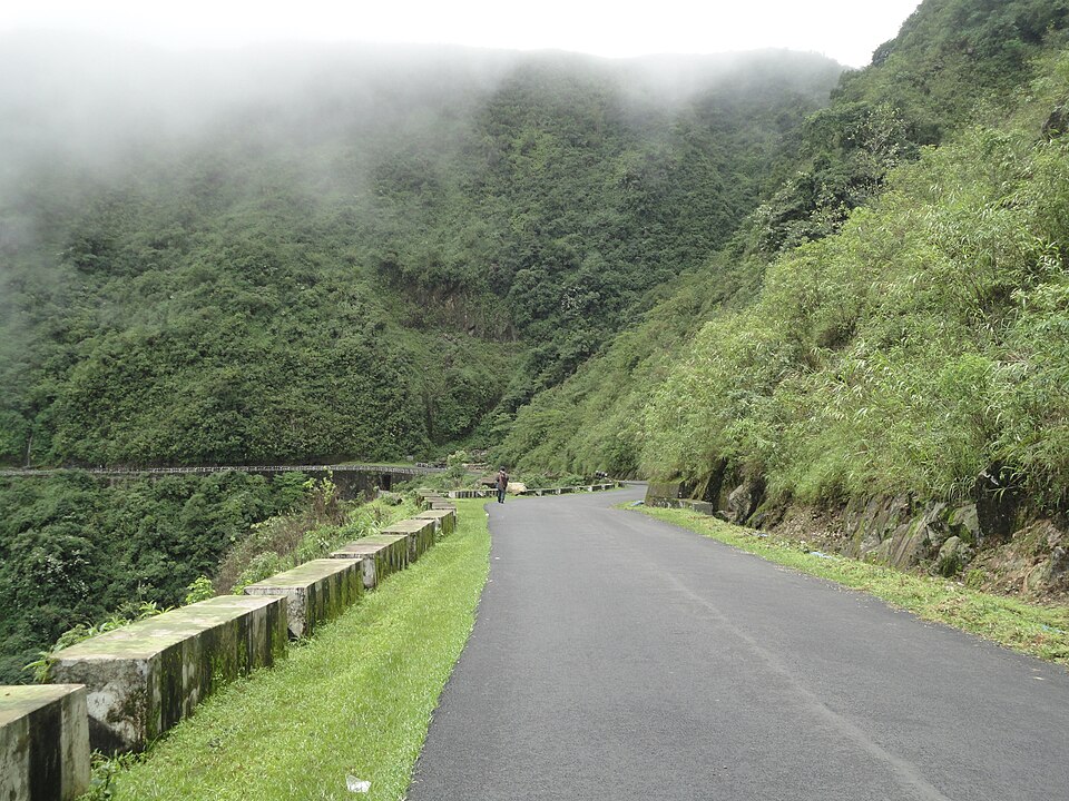
The areas of very heavy rainfall, over 200 cm, are the western coast and the Western Ghats, which face the Arabian Sea branch head-on, and the hills of the north-east, where the Bay of Bengal branch is trapped by the mountains. These are the wettest parts of India.
Areas with 100 to 200 cm include the eastern parts of the country, such as the eastern Ganga plain, Odisha and parts of central India. Areas with 50 to 100 cm cover much of the interior plateau and the western Ganga plain. Rainfall falls steadily as one moves inland and west.
The areas of low rainfall, under 50 cm, include western Rajasthan, parts of Gujarat, Ladakh and the interior of the Deccan plateau. Rajasthan lies away from the main paths of moist winds, Ladakh is cut off by high mountains, and the Deccan interior lies in the rain shadow of the Western Ghats.
There is one more pattern that matters a great deal. Rainfall is not only low in dry regions; it is also unreliable. Rainfall variability, meaning how much the rain changes from one year to the next, is generally highest where average rainfall is lowest.
Why it matters. The driest regions suffer twice: they get less rain and cannot count on it. That is why drought is most frequent in western Rajasthan, Gujarat and the interior Deccan. Policies such as watershed development, drought-tolerant crops and canal irrigation from distant rivers are concentrated in these regions for this reason.
Climate regions: Köppen's way of sorting India
Seasons and rainfall maps describe the climate, but geographers also like to sort places into climate types. The best-known scheme is that of the German climatologist Wladimir Köppen. He used average temperature and rainfall, and the season when rain falls, to give each region a short letter code.
The first letter tells the broad group. A stands for tropical humid climates, B for dry climates, C for warm temperate climates, D for cold climates with snowy winters and E for very cold, ice-type climates. Small letters added after it tell when rain falls or how hot the summer is.
Most of the peninsula has a tropical savanna (Aw) climate, which means warm all year with a dry winter. The Konkan and Malabar coasts have a monsoon climate with a short dry season (Amw), because their rain is very heavy. The Coromandel coast of Tamil Nadu has an unusual As type, with a dry summer, because its main rain comes in winter from the north-east monsoon.
In the north-west, western Rajasthan has a hot desert (BWhw) climate, surrounded by a belt of semi-arid steppe (BShw). The Ganga plain has a monsoon climate with dry winters (Cwg). High in the Himalaya, cold climate types appear, and the highest areas of Ladakh have ice-type climates.
Köppen's scheme has limits. It is based on averages, so it can hide year-to-year variability, and it pays little attention to how the monsoon works. Many Indian geographers therefore also describe India's climate through the monsoon and its seasons, as we did above.
Why it matters. Climate types help explain why particular crops, forests and ways of life are found in particular places. They are also used in planning, for example in deciding which crop varieties, building designs or water systems suit a region. In exams, the Köppen codes for Indian regions are a common source of factual questions.
Mains lens: what, why, where and so what
UPSC Mains (GS Paper I and III) asks about India's seasons and rainfall when it wants you to link climate with farming, disasters and regional inequality. Here are four angles that connect this chapter to those issues.
1. Seasons and the farm calendar. Kharif crops follow the monsoon, while rabi crops depend on cool winters, stored soil moisture, irrigation and the small rain from western disturbances. A warm February or a failed winter rain can hurt the wheat crop just as a weak monsoon hurts rice. Answers should show how each season supports a specific part of India's food supply.
2. Heatwaves and cold waves. The hot season now brings frequent and longer heatwaves, while winter brings cold waves and fog in the north. Both hit the poor hardest, because they work outdoors and live in poor housing. Answers should discuss heat action plans, early warnings, shelters and changes in working hours.
3. Uneven and unreliable rain. The driest regions also have the most variable rain, which makes drought a regular event rather than a rare shock. That explains why drought-prone area programmes, watershed projects and crop insurance focus on these regions. A strong answer links the rainfall map directly to policy choices.
4. Unity amid diversity. India's climate varies from deserts to rainforests, yet the monsoon rhythm gives the whole country a shared calendar of sowing, harvest and festivals. This angle works well in essay-style answers on India's geography and culture. It also shows why a failed monsoon becomes a national issue, not just a regional one.
Mains lens: practice questions and answer plans
Now turn this understanding into written answers. The four questions below are written in the UPSC style, but they are our own practice questions, not previous-year questions. The real previous-year questions of your exam appear in the "Previous year questions" box once we have matched them with the official papers.
Q1. "Describe the characteristics of the four seasons of India and their significance for agriculture." (250 words)
- Introduction: Explain that the monsoon's reversal of winds divides India's year into four seasons.
- Body: Describe the cold season with western disturbances and rabi crops, the hot season with the loo and pre-monsoon showers, the south-west monsoon with kharif sowing, and the retreating monsoon with cyclones and Tamil Nadu's rain. Add a simple seasonal calendar.
- Conclusion: Say that each season supports a part of India's food system, so changes in any season affect food security.
Q2. "Rainfall variability is highest in areas of lowest rainfall. Explain with examples from India and suggest policy responses." (150 words)
- First, define rainfall variability in simple words.
- Then give the examples of western Rajasthan, Gujarat and the interior Deccan.
- After that, explain the result: frequent drought and farm distress.
- Finally, suggest watershed development, storage, drought-tolerant crops and crop insurance.
Q3. "Why does the Coromandel coast receive most of its rainfall in winter?" (150 words)
- Begin with the retreating monsoon and the north-east winds.
- Next, explain how they pick up moisture over the Bay of Bengal.
- Then add the role of cyclones and depressions in October to December.
- Close by noting its Köppen type (As) and its effect on crop seasons.
Q4. "Discuss the local storms of the hot weather season in India and their economic significance." (150 words)
- Name and locate the loo, dust storms, mango showers, blossom showers and Kalbaisakhi.
- Then explain their benefits for mango, coffee, tea and jute.
- End with their damage, including heatstroke, lightning and crop loss.
Useful keywords: cold weather season, western disturbances, rabi, hot weather season, loo, mango showers, blossom showers, Kalbaisakhi, October heat, retreating monsoon, rainfall variability, rain shadow, Köppen, Aw, As, BWhw, Cwg.
Quick revision
- India's year is divided into four seasons: cold weather, hot weather, the south-west monsoon and the retreating monsoon.
- In the cold season (December–February), temperatures fall from south to north, dry north-east winds blow, and western disturbances bring winter rain and snow to the north-west, which helps rabi crops.
- In the hot season (March–May), the heat belt moves north, and the loo blows over the north-western plains.
- Pre-monsoon showers are mango showers (Kerala, coastal Karnataka), blossom showers (coffee areas of Karnataka and Kerala) and Kalbaisakhi (West Bengal and Assam).
- The retreating monsoon (October–November) brings "October heat", Bay of Bengal cyclones and rain to the Tamil Nadu coast.
- Rain is over 200 cm on the western coast and in the north-east hills, and under 50 cm in western Rajasthan, parts of Gujarat, Ladakh and the interior Deccan.
- Variability is highest where rainfall is lowest, which makes dry regions drought-prone.
- In Köppen's scheme, western Rajasthan is BWhw, the Ganga plain Cwg, most of the peninsula Aw, and the Coromandel coast As.
MPPSC SSE (State Service) questions from this chapter
Why it is much colder in the northern parts of India during December - January?
Divide India into climatic zones according to Koppen and Thornthwaite.