

RPSC Sub Inspector · Module 23 · standard depth · 14 min
Landforms made by glaciers, wind and waves
What RPSC Sub Inspector asks from this chapter
Syllabus lines this chapter covers:
- Paper II: General Knowledge and General Science · World geography: physical features, environmental issues, wildlife and biodiversity, international waterways, industrial regions.
RPSC Sub Inspector questions from this module are being sorted into our bank.
Cut to standard depth for RPSC Sub Inspector. 11 deeper paragraphs are in the full chapter.
Start from zero: three more sculptors
Running water shapes most of the land, but three other agents take over in special places. Glaciers carve high mountains and polar lands, wind shapes deserts, and waves shape every coastline.
Each works in the same basic way as a river: it erodes, carries and deposits. What differs is the tool. Ice is heavy and slow, wind is light and can lift only fine grains, and waves strike the same coast again and again.
Because each agent leaves typical marks, geographers can read a landscape like a record. U-shaped valleys in hills that have no ice today, for example, tell us that glaciers were once there.
Why it matters. Glaciers feed the great rivers of North India, deserts cover a large part of Rajasthan, and India has a long coastline with major ports and crowded cities. Understanding these landforms helps us plan water supply, desert farming and coastal protection.
Glaciers and the landforms they carve
A glacier forms where more snow falls each winter than melts each summer. Over years, the snow is pressed into dense ice, which begins to flow slowly downhill under its own weight, often only a few metres a year. Valley glaciers flow down mountain valleys, as in the Himalaya, while continental ice sheets bury whole landmasses; today they cover about a tenth of Earth's land, almost all of it in Antarctica and Greenland.
During the Pleistocene ice age, which lasted from about 2.6 million to about 11,700 years ago, ice sheets repeatedly spread over much of North America and northern Europe. Many lakes, valleys and fertile plains of those regions were shaped by that ice. Himalayan glaciers were also much larger then.
Glaciers erode in two main ways. In plucking, meltwater freezes onto cracked bedrock and the moving ice tears out blocks of rock. In abrasion, rocks frozen into the base of the ice scrape and polish the bedrock like giant sandpaper, leaving parallel scratches called striations that show the direction of ice flow.
At the head of a valley glacier, ice carves an armchair-shaped hollow called a cirque; after the ice melts, it may hold a small lake called a tarn. When two cirques cut back towards each other, a sharp knife-edge ridge called an arête remains, and where three or more cirques meet, a pointed pyramidal peak called a horn forms, like the Matterhorn in the Alps.
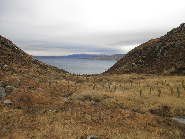
A glacier flowing down a river valley widens and deepens it into a U-shaped valley or glacial trough with steep sides and a flat floor. Smaller side glaciers cannot cut as deep, so when the ice melts their valleys are left high above the main valley as hanging valleys, often with waterfalls. Where glacial troughs reach the sea and are drowned, they form long, deep, narrow inlets called fjords, as in Norway and New Zealand.
Bedrock knobs shaped by moving ice become roches moutonnées: smooth and gentle on the side facing the oncoming ice, and steep and jagged on the downstream side where blocks were plucked out.
Why it matters. Himalayan glaciers store water that feeds the Ganga, Indus and Brahmaputra in the dry season. Glacial landforms also reveal past climates, and retreating glaciers today are a clear sign of warming.
What glaciers leave behind
A glacier carries a huge mix of rock debris, from fine clay to boulders as big as houses. When the ice melts, it dumps this unsorted mixture, called till or boulder clay. Unlike river deposits, till is not sorted by size, because ice does not slow down and drop the heaviest pieces first.
Ridges of till are called moraines. Lateral moraines form along the sides of a valley glacier, a medial moraine forms down the middle where two glaciers join, a terminal moraine marks the farthest point the ice reached, and ground moraine is the sheet of till spread under the glacier. Terminal moraines often dam lakes when the ice retreats.
Drumlins are smooth, oval hills of till shaped like an upturned spoon, with the blunt end facing the direction the ice came from. They often occur in groups called "basket of eggs" topography.
Meltwater flowing from and under the ice sorts and spreads the debris. Eskers are long, winding ridges of sand and gravel laid down by streams flowing in tunnels under the ice. Kames are mounds of sorted sand and gravel left at the ice edge, and the broad sheet of meltwater gravel beyond the ice front is an outwash plain. Blocks of ice buried in this outwash later melt and leave hollows called kettle holes, which often fill with water.
Melting glaciers in the Himalaya are now forming new lakes behind loose moraine dams. If such a dam bursts, it can release a sudden flood called a glacial lake outburst flood (GLOF), which can destroy roads, villages and hydropower projects far downstream.
Why it matters. Moraines and outwash give soils, sand and gravel, and record how far ice once advanced. Moraine-dammed lakes are a growing hazard in the Himalaya, so they must be mapped and watched.
Wind in the desert
In deserts, there is little vegetation or moisture to hold the ground, so wind becomes an important agent. It works in two ways. Deflation lifts and blows away loose dust and sand, and abrasion uses the sand it carries to blast and polish rock, rather like a sand-blasting machine.
Deflation scoops out shallow hollows called blowouts. Where it removes all the fine material, a surface of closely packed pebbles is left behind, called desert pavement; rocky deserts stripped bare are called hammada, and stony ones reg. Most sand travels by bouncing along close to the ground (saltation), so abrasion is strongest within a metre or two of the surface.
That is why rocks are undercut near their base, leaving mushroom rocks or pedestal rocks with a narrow stem and a wide cap. Stones polished and faceted by wind are called ventifacts, and long ridges of rock carved parallel to the wind, with grooves between them, are called yardangs.
When wind slows down or meets an obstacle, it drops its sand as dunes. A barchan is a crescent-shaped dune with its horns pointing downwind; it forms where sand is limited and the wind blows from one direction. Where sand is plentiful, long transverse dunes form at right angles to the wind; seif or linear dunes run parallel to the wind; and star dunes with several arms form where winds shift.
The finest dust can be carried hundreds of kilometres before settling as loess, a thick, fertile, yellowish silt. The Loess Plateau of China is the best-known example.
Running water also matters in deserts, because rare cloudbursts send flash floods down bare slopes. They build gently sloping rock surfaces at the foot of mountains called pediments, merged alluvial fans called bajadas, and shallow salty lakes called playas in basins. Isolated rocky hills rising from a plain are inselbergs.
Why it matters. In the Thar Desert, moving dunes bury roads, canals and fields, so shelter belts and dune stabilisation are vital. Dust storms affect health and air quality far from the desert, and loess soils feed millions.
Waves and the coast
Waves are made by wind blowing over the sea. As a wave reaches shallow water, it slows, steepens and breaks, rushing up the beach as swash and draining back as backwash. Waves usually reach the coast at an angle, so swash moves sand diagonally up the beach while backwash pulls it straight down, slowly shifting sand along the shore; this is longshore drift.
Waves erode by hydraulic action, as water and trapped air are forced into cracks, and by abrasion, as waves hurl sand and pebbles at the rock. Waves also refract, bending around headlands so that their energy concentrates on the headlands and spreads out in the bays. As a result, headlands are worn back while bays collect sand.
On a rocky coast, waves undercut the base of a slope, cutting a wave-cut notch. The rock above collapses, leaving a steep sea cliff, and as the cliff retreats a flat rocky wave-cut platform is left at its foot, exposed at low tide. Waves attacking weak spots in a headland hollow out sea caves; when caves on both sides meet, an arch forms, and when the arch roof falls, a pillar of rock called a stack stands alone in the sea.
Where waves and currents drop sand, they build beaches. Longshore drift can extend a narrow ridge of sand from the coast across a bay, called a spit. If a ridge closes off the mouth of a bay, it becomes a bar, and the calm water behind it is a lagoon, such as Chilika on the east coast and the backwaters of Kerala. A sand ridge joining an island to the mainland is a tombolo, and long sandy islands running parallel to the coast are barrier islands.
Geographers also group coasts by their history. Coasts of emergence, where land has risen or the sea has fallen, are usually smooth, with offshore bars and lagoons, much like India's east coast. Coasts of submergence, where land has sunk or the sea has risen, are indented, with drowned valleys and fjords.
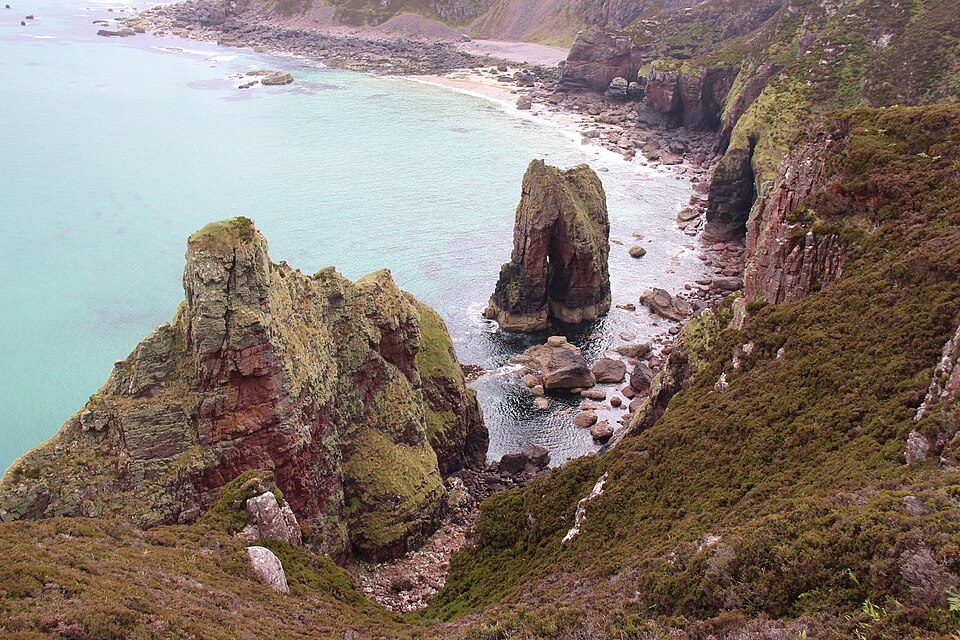
Why it matters. Many Indian coasts are eroding, partly because dams trap river sand and ports and sea walls block longshore drift. Knowing how waves move sand helps in placing ports, groynes and beach nourishment so that one beach is not saved at another's cost.
Reading landscapes and changing climate
Landforms are not only shapes; they are evidence. Moraines far below today's glacier snouts show how much Himalayan glaciers have shrunk. Old dune fields now covered by vegetation show that some regions were once drier, and raised beaches and wave-cut platforms above today's sea level show that the land has risen or the sea has fallen.
Today all three agents are being changed by people and by a warming climate. Many glaciers are retreating, which first increases meltwater and then threatens to reduce it. Overgrazing and loss of vegetation can reactivate dunes, while sea-level rise, cyclones and sand mining speed up coastal erosion.
Tsunamis are a special case of wave action. They are caused by sudden movements of the sea floor, usually undersea earthquakes, and can reshape coasts in hours; they are covered in earthquakes, seismic zones and tsunamis.
Why it matters. The same landform knowledge supports glacier monitoring, desert management and coastal zone planning. It turns geography from description into a tool for disaster risk reduction and climate adaptation.
Quick revision
- Glaciers: valley glaciers and ice sheets (about a tenth of land; Antarctica, Greenland). Pleistocene: about 2.6 million to 11,700 years ago.
- Glacial erosion: plucking, abrasion, striations → cirque/tarn, arête, horn, U-valley, hanging valley, fjord, roche moutonnée.
- Glacial deposits: unsorted till → moraines, drumlins; meltwater → eskers, kames, outwash plain, kettles. GLOF risk.
- Wind: deflation (blowouts, desert pavement) and abrasion (mushroom rocks, ventifacts, yardangs). Dunes: barchan, transverse, seif, star. Loess (China).
- Desert water forms: pediment, bajada, playa, inselberg.
- Waves: swash, backwash, longshore drift, refraction. Erosion: cliff, notch, platform, cave → arch → stack. Deposition: beach, spit, bar, lagoon, tombolo.