

RSSB Rajasthan CET (Graduate) · Module 12 · basic depth · 10 min
How India was built: geological structure and rock systems
What RSSB Rajasthan CET (Graduate) asks from this chapter
Syllabus lines this chapter covers:
- CET Graduation Level (one paper) · Geography of India.
RSSB Rajasthan CET (Graduate) questions from this module are being sorted into our bank.
Cut to basic depth for RSSB Rajasthan CET (Graduate). 17 deeper paragraphs are in the full chapter.
Start from zero: rocks are a calendar
Look at a road cutting on a highway. You may see layers of rock stacked one above the other, like pages of a book. In general, the lower layers were laid down first and are older, while the upper layers are younger. Geologists read these layers like a calendar of the earth's past.
The earth is about 4.5 billion years old, and India's rocks record a large part of this story. Geologists divide this long time into eras and periods, and they group rocks formed in the same span into a rock system. Each system has its own kinds of rock and its own minerals.
India is unusual because it contains some of the oldest rocks on earth as well as some of the youngest landforms. The Peninsular plateau is estimated to be about 500 million years old or more, while the Himalaya and the Northern Plains are geologically young. This mix explains why India has both ancient mineral belts and fresh, fertile plains.
Why it matters. Knowing the age and type of rocks tells us where to look for iron, coal, oil, building stone and groundwater. It also tells us which areas are stable and which are prone to earthquakes. Geology is therefore the hidden base of India's economy and safety.
India's long journey north
About 200 million years ago, all the continents were joined in a single landmass called Pangaea, surrounded by a vast ocean. Its northern part is called Angaraland or Laurasia, and its southern part Gondwanaland. Between them lay a long, shallow sea called the Tethys.
Gondwanaland included what are now India, Africa, South America, Australia and Antarctica. Over time, it broke apart, and its pieces drifted away from each other. The piece carrying India, the Indian plate, began to move northwards across the ocean, and the Indian Ocean opened behind it.
As India drifted, it passed over a hot spot deep in the mantle. Near the end of the Cretaceous period, huge cracks opened and poured out sheet after sheet of lava, which built the Deccan Traps. Meanwhile, rivers on both landmasses kept dumping sediments into the Tethys.
Finally, the Indian plate collided with the Eurasian plate. The sediments of the Tethys were squeezed, folded and pushed up to form the Himalaya. Because India is still pushing north, the Himalaya are still rising, and the region suffers frequent earthquakes.
As the mountains rose, the crust in front of them bent down into a deep trough, called the foredeep. Rivers flowing from the new mountains, and from the plateau, filled this trough with thick layers of alluvium. This filled trough is today's Northern Plains.
Why it matters. This story connects India's three great landforms in one chain of cause and effect: an old plateau, young mountains and a new plain. It also explains why India shares rocks and fossils with Africa and Australia, and why the Himalayan belt is one of the world's most earthquake-prone zones.
Three geological divisions
Physically, India is often divided into five parts: mountains, plains, plateau, coasts and islands. Geologically, however, it is simpler to see three divisions, based on how and when the land was formed.
The first is the Peninsular block. It is a rigid, stable mass of very old rocks, the part of Gondwanaland that drifted north. It has not been folded into new mountains for a very long time, but it has been cracked by faults, as in the Narmada and Tapi valleys, and part of it has been covered by lava. Its north-eastern extension continues into the Meghalaya plateau and the Karbi Anglong hills.
The second is the Himalaya and other young fold mountains. These include the Himalaya, the hills of the North-East (the Purvanchal), and, further south-east, the mountain ranges that continue into the Andaman and Nicobar Islands. These are young, unstable and still active, with folded, faulted rocks and frequent earthquakes.
The third is the Indo-Ganga-Brahmaputra plain. It is the filled-up foredeep between the two, made of loose alluvium brought down by rivers. Its rocks lie buried under hundreds or even thousands of metres of sediment.
Why it matters. Each division has a different kind of wealth and a different kind of risk. The Peninsula is rich in minerals and fairly stable; the mountains hold forests, water and hydropower but are hazard-prone; the plains are fertile and groundwater-rich but flood-prone. Planning for mining, dams, cities and disasters starts from this basic map.
The oldest rock systems
The rocks of the Peninsula are grouped into a few main systems. From oldest to younger, they are the Archaean, Dharwar, Cuddapah, Vindhyan and Gondwana systems. Later came the Deccan Traps, the Tertiary rocks and the alluvium.
The Archaean rocks are the oldest. They formed when the earth's crust first cooled and hardened, and they include granite and gneiss. They contain no fossils, because life had not yet developed in forms that could be preserved, and they form the base of the Peninsula, exposed widely in Karnataka, Tamil Nadu, Andhra Pradesh, Odisha and Jharkhand.
The Dharwar rocks came next. They are the oldest sedimentary rocks that have been metamorphosed, that is, changed by heat and pressure. They are named after Dharwar in Karnataka and are very rich in metallic minerals such as iron ore, manganese, copper and gold, which is why the old gold fields of Karnataka and many iron ore mines lie in Dharwar belts.
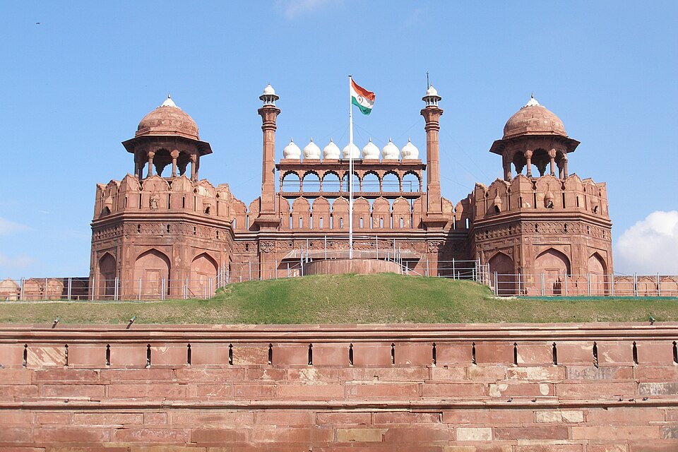
The Cuddapah system, named after Cuddapah district in Andhra Pradesh, consists of sandstone, limestone, shale and quartzite laid down in basins. The Vindhyan system, spread over the Vindhya region of central India, is famous for its red sandstone, used in historic buildings such as the Red Fort and many temples and forts. Vindhyan beds near Panna also hold diamonds.
Why it matters. These old rocks hold most of India's iron, manganese and many other metals, which feed the steel and engineering industries. They also give building stone, limestone for cement, and hard ground for dams. Their mining, however, often lies in forested tribal areas, which raises questions of displacement and environmental damage.
Coal, lava, oil and alluvium
The Gondwana rocks formed much later, in long river valleys and swamps on the old Gondwana land. Thick forests grew in these swamps, were buried by sediments, and slowly turned into coal. That is why almost all of India's good-quality coal lies in Gondwana rocks, in the valleys of the Damodar, Mahanadi, Godavari and Son.
Next came the Deccan Traps. Near the end of the Cretaceous period, lava poured out of long fissures rather than single volcanoes, spreading in flat sheets, one above the other, over a vast area of Maharashtra, Gujarat and Madhya Pradesh. These dark basalt rocks give the step-like hills of the western Deccan, and they have weathered into fertile black soil, ideal for cotton.
During the Tertiary period, the Himalaya were formed, and sediments collected in basins along the coasts and in the North-East. These Tertiary rocks are young and hold India's petroleum and natural gas (as in Assam, Gujarat and the Mumbai offshore) and lignite, a lower grade of coal (as at Neyveli in Tamil Nadu).
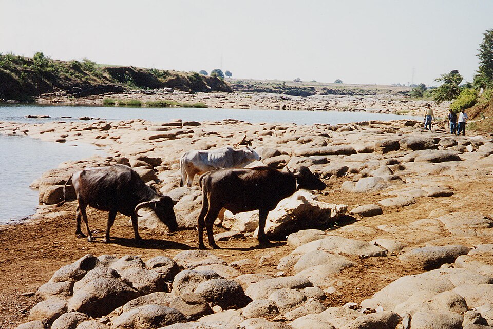
The youngest deposits are the Quaternary alluvium of the plains and deltas. Older alluvium, called bhangar, lies on higher ground above flood level and often contains lime nodules called kankar. Newer alluvium, called khadar, lies on the flood plains and is renewed almost every year by floods.
Why it matters. This part of the rock record explains India's energy map: coal from Gondwana, oil and gas from Tertiary basins, and fertile food land from Quaternary alluvium. The black soil of the Deccan Traps supports the cotton belt and its textile industry. The location of these rocks shapes where power plants, refineries and farm belts are built.
Quick revision
- Pangaea → Angaraland (north) + Gondwanaland (south), with the Tethys between.
- Indian plate drifted north, collided with Eurasia → Tethys sediments folded into the Himalaya (still rising) → foredeep filled with alluvium = Northern Plains.
- Three geological divisions: Peninsular block (stable, old), young fold mountains (active), Indo-Ganga-Brahmaputra plain (alluvium).
- Rock order: Archaean → Dharwar → Cuddapah → Vindhyan → Gondwana, then Deccan Traps, Tertiary, Quaternary.
- Archaean: granite, gneiss, no fossils. Dharwar: iron, manganese, gold. Vindhyan: red sandstone, Panna diamonds.
- Gondwana: coal (Damodar, Mahanadi, Godavari, Son). Deccan Traps: fissure basalt, end of Cretaceous, black soil.
- Tertiary: oil, gas, lignite. Quaternary: bhangar (old, kankar) and khadar (new, flood plains).