

UKPSC PCS (Upper) · Module 24 · Mains depth · 24 min
Pressure belts, planetary winds and local winds
What UKPSC PCS (Upper) asks from this chapter
Syllabus lines this chapter covers:
- Prelims Paper I: General Studies · Geography of world: earth and solar system, lithosphere, latitudes and longitudes, rotation and revolution, landforms, hydrosphere, atmosphere, oceans, agriculture, resources, industries, population, transport, world trade and geographical glossary.
- Mains Paper 3: General Studies I (heritage, culture, history, geography, society) · Salient features of word’s physical geography.
1 UKPSC PCS (Upper) questions in our bank come from this module (The atmosphere and climate).
Read at full depth: basics, the standard layer and the Mains analysis.
Start from zero: what moves the air around the planet?
Stand on a rooftop on a hot afternoon and you can feel the wind on your face. That wind is part of a much bigger system that circles the whole planet. To understand it, we need only three simple ideas.
First, air moves from high pressure to low pressure. Where air is heated it expands and rises, so it presses less on the ground and the pressure there is low. Where air is cooled, or where it piles up from above, it presses more and the pressure is high. Air then flows from the high towards the low, just as water flows downhill, and this moving air is what we call wind.
Second, the spinning Earth turns the wind. Because the Earth rotates, moving air does not travel in a straight line. It is turned to the right in the northern hemisphere and to the left in the southern hemisphere. This turning effect is called the Coriolis force, and it is why the great winds of the world blow at an angle instead of straight from high to low.
Third, a wind is named after the direction it comes from. A wind that blows from the west towards the east is a westerly, and one that comes from the north-east is a north-easterly. Keep this rule in mind, because many exam questions test it.
Why it matters. With these three ideas you can explain why deserts are dry, why the equator is rainy and why India's rains arrive in one season. The sun heats the Earth unevenly, and the air tries to even out that difference by moving. The pressure belts and winds in this chapter are simply that effort, seen on the scale of the whole planet.
The world's pressure belts
Zoom out to the whole Earth. The sun heats the equator most and the poles least. Warm air rises near the equator and cool or crowded air sinks elsewhere, and together this sets up a neat pattern of pressure belts that circle the globe like stripes on a ball. From the equator to each pole:
- Equatorial low (near the equator): strong heating all year makes air rise, so pressure is low. Its calm belt of light, shifting winds is called the doldrums.
- Subtropical highs (along about 30° N and 30° S): air that rose at the equator sinks here, so pressure is high and the air is dry. Its calm belt is called the horse latitudes.
- Sub-polar lows (along about 60° N and 60° S): warm air from lower latitudes meets cold polar air and is forced up, so pressure is low and the weather stormy.
- Polar highs (near the poles): intense cold makes dense air sink, so pressure is high.
Because sinking air in the subtropical highs is dry, many of the world's great hot deserts lie in or near these latitudes. Examples are the Sahara, Arabia, the Thar, the Kalahari and the Australian deserts.
Counted across both hemispheres, that is seven bands: one equatorial low and three on each side of it.
The belts are not fixed. They move with the apparent movement of the sun. In the northern summer, when the overhead sun moves towards the Tropic of Cancer, the whole system shifts north; in the northern winter it shifts south.
The shift is only a few degrees of latitude, but for a country like India it changes everything: it decides whether a place is under dry sinking air or moist rising air at a given time of year. That is why the arrival and retreat of India's rains follow this seasonal shift.
Why it matters. The pressure belts are a first map of where the world is wet and where it is dry. Rising air at the equator gives rainforests; sinking air near 30° gives deserts. Because the belts shift with the sun, a place on their edge gets a wet season and a dry season. Much of India lies in exactly such a zone, which is why our year is split into a rainy monsoon and long dry months.
Planetary winds and the three-cell model
Pressure belts tell us where air is pushed from and to. Add the Coriolis turn, and we get the great planetary winds that blow over most of the Earth for most of the year. Scientists explain them with a three-cell model in each hemisphere.
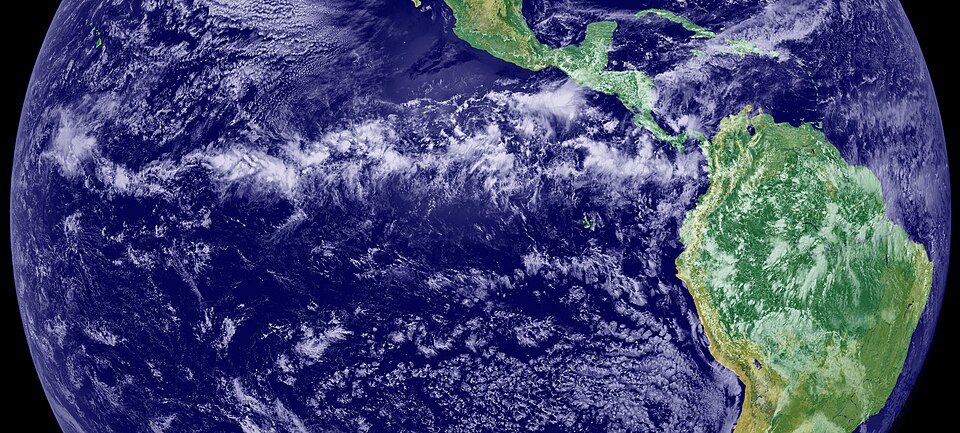
The Hadley cell (equator to about 30°). At the equator, high insolation heats the air; it rises by convection and creates the Inter Tropical Convergence Zone (ITCZ), a belt of low pressure where winds from both hemispheres converge. The rising air cools, forms tall clouds and gives heavy rain, which is why equatorial forests are so wet.
High up, the air moves towards the poles, cools and sinks around 30° N and S, building the subtropical highs. From there, surface air flows back towards the equator to complete the loop. These surface winds are the trade winds.
The Coriolis force bends them: in the northern hemisphere they come from the north-east (north-east trades), and in the southern hemisphere from the south-east (south-east trades). Since they blow from the east, they are also called easterlies. Sailing ships of earlier centuries used these steady winds to cross the Atlantic, which is how they got their name.
The Ferrel cell (middle latitudes). Between about 30° and 60°, surface air flows from the subtropical highs towards the poles, to the sub-polar lows. The Coriolis turn makes these winds come from the west, so they are the westerlies. In this cell, warm air rising near 60° and air sinking near 30° work together, so it behaves like a gear driven by the two cells on either side.
The Polar cell. Over the poles, cold dense air subsides to form the polar high and then flows outward towards the middle latitudes. Deflected by the Coriolis force, these become the polar easterlies.
Put together, from the equator outward in each hemisphere you have: ITCZ and doldrums, trade winds, horse latitudes, westerlies, sub-polar low, polar easterlies, polar high. These winds move heat from the hot equator towards the cold poles. Without this circulation, the tropics would keep getting hotter and the poles colder.
Why it was worked out, and why it matters. Scientists first drew this circulation to answer a sailors' puzzle: why did the trade winds blow so steadily from the east, year after year? The answer, a loop of rising and sinking air bent by the Earth's turning, became the base of modern climate science. The planetary winds shaped history too: the trade winds and westerlies set the sea routes of the age of sail. Today the same pattern tells us where deserts spread, where rain falls and how heat travels from the tropics to the poles.
Why the real map is messier than the model
The three-cell model is a clean picture, like a school map of a city that shows only the main roads. The real atmosphere has lanes, traffic jams and diversions. So what decides the actual pattern of planetary winds? Five things work together:
- Uneven heating by latitude creates the basic belts.
- The pressure belts themselves and the cells that link them set the main flow.
- The belts migrate with the apparent movement of the sun.
- The distribution of land and sea breaks the smooth belts into separate cells of high and low pressure.
- The rotation of the Earth gives the Coriolis turn.
The fourth point needs a closer look. Land heats and cools much faster than water. In summer a continent becomes a hot plate and pulls in air as a low; in winter it becomes a cold slab and pushes air out as a high. The effect is strongest in the northern hemisphere, where most of the land is.
Seasonal winds. When a large landmass heats up in summer and cools in winter, the wind over it and the sea beside it can reverse direction with the season. Such seasonal reversals of wind are called monsoons, from the Arabic word mausim, meaning season. South Asia shows this most strongly.
In summer, intense heating over north-west India and the shift of the ITCZ towards the north draw moist winds from the Indian Ocean onto the subcontinent. In winter the flow reverses. Jet streams and El Nino add more layers to this story, but the core idea stays simple: the monsoon is the three-cell model bent by a giant landmass and the moving sun.
Why it matters for India. The monsoon is the biggest "departure" from the neat model, and for India it is not a theory but the calendar of life. Kharif sowing, the filling of reservoirs, hydropower, drinking water and rural incomes all depend on when the monsoon winds arrive and how long they stay. This is why every Indian student of geography must first understand pressure and winds: every explanation of the monsoon is built on them.
Local winds: breezes you can feel in a day
Planetary winds cover half the globe. Local winds are the same physics working over a few kilometres, often changing within a single day.
Sea breeze and land breeze. Spend a day on the beach at Puri, Mumbai or Chennai. By late morning the land heats up much faster than the sea. Air over the land rises and a small low forms there, while the cooler sea keeps a relatively high pressure.
So air blows from the sea to the land: the cool sea breeze that makes coastal afternoons bearable. At night the process flips. Land loses heat quickly and becomes cooler than the sea, so the pressure is now higher over land and air flows from the land to the sea: the land breeze. Fishermen have used this daily rhythm for centuries, going out with the land breeze before dawn and returning with the sea breeze.
Valley breeze and mountain wind. In hill regions, the slopes facing the sun heat up during the day. The air touching them warms and rises up the slopes, and air from the valley floor moves up to replace it: this is the valley breeze.
At night the slopes cool quickly; the cold, dense air near them flows down into the valley as the mountain wind. This is why valley floors in the hills can be much colder at dawn than the slopes above them, and why fog often fills the valleys in the early morning.
The loo. In May and June, the northern plains of India, from Punjab to Bihar, are baked by the sun. In the afternoons a hot, dry wind called the loo blows across them. It is a classic example of how intense heating over land creates local pressure differences, and it is a real health hazard, causing heatstroke.
The loo is fiercest in the stretch between Delhi and Patna. In May and June its afternoons carry a serious risk for farm workers, labourers and anyone travelling at noon. It also dries out the soil and stresses animals just before the monsoon rains arrive.
Many regions of the world have their own named local winds, and they are best learnt on a map, region by region. The first group is warm, dry winds that come down a mountain slope. The Chinook blows down the eastern slopes of the Rocky Mountains in winter and is called the "snow eater", because it melts snow on the prairies. The Foehn does the same on the northern slopes of the Alps, where it clears the pastures and helps grapes ripen.
The second group is cold, dry winds. The Mistral comes down from the Alps through the Rhone valley of France towards the Mediterranean, and the Bora is a similar, very strong wind over the Adriatic Sea. Both can drop temperatures below freezing in the areas they reach.
The third group comes from the hot deserts. The Sirocco is a hot, dry, dusty wind that blows north from the Sahara across the Mediterranean towards Italy and Spain; in Egypt the same kind of wind is called the Khamsin. The Harmattan is a dry wind that blows west across the Sahara and is called the "doctor" on the humid Guinea coast of West Africa, because it brings relief from the damp heat. Finally, blizzards are violent, very cold polar winds full of dry snow, common in Siberia, Canada and the polar regions.
Why it matters. Local winds touch daily life more than any planetary belt. Sea breezes keep coastal cities cooler in the afternoon and shape where coastal wind turbines work best. Valley and mountain winds decide where frost and fog settle, which matters for orchards and hill roads. The loo turns summer afternoons dangerous, which is why heatwave warnings and simple steps like drinking water and staying indoors at noon save lives.
Mains lens: what, why, where and so what
UPSC Mains (GS Paper I) rarely asks you only to describe the winds. It asks why a pattern exists, where it shows up and what it means for people. Here are four angles. Each one links the physics of pressure and winds to a real issue.
1. The model and its limits (why the three-cell model exists). The model was built to explain a pattern sailors saw: steady easterly trade winds and stormy westerlies further from the equator. It works well for the big picture. It explains wet equatorial forests, dry subtropical deserts and the flow of heat from the tropics to the poles.
But it assumes a smooth Earth with no continents, it is static while the real belts move, and it cannot explain monsoons alone. The Ferrel cell is the weakest part: much of mid-latitude weather comes from moving cyclones, not a smooth loop. In an answer, praise the model as a first approximation, then explain real climates as departures from it.
2. Agriculture and water (where it hits India). The seasonal shift of the belts and the ITCZ decides when moist ocean air reaches India. That timing sets kharif sowing, reservoir levels, hydropower and rural incomes. A delayed or weak monsoon is, at its root, a change in pressure and winds.
So a question on drought or food security can begin with the physics of pressure and winds. That link is what examiners look for: a cause in the atmosphere, an effect on the ground.
3. Heat and health (why the plains suffer in summer). In May and June, strong heating over dry land and the hot, dry loo make heatwaves deadly across the northern plains. The risk is highest for outdoor workers, the elderly and people without shade or water.
This shows that pressure and wind are not only exam topics. They shape public health, so heat warnings, working hours and town plans must take them into account.
4. Energy and the economy (how winds become resources). Steady winds are a source of clean power, and coastal sea breezes and open plateaus are natural sites for wind farms. Ports, fishing and shipping all plan around seasonal winds.
The broader point for Mains: the same air that moves heat around the planet also moves money, food and people. A good answer shows that chain from cause to consequence.
Mains lens: practice questions and answer plans
Now turn this understanding into written answers. The four questions below are written in the UPSC style, but they are our own practice questions, not previous-year questions. The real previous-year questions of your exam appear in the "Previous year questions" box once we have matched them with the official papers.
Q1. "Explain the general circulation of the atmosphere with the help of the three-cell model. How does the distribution of land and sea modify it?" (250 words)
- Introduction: Define the general circulation as the large-scale pattern of planetary winds. Add that unequal heating drives it and the Earth's rotation steers it.
- Body: Explain the three forces first. Then describe the seven pressure belts and how they shift with the sun, and finish with the Hadley, Ferrel and Polar cells and their winds, drawn on a quick globe diagram.
- Modification: Show that land heats and cools faster than the sea and so breaks the belts into cells. Then give two examples: the seasonal reversal of winds over South Asia, and the stronger westerlies of the ocean-dominated south.
- Conclusion: Say that the model is a strong first approximation, and that real climates are departures from it caused by land, sea and season.
Q2. "Pressure belts are not static. Discuss how their seasonal shift influences the climate of India." (150 words)
- First name the belts and the ITCZ, and explain that they shift with the apparent movement of the sun.
- Then show that in summer they move north, north-west India heats up and moist winds are drawn in.
- After that, show that in winter they move south, the flow reverses and the dry season begins.
- Finally, state the implications for the timing of rain, kharif crops and water storage.
Q3. "Local winds are the same physics on a small scale. Explain with examples from India." (150 words)
- Start with sea and land breezes on the coasts, and then describe valley and mountain winds in the Himalaya.
- Add the loo of the northern plains and explain its effect on health.
- For every example, show the same chain: uneven heating creates a pressure difference, and the pressure difference creates the wind.
Q4. "Discuss the causes of heatwaves in the Indo-Gangetic plains and suggest measures to reduce their impact." (150 words)
- Begin with the cause: strong heating over dry land in May and June, and the hot, dry loo that blows across the plains.
- Then explain why the stretch between Delhi and Patna is hit hardest, and who suffers most: farm workers, labourers and the elderly.
- After that, add the effects on crops, animals and water before the monsoon arrives.
- Close with measures: heat warnings, shaded rest points and drinking water for workers, changed working hours, and heat plans for towns.
Useful keywords: differential heating, pressure gradient, Coriolis deflection, convergence and subsidence, ITCZ, Hadley-Ferrel-Polar cells, heat transfer to the poles, land-sea contrast, seasonal migration, heatwave, heat action plan.
Quick revision
- Air moves from high to low pressure, the spinning Earth turns it, and a wind is named after the direction it comes from.
- There are seven pressure bands: the equatorial low, the subtropical highs (30°), the sub-polar lows (60°) and the polar highs. They shift with the sun through the year.
- The calm belt at the equator is the doldrums, and the calm belt of the subtropical highs is the horse latitudes.
- Each hemisphere has three cells. The Hadley cell drives the trade winds, the Ferrel cell the westerlies and the Polar cell the polar easterlies, and the ITCZ is where the trade winds meet near the equator.
- Land and sea, and the moving sun, break the neat belts into cells, and the monsoon is the largest example of this.
- The sea breeze blows by day and the land breeze by night. Likewise, the valley breeze blows by day and the mountain wind by night.
- The loo is the hot, dry wind of the northern plains in May and June, and it is fiercest between Delhi and Patna.