

UPPSC PCS · Module 35 · Mains depth · 22 min
Ecosystems of the world and of India: forests, grasslands, deserts, waters and coasts
What UPPSC PCS asks from this chapter
Syllabus lines this chapter covers:
- Prelims: General Studies I · Environment and ecology
UPPSC PCS questions from this module are being sorted into our bank.
Read at full depth: basics, the standard layer and the Mains analysis.
Start from zero: one country, many worlds
Take a train from Jaisalmer to Kolkata and you cross several different worlds. You begin among sand dunes and thorny bushes, pass through dry teak and sal forests, cross wide farmlands, and end near the tangled mangroves of the Sundarbans. A trip north from Kolkata to Sikkim adds tea gardens, oak forests, pine and deodar slopes and finally alpine meadows below the snow.
Each of these worlds is a different kind of ecosystem. What decides which one grows where? Mainly two things, rainfall and temperature, with altitude and soil adding their own twists.
Ecologists group the land's great ecosystems into biomes. A biome is a large community unit, with a major type of vegetation and its animals, found in a particular climatic region. Water ecosystems are grouped differently, mainly by how salty the water is.
This chapter is a tour of these ecosystems, first across the world and then across India. For each one we will ask the same questions: what are the conditions, what lives there, and why does it matter for people and policy. You will find that many exam questions on geography, environment and disasters are really questions about these ecosystems.
Forest biomes of the world
Forests grow wherever there is enough rain for trees, but the kind of forest changes with temperature and the pattern of rain. Three forest biomes are most important for exams. They run roughly from the warm, wet tropics towards the cold north.
Tropical rain forests. These forests grow near the equator, where it is warm all year and rainfall is more than 200 cm. The tallest trees reach 50–60 m, and many plants called epiphytes, such as orchids and ferns, grow on tree branches to reach the light. These forests have several layers and are the richest of all land ecosystems in the number of species, which makes their loss especially serious.
Temperate deciduous forests. In regions with warm summers, cold winters and about 75–150 cm of rain, trees such as oak and maple shed their leaves in autumn. Shedding leaves helps them survive the winter, when frozen ground makes water hard to get. These forests once covered much of Europe, eastern North America and East Asia, but much of them has been cleared for farming and towns.
Taiga, the northern coniferous forest. Across the far north of Asia, Europe and North America lies the taiga, or boreal forest. It is cold for most of the year, and its soils are acidic and poor in nutrients. Cone-bearing trees such as spruce, fir and pine dominate, with needle-shaped leaves that resist cold and shed snow.
Why forest biomes matter. Rain forests hold a huge share of the world's species and store large amounts of carbon. The taiga stores vast amounts of carbon in its cold soils. Losing either forest therefore affects both biodiversity and climate.
Grasslands, deserts and tundra
Where rain is too little for forests but enough for grass, grasslands spread. Where rain is even less, deserts form. And where it is too cold for trees, tundra takes over.
Grasslands. Grasslands cover about a fifth of the world's land. They have different names on different continents: prairies in North America, steppes in Eurasia, savannas in Africa and pampas in South America. Grazing animals, fire and seasonal dryness keep trees from taking over, and grasslands have deep, fertile soils, which is why many have been ploughed into the world's great grain belts.
Deserts. Deserts cover about a seventh of the Earth's surface. Rain is scarce and uncertain, days can be very hot and nights cold. Desert plants store water in thick stems, have small or spiny leaves to reduce water loss and grow deep or spreading roots, while many animals hide by day and come out at night.
Tundra. Tundra is treeless, barren land found where it is too cold for trees to grow. Arctic tundra lies in the far north, while alpine tundra lies high on mountains above the tree line. The growing season is very short, and the plants are mostly mosses, lichens, grasses and low shrubs.
Why these biomes matter. Grasslands support much of the world's livestock and grain, but over-grazing and ploughing can turn them to dust. Deserts can spread into nearby dry lands when vegetation is lost, a process called desertification. Tundra and alpine zones are warming fast, which threatens their plants and animals and releases carbon from thawing ground.
Freshwater ecosystems: still water and running water
Fresh water covers only a small part of the Earth, yet it supports a remarkable share of life and almost all human settlements. The scientific study of fresh waters is called limnology. Freshwater ecosystems fall into two groups, depending on whether the water stands still or flows.
Lentic: standing water. Ponds, lakes, bogs and swamps are lentic ecosystems. Their water stays in one place for a long time, so nutrients and pollutants can build up. A lake has three main zones: the shallow littoral zone near the shore, where rooted plants grow; the open-water zone, where plankton and fish live; and the benthic zone at the bottom, where mud, worms and decomposers are found.
Lotic: running water. Springs, streams and rivers are lotic ecosystems. Their water keeps moving, so it is usually rich in oxygen, and plants and animals must cling to rocks or swim strongly to avoid being swept away. A river changes along its length, from a cold, fast, rocky mountain stream to a warm, slow, muddy river on the plains.
Why the difference matters. A lake recovers slowly from pollution because its water is not quickly replaced, so a sewage outlet can choke it for years. A river can carry pollution far downstream, spreading the damage to towns that did not cause it. That is why lake conservation focuses on stopping inflows of sewage and silt, while river cleaning has to cover the whole basin.
Oceans and estuaries
Oceans are the largest ecosystem on Earth. They cover about 71 per cent of the surface, with an average depth of about 4,000 m and a salinity of about 3.6 per cent. Sunlight reaches only the top layer, so most food is made near the surface by phytoplankton.
Life in the sea. Near the coasts, where rivers bring nutrients and the water is shallow, the sea is rich in life and supports most of the world's fisheries. The open ocean far from land is poorer in nutrients. In the deep, dark waters, animals depend on dead matter sinking from above.
Estuaries. An estuary is where a river opens into the sea. There fresh and salt water mix, and the river brings a steady supply of nutrients and silt. An estuary is a classic ecotone, and it is richer in nutrients than either the river or the sea, which makes it a nursery for many fish and shrimps.
Why oceans and estuaries matter. Oceans regulate climate by absorbing heat and carbon dioxide and by moving heat around the globe in currents. Estuaries feed coastal fishing communities and protect coasts from storms. Both are threatened by over-fishing, plastic, sewage and warming water, which is why coastal regulation and marine protected areas matter.
Wetlands and mangroves: nature's sponges and shields
Wetlands are areas that are flooded with water from time to time, either seasonally or permanently. They include swamps, marshes, flood-plain lakes and mangrove forests. They sit between land and water, which is why they are often overlooked as "wasteland" and filled in.
What wetlands do. Wetlands soak up floodwater like a sponge and release it slowly. They filter silt and pollutants from water, recharge groundwater and provide fish, fodder and fibre to local people. They are also crucial resting and feeding places for migratory birds.
Mangroves. Mangroves are trees and shrubs that grow in salty, muddy coastal areas between high and low tide. They are halophytic, meaning salt-tolerant. Because their mud is waterlogged and short of oxygen, many mangroves send up special breathing roots called pneumatophores, which stick out of the mud like pencils.
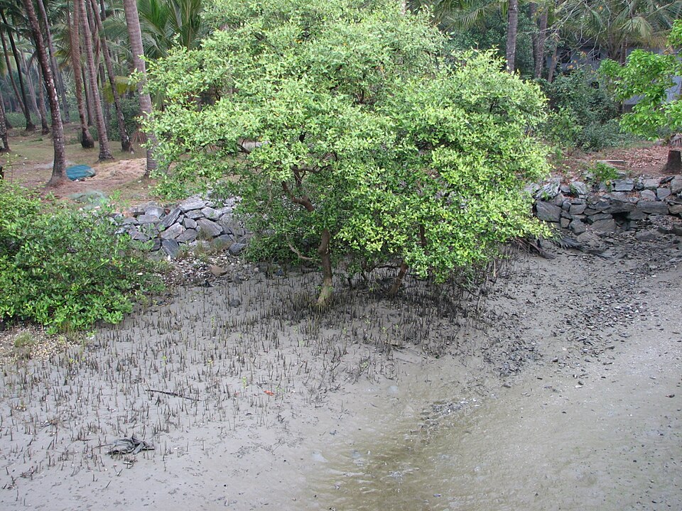
The Sundarbans. The Sundarbans, in the delta of the Ganga and Brahmaputra, are named after the Sundari tree that grows there. They are the only mangrove forest in the world with tigers. The mangroves shelter the coast of West Bengal and Bangladesh from cyclones and storm surges.
Why wetlands and mangroves matter. When mangroves are cut for fish farms, ports or housing, coasts lose their natural shield, and cyclones and storm surges cause far more damage. When urban wetlands are filled, cities flood more often. Protecting them is cheaper than building concrete flood defences, which is why wetland and coastal rules are an important part of environmental policy.
India's forests: shaped by rain and height
India's forests change in a clear pattern, first with rainfall and then with altitude. If you remember the rain and height bands, you can predict which forest grows almost anywhere in the country. This makes them a favourite topic for both Prelims and Mains.
Tropical rain forests (more than 200 cm of rain). These dense evergreen forests grow on the western slopes of the Western Ghats and in the North-East. They are tall, layered and full of epiphytes, and they hold much of India's biodiversity. Because they are so rich, losing even small patches can wipe out species found nowhere else.
Tropical deciduous forests (75–200 cm). These are India's most widespread forests, covering much of central India and the plateaus. Their trees shed leaves in the dry season to save water. Valuable trees such as teak, sal and sandalwood grow here, which is why these forests have long been important for timber and for forest-dwelling communities.
Mountain forests change with height. In the Himalaya, forests change as you climb. Temperate broadleaf forests, with oak, grow at about 1,500–2,400 m, and coniferous forests, with trees such as deodar, grow at about 1,700–3,000 m. Above about 3,600 m, trees give way to alpine meadows and shrubs, and above that lies snow.
Why this matters. These forests protect watersheds, hold soil on slopes and supply fuel, fodder and forest produce to millions of people. Deciduous forests overlap with tribal regions and mineral belts, which creates hard choices between mining and conservation. Himalayan forests guard against landslides and floods, so clearing them raises disaster risks downstream.
India's special landscapes: desert, salt flats, corals and the Ghats
Beyond its forests, India has several distinctive ecosystems that exams love to ask about. Each one has its own story of how it formed and why it matters. Learning them as a set also helps with map-based questions.
The Thar desert. The Thar in western Rajasthan is an extension of the Sahara, linked through the deserts of Arabia and Persia. Rain is low and uncertain, and sand dunes shift with the wind. Yet it is one of the most densely populated deserts in the world, and its people have adapted with water-harvesting structures and hardy livestock.
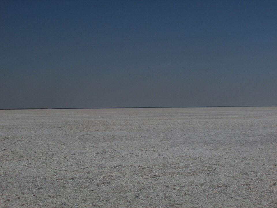
The Rann of Kutch and the Gulf of Kutch. The Rann of Kutch in Gujarat is a vast area of saline flats that floods in the monsoon and dries into white salt in summer; it is home to the wild ass. Nearby, the Gulf of Kutch has coral reefs, among India's few on the mainland coast. Corals are tiny animals that build reefs and are very sensitive to warming water and pollution.
The Western and Eastern Ghats. The Western Ghats run along the west coast from the Tapti river to Kanyakumari, forming an almost unbroken wall that catches the monsoon and feeds the rivers of peninsular India. The Eastern Ghats are lower and broken into separate hills by the great east-flowing rivers, the Mahanadi, Godavari and Krishna. The Western Ghats are especially rich in species found nowhere else.
Why these landscapes matter. The Thar shows how people can live sustainably in harsh lands, but also how over-grazing and canal irrigation can spread salinity. The Kutch corals and the Western Ghats are biodiversity treasures under pressure from development. Knowing them helps you write precise, location-based answers instead of general ones.
Mains lens: ecosystems in governance and disaster answers
Knowing ecosystems by name is useful for Prelims, but Mains asks why they matter. Four lines of argument are worth practising.
1. Ecosystems as natural infrastructure. Mangroves shield coasts from cyclones, wetlands absorb floods and Himalayan forests hold slopes together. Protecting them is usually cheaper than building concrete defences and works better over time. Use this argument in answers on disaster management, urban floods and coastal development.
2. Livelihoods and rights. Deciduous forests, grasslands and wetlands support tribal communities, herders and fishers. Conservation that shuts these people out often fails, while conservation that involves them tends to succeed. This links ecosystems to questions on forest rights, tribal welfare and community-based management.
3. Development versus conservation. Mineral belts overlap with forests, ports with mangroves and hill roads with fragile slopes. Good answers show both sides, the need for development and the cost of ecosystem loss, and then suggest ways to reduce the harm. Environmental impact assessment and careful site selection belong here.
4. Climate change and ecosystems. Warming threatens coral reefs, alpine meadows and glaciers, while healthy forests and mangroves store carbon. So ecosystems are both victims of and solutions to climate change. This dual role makes a strong conclusion for climate answers.
Mains practice: six questions, six angles
These are practice questions written by us, not past papers. Past questions from each exam appear in the PYQ panel of this module.
| Angle | Question | Key points to cover |
|---|---|---|
| Biomes | Explain how rainfall and temperature determine the distribution of the world's major biomes. | Describe rain forest, deciduous forest, taiga, grassland, desert and tundra with their conditions. Then explain why each threshold of rain or cold changes the vegetation. |
| Disasters | Mangroves are the first line of defence against cyclones. Discuss with Indian examples. | Explain halophytic adaptations and pneumatophores, and the role of the Sundarbans. Then discuss threats from fish farms and ports, and suggest protection and replanting. |
| Urban | Why are urban wetlands disappearing, and what are the consequences? | Explain that wetlands are seen as wasteland and filled for housing. Then link their loss to urban flooding and falling groundwater, and suggest mapping and legal protection. |
| Forests | Classify India's forests on the basis of rainfall and altitude. | Give the rainfall bands for rain and deciduous forests with regions and trees. Then give the altitude bands for oak, deodar and alpine vegetation in the Himalaya. |
| Water | Compare lentic and lotic ecosystems. Why do lakes recover more slowly from pollution than rivers? | Define both types and the zones of a lake. Then explain slow water replacement in lakes and downstream spread in rivers, with basin-level management as the way forward. |
| Way forward | Ecosystems are both victims of and solutions to climate change. Examine. | Give corals, alpine meadows and tundra as victims of warming. Then give forests, mangroves and wetlands as carbon stores and natural defences, and suggest nature-based solutions. |
How to use this table: each answer should first explain the what, then give the why from this chapter, and end with a way forward.
Quick revision
- A biome is a large land community set by climate; water ecosystems are divided by salinity.
- Rain forest >200 cm, trees 50–60 m, epiphytes; temperate deciduous 75–150 cm, leaves shed in autumn; taiga cold, acidic soils, spruce, fir and pine.
- Grasslands cover about one-fifth of land (prairie, steppe, savanna, pampas); deserts about one-seventh; tundra is arctic or alpine.
- Lentic = still water, lotic = running water; the study is limnology; lake zones are littoral, open water, benthic.
- Oceans: about 71% of the surface, depth about 4,000 m, salinity about 3.6%; an estuary is a nutrient-rich ecotone.
- Mangroves are halophytic with pneumatophores; the Sundarbans are the only mangroves with tigers.
- India: rain forests >200 cm (Western Ghats, North-East), deciduous 75–200 cm (teak, sal, sandalwood), oak 1,500–2,400 m, deodar 1,700–3,000 m, alpine >3,600 m.
- Thar = extension of the Sahara; Rann = salt flats; Gulf of Kutch = corals; Western Ghats Tapti to Kanyakumari; Eastern Ghats broken by rivers.