

UPPSC PCS · Module 12 · Mains depth · 16 min
The interior of the Earth and isostasy
What UPPSC PCS asks from this chapter
Syllabus lines this chapter covers:
- Prelims: General Studies I · Indian and world geography
UPPSC PCS questions from this module are being sorted into our bank.
Read at full depth: basics, the standard layer and the Mains analysis.
Start from zero: looking inside without digging
Imagine being given a wrapped gift and asked what is inside, without opening it. You might weigh it, shake it and listen, or tap it and feel how it rings. Geographers face the same problem with the Earth, because its centre lies about 6,371 km below our feet.
The deepest hole humans have ever drilled reaches only about 12 km, less than one five-hundredth of the way to the centre. Beyond that, heat and pressure become too great for drills. So almost everything we know about the deep interior comes from clever indirect clues.
One clue is weight. The Earth's average density is about 5.5 g/cm³, roughly twice that of ordinary surface rocks (about 2.7 g/cm³). The only way to get such an average is if very heavy material is packed inside, and this hints at a metal core.
Why it matters. The interior drives earthquakes, volcanoes, mountain building and the movement of continents. It also creates the magnetic field that protects life and helps compasses work. Understanding the inside is the foundation for understanding almost every landform on the outside.
Direct and indirect sources
Direct sources give us actual material from below. Mining and deep drilling, for oil, minerals or science, bring up rock samples from a few kilometres down. Volcanic eruptions throw out lava and rock fragments from much deeper, sometimes from the mantle itself.
Indirect sources are measurements from which we infer conditions. In mines and boreholes, temperature and pressure rise with depth, so the deep interior must be very hot and under enormous pressure. Meteorites are pieces of other bodies made of the same stuff as the early solar system; their iron-rich kinds hint at what the Earth's core may be like.
Gravity is not exactly the same everywhere on the surface; differences, called gravity anomalies, reveal how mass is spread below. The Earth's magnetic field points to a moving, electrically conducting liquid deep inside, which can only be molten metal.
But the most powerful source is seismic waves from earthquakes. These waves travel through the whole planet, and seismographs around the world record when and how they arrive. Like an X-ray or ultrasound scan, they reveal the inner layers without any digging.
Why it matters. Combining many independent clues is how science builds confidence about places no one can visit. The same methods are used to find oil, groundwater and minerals, and to choose safe sites for dams and nuclear plants.
Earthquake waves: P, S and surface waves
An earthquake releases energy at a point inside the Earth called the focus (hypocentre); the point on the surface directly above it is the epicentre. The energy spreads out as seismic waves, which come in two families.
Body waves travel through the interior. P waves (primary waves) are the fastest and arrive first. They move by pushing and pulling the material in the direction they travel, like sound, so they can pass through solids, liquids and gases.
S waves (secondary waves) are slower and arrive later. They shake the material side to side, at right angles to the direction of travel, like a rope flicked up and down. Liquids cannot resist this kind of shearing, so S waves cannot pass through liquids.
When body waves reach the surface, they create surface waves, the slowest but most destructive. Love waves shake the ground sideways, and Rayleigh waves roll it up and down like ocean waves. These cause most of the damage to buildings, bridges and power lines.
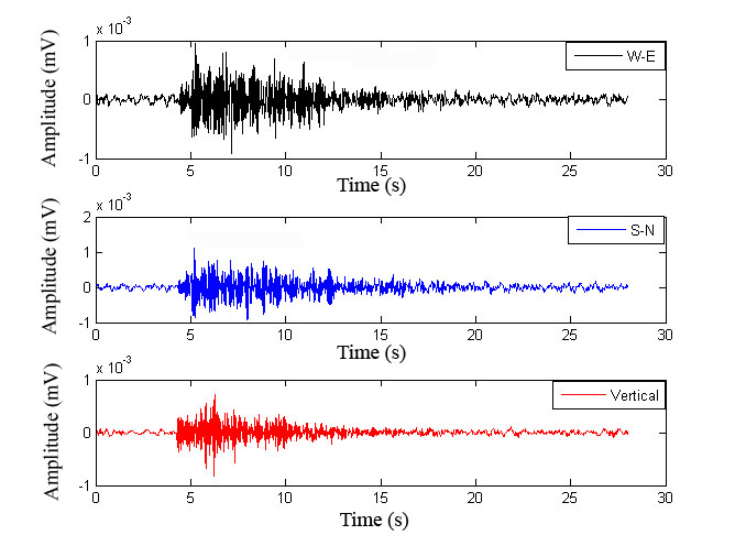
Waves also change speed and bend (refract) or bounce (reflect) when they pass into materials of different density. In denser, more rigid material, they generally travel faster. This changing speed is the key that lets scientists map the layers.
Why it matters. The difference between P and S waves is the single most important tool for reading the Earth's interior. Because P waves arrive first, they also give a few seconds' warning before strong shaking, which earthquake early-warning systems use.
The shadow zone: proof of a liquid core
When a big earthquake happens, seismographs all over the world record it. But scientists noticed something strange: in a band roughly 105° to 145° away from the epicentre, no direct waves are recorded at all. This band is called the shadow zone.
The explanation lies deep inside. S waves disappear everywhere beyond about 105°, because they reach a layer they cannot cross. Since S waves cannot pass through liquids, that layer, the outer core, must be liquid.
P waves do cross the core, but they bend sharply as they enter and leave it, because their speed changes suddenly. This bending throws them away from the 105°–145° band, so P waves too are missing there, and they reappear beyond 145°.
Later, very faint P waves were detected inside the shadow zone. Their pattern showed that the core has a solid inner part, which reflects and speeds up the waves. So the shadow zone revealed both the liquid outer core and the solid inner core.
Why it matters. The shadow zone is a classic example of reasoning from evidence, and examiners often ask about it. A liquid outer core of moving molten iron is also what generates the Earth's magnetic field, which shields the planet from harmful solar particles.
Crust, mantle and core
Using seismic waves, the Earth is divided into three main layers, separated by surfaces where wave speed jumps suddenly, called discontinuities.
The crust is the thin, brittle outer skin. It is only about 5 km thick under the oceans but about 30 km under the continents, and around 70 km under great mountain ranges like the Himalaya. Continental crust is lighter, made largely of granite-like rocks rich in silica and aluminium, while oceanic crust is heavier basalt rich in silica and magnesium.
At the base of the crust, wave speed rises sharply. This boundary is the Mohorovičić discontinuity, or Moho, discovered in 1909 by the Croatian seismologist Andrija Mohorovičić.
The mantle extends from the Moho down to about 2,900 km. It is solid rock, but so hot that it can flow very slowly over millions of years, like thick toffee. Its upper part, up to about 400 km, contains a weak, partly molten zone called the asthenosphere, the main source of magma for volcanoes. The crust and the rigid top of the mantle together form the lithosphere, which is broken into the plates that move over the asthenosphere.
At about 2,900 km lies the Gutenberg discontinuity, the boundary between the mantle and the core. The core is made mainly of iron and nickel. Its outer core is liquid, and its inner core, from about 5,150 km to the centre at about 6,371 km, is solid because the enormous pressure keeps the metal from melting.
The geologist Eduard Suess gave older names to these layers: sial (silica + aluminium) for the continental crust, sima (silica + magnesium) for the denser layer below and the ocean floor, and nife (nickel + iron) for the core. These names are still used in many textbooks and exams.
What keeps the interior so hot? Part of the heat is left over from the Earth's formation, and part comes from the slow decay of radioactive elements such as uranium and thorium. Near the surface, temperature in mines rises by roughly 1 °C for every 30 or so metres, though the rate slows deeper down. The centre is estimated at several thousand degrees Celsius, and this heat drives slow convection currents in the mantle that help move the plates.
Why it matters. The weak asthenosphere lets plates move, causing earthquakes, volcanoes and mountains. The light continental crust explains why continents stand high and oceans lie low. The metal core, with its liquid outer part, explains the magnetic field.
Isostasy: why mountains float
In the nineteenth century, surveyors measuring latitudes across northern India hung plumb lines (weights on strings) to find the true vertical. Near the Himalaya, the plumb lines were pulled towards the mountains, as expected, but much less than the mountains' huge mass predicted. Something under the mountains seemed to make up for their weight.
In 1855, two explanations were offered. George Airy suggested that the crust has the same density everywhere but different thickness: mountains have deep roots of light rock pushing down into the denser layer below, like an iceberg whose bigger part lies underwater. J.H. Pratt suggested instead that the base of the crust is level, but mountains are made of lighter rock than plains and ocean floors, so a taller column weighs the same as a shorter, denser one.
Both ideas describe isostasy, a word from Greek meaning "equal standing". It means that blocks of the light crust float on the denser, slowly flowing mantle and settle at a height that balances their weight. Seismic studies later found that mountains do have deep roots, so Airy's model fits most ranges well, but density differences also play a part.
Isostasy is a dynamic balance. When mountains are worn down by erosion, the crust slowly rises to replace the lost weight, so mountains can keep rising for a long time. When ice sheets thousands of metres thick melted at the end of the last ice age, the land beneath began to rebound, and in regions such as Scandinavia and Canada it is still rising today.
Why it matters. Isostasy explains why continents stand high and ocean basins lie low, and why deeply eroded old mountains still exist. It also matters for engineering: very heavy loads, such as large reservoirs, can slightly press the crust down and may trigger small earthquakes.
Mains lens: what, why, where and so what
This chapter belongs to GS Paper I and links to disaster management in GS Paper III. Here are four angles.
1. Evidence over observation. No one has seen the mantle or core, yet we know their depth and state. Answers can show how seismic waves, density, meteorites and magnetism together build the picture.
2. Interior and hazards. The asthenosphere and moving plates explain earthquakes and volcanoes. Answers on Himalayan earthquakes or tsunamis can begin from the layered interior.
3. The core and the magnetic field. The liquid outer core generates the magnetic field, which protects life, guides navigation and records past plate movements in rocks.
4. Isostasy and landscapes. Isostasy explains continent–ocean levels, the persistence of old mountains and post-glacial rebound. Answers can also mention reservoir-induced seismicity as a practical concern.
Mains lens: practice questions and answer plans
Now turn this understanding into written answers. The four questions below are written in the UPSC style, but they are our own practice questions, not previous-year questions. The real previous-year questions of your exam appear in the "Previous year questions" box once we have matched them with the official papers.
Q1. "How have seismic waves helped us understand the interior of the Earth?" (150 words)
- Explain P, S and surface waves.
- Explain changes in speed at discontinuities.
- End with the shadow zone and the liquid outer core.
Q2. "What is the seismic shadow zone? What does it tell us about the Earth's core?" (150 words)
- Define the 105°–145° band.
- Explain the absence of S waves and the bending of P waves.
- Conclude with the liquid outer and solid inner core.
Q3. "Describe the internal structure of the Earth and explain how it influences surface processes." (250 words)
- Introduction: State the three layers and how they were found.
- Body: Describe the crust, mantle with asthenosphere and core; link them to plates, volcanoes, earthquakes and the magnetic field.
- Conclusion: Note the importance for hazard planning.
Q4. "Explain the concept of isostasy with reference to the views of Airy and Pratt." (150 words)
- Give the Himalayan plumb-line puzzle.
- Contrast Airy's roots with Pratt's density differences.
- End with isostatic rebound.
Useful keywords: direct and indirect sources, focus, epicentre, P waves, S waves, Love and Rayleigh waves, shadow zone, crust, Moho, mantle, asthenosphere, lithosphere, Gutenberg discontinuity, outer and inner core, sial, sima, nife, isostasy, Airy, Pratt, isostatic rebound.
Quick revision
- Centre at about 6,371 km; deepest drilling only about 12 km; average density about 5.5 g/cm³.
- P waves: fastest, push–pull, pass through solids, liquids, gases. S waves: slower, side to side, no liquids. Surface waves (Love, Rayleigh): most damage.
- Shadow zone: about 105°–145° from the epicentre; no S waves beyond 105° → liquid outer core.
- Crust: about 5 km (oceans), 30 km (continents), about 70 km (Himalaya). Moho (1909) at its base.
- Mantle to about 2,900 km; asthenosphere in the upper mantle (to about 400 km) → magma. Lithosphere = crust + rigid top mantle.
- Gutenberg discontinuity at about 2,900 km; liquid outer core; solid inner core from about 5,150 km.
- Suess: sial, sima, nife.
- Isostasy ("equal standing"): Airy (1855) roots, same density; Pratt (1855) level base, different density; post-glacial rebound.