

UPPSC PCS · Module 19 · Mains depth · 16 min
Land use, cropping seasons and the Green Revolution
What UPPSC PCS asks from this chapter
Syllabus lines this chapter covers:
- Prelims: General Studies I · Indian and world geography
UPPSC PCS questions from this module are being sorted into our bank.
Read at full depth: basics, the standard layer and the Mains analysis.
Start from zero: a country that lives off its land
Fly over India in any season and you will see a patchwork of fields, from the green paddy of Bengal to the golden wheat of Punjab and the cotton of the Deccan. Farming is still the biggest single use of India's land and the largest source of jobs. In the 2011 Census, more than half of all workers depended on agriculture.
Yet India has limited land and a very large population. The total area is fixed, and good farmland is being swallowed by towns, roads and factories. So the key questions of this chapter are how India's land is used, when and how crops are grown, and how India went from food shortage to food surplus.
The answers depend on geography. Rainfall, temperature, soil and water decide what can be grown, while landholdings, technology and markets decide how well it is grown.
Why it matters. Food security, rural incomes, water use and climate resilience all depend on how land is used. These ideas are the base for later chapters on crops, irrigation and rural policy.
How India's land is used
India's geographical area is about 328.7 million hectares, but land-use records cover a slightly smaller reporting area of about 307.8 million hectares. The gap exists because some border and remote areas have never been surveyed in revenue records. All land-use figures are therefore given as shares of the reporting area.
Revenue records sort the reporting area into nine classes. They are forests; land put to non-agricultural uses such as settlements, roads and canals; barren and unculturable land such as deserts and rocky mountains; permanent pastures and grazing land; land under miscellaneous tree crops and groves; culturable wasteland; current fallow; fallow other than current fallow; and net sown area, the land actually sown at least once in the year.
The three kinds of idle farmland are easy to confuse. Current fallow is left unsown for one year or less, usually to let the soil recover moisture and nutrients. Fallow other than current fallow is left unsown for one to five years, and culturable wasteland has not been cultivated for more than five years but could be reclaimed.
The net sown area is about 140 million hectares, roughly 45% of the reporting area. It grew after Independence as forests and wasteland were cleared, but since the early 1990s it has been slowly shrinking, as farmland is converted to urban, industrial and infrastructure uses and as culturable wasteland is used up. Fallow land has meanwhile increased in many dry and uncertain areas.
Because new land can no longer be brought under the plough, more food must come from growing more crops on the same land and higher yields per hectare. This is why irrigation, multiple cropping and better seeds matter so much.
Why it matters. Land-use change reveals pressures such as urban sprawl, loss of pastures and rising fallows in rain-fed areas. It underlies debates on land acquisition, wasteland development and protecting prime farmland.
Kharif, rabi and zaid: India's crop calendar
India's farming year follows the monsoon. Over most of North and Central India there are three cropping seasons, each suited to different crops.
Kharif crops are sown with the onset of the south-west monsoon in June–July and harvested around September–October. They need heat and plenty of water, so they include rice, cotton, jute, jowar, bajra, maize, groundnut, soybean and tur (arhar). Because they depend on rain, a delayed or weak monsoon hits kharif output first.
Rabi crops are sown after the monsoon in October–November and harvested in March–April. They grow in the cool, dry winter, using stored soil moisture, irrigation and the light winter rain brought by western disturbances in the north-west. Rabi crops include wheat, gram (chana), mustard, barley and peas.
Zaid is a short summer season between rabi and kharif, from about March–April to June. Mostly irrigated, it is used for quick crops such as watermelon, muskmelon, cucumber, vegetables and fodder.
This neat pattern belongs mainly to the north and the interior. In South India, temperatures stay high all year, so there is no true cold season, and where water is available farmers can grow the same tropical crops such as rice two or three times a year; Tamil Nadu and coastal Andhra Pradesh, for example, have several paddy seasons. Irrigation has also let farmers grow crops outside their natural zones, such as rice in Punjab and Haryana.
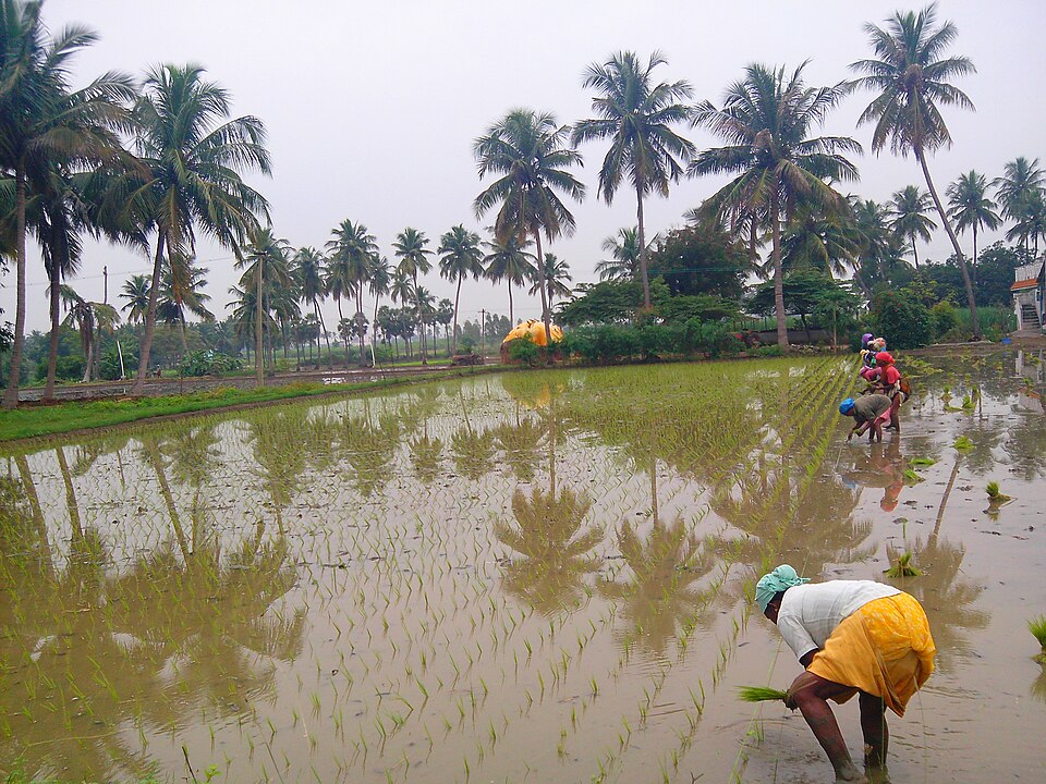
Why it matters. The crop calendar decides when credit, seeds, fertiliser, power and labour are needed and when prices are announced. A weak monsoon, an early heatwave in March or unseasonal rain at harvest can each damage a different season's crop.
Cropping patterns, intensity and types of farming
A cropping pattern is the share of a region's area under different crops at a given time. It reflects climate, soil, water, prices, food habits and government policy, and it keeps changing. In India, food grains, that is cereals and pulses, still take up roughly two-thirds of the cropped area.
When the same field is sown more than once a year, the gross cropped area becomes larger than the net sown area. Cropping intensity is the gross cropped area divided by the net sown area, multiplied by 100. A value of 100 means one crop a year, and 200 means two crops on all land; it is highest where irrigation is assured, as in Punjab, West Bengal and Haryana.
Farmers use several cropping systems. Mixed cropping sows two or more crops together in the same field, a form of insurance in rain-fed areas, since at least one crop may survive a bad monsoon. Intercropping grows crops in separate rows, crop rotation alternates crops season by season, and growing legumes such as pulses in rotation restores nitrogen to the soil.
Farming is also divided by water supply. Dryland farming is practised where annual rainfall is below about 75 cm; it relies on hardy crops such as bajra, jowar, ragi and pulses and on saving soil moisture. Wetland farming is practised where rainfall exceeds crop needs, as in the eastern and southern rice regions, which face floods and waterlogging rather than drought.
Rain-fed farming covers roughly half of India's net sown area, and it supports many of the poorest farmers. Rainfall variability, low inputs and degraded soils keep its yields low.
Why it matters. Cropping patterns shape water demand, nutrition and farm incomes. Shifting from water-thirsty rice in dry regions to millets and pulses is now a major policy debate.
Small farms and the pressure on land
Most Indian farmers work very small plots. The average size of an operational holding fell from 2.28 hectares in 1970–71 to 1.08 hectares in 2015–16, as land was divided among heirs generation after generation. More than 85% of all holdings are small (1–2 hectares) or marginal (below 1 hectare).
Small size is made worse by fragmentation: one family's land is often scattered in several tiny plots in different parts of the village. Moving seed, tools and animals between plots wastes time, and wells or tube wells are hard to use efficiently. Consolidation of holdings, which regroups scattered plots into one or two blocks, has succeeded mainly in Punjab, Haryana and western Uttar Pradesh.
Population pressure is the root cause. Per-person farmland in India is only about a tenth of a hectare, far below the world average. With few other jobs in villages, many people stay on the land even when it cannot fully employ them, a condition called disguised unemployment.
Small farms are not always less productive per hectare, because families work them intensively. But small farmers find it harder to afford machines, borrow money, store produce and bargain in markets, which is why farmer producer organisations and cooperatives are promoted.
Why it matters. Landholding size shapes farm incomes, mechanisation, credit and the reach of government schemes. It explains why most farm policy debates in India centre on the small and marginal farmer.
The Green Revolution: why, how and at what cost
Why it was needed. In the early 1950s, India produced only about 50 million tonnes of food grains for some 360 million people, and depended heavily on imports, including food aid from the United States. Severe droughts in 1965 and 1966 made the shortage a national emergency. Since new land was running out, the only way forward was to raise yields on existing land.
How it came. In Mexico, the scientist Norman Borlaug had bred short, sturdy, high-yielding varieties (HYV) of wheat that did not fall over when heavily fertilised. Indian scientists led by M. S. Swaminathan tested and adapted these seeds.
From 1966–67 the new package spread rapidly. The package combined HYV seeds of wheat and later rice with assured irrigation, chemical fertilisers and pesticides, cheap credit, rural electricity, and government minimum support prices and procurement.
What it achieved. Food-grain output roughly doubled within about a decade and kept rising, crossing 300 million tonnes in recent years, and India became self-sufficient and later an exporter of grain. The term "Green Revolution" itself was coined in 1968 by William Gaud of the US aid agency. Machinery, fertiliser and agro-processing industries grew along with it.
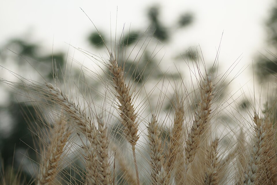
What it cost. The gains were concentrated in Punjab, Haryana and western Uttar Pradesh, along with parts of Andhra Pradesh and Tamil Nadu, where irrigation already existed, so regional inequality widened. It focused on wheat and rice, while pulses, oilseeds and coarse grains lagged. Larger farmers gained most, and heavy use of water and chemicals caused falling water tables, waterlogging and salinity in canal areas, soil nutrient loss and health concerns.
These problems led Swaminathan to call for an "Evergreen Revolution", which raises productivity while protecting soil, water and biodiversity. Today's priorities include spreading gains to eastern India and rain-fed areas, crop diversification, micro-irrigation and balanced use of fertilisers.
Why it matters. The Green Revolution is a classic Mains case of technology solving one crisis while creating new ones. Its legacy shapes today's debates on procurement, groundwater, stubble burning and crop diversification.
Mains lens: what, why, where and so what
This chapter supports GS Paper I (distribution of resources and cropping patterns) and links to agriculture and food security in GS Paper III. Here are four angles.
1. Land under pressure. Answers can use land-use trends to show shrinking net sown area, rising fallows and conversion of farmland, and argue for higher productivity per hectare.
2. Seasons and climate risk. The kharif–rabi–zaid calendar links agriculture to the monsoon, western disturbances and heatwaves, which helps in questions on climate change and farming.
3. Smallholders. Shrinking holdings and fragmentation explain low mechanisation and incomes, and support arguments for consolidation, cooperatives and producer organisations.
4. Green Revolution lessons. Its successes and costs support balanced answers on food security, regional disparity and sustainability.
Mains lens: practice questions and answer plans
Now turn this understanding into written answers. The four questions below are written in the UPSC style, but they are our own practice questions, not previous-year questions. The real previous-year questions of your exam appear in the "Previous year questions" box once we have matched them with the official papers.
Q1. "Analyse the changing pattern of land use in India and its implications for food security." (250 words)
- Introduction: Explain reporting area and the nine-fold classification.
- Body: Trends in net sown area, fallows, wasteland and non-farm use; causes.
- Conclusion: Need for higher yields and protection of prime farmland.
Q2. "Explain the cropping seasons of India. Why is the seasonal pattern less distinct in South India?" (150 words)
- Describe kharif, rabi and zaid with crops.
- Link South India to year-round warmth and water.
Q3. "The Green Revolution was a success with serious costs. Critically examine." (250 words)
- Explain why it was needed and its package.
- Weigh gains against regional, social and ecological costs; end with the Evergreen Revolution.
Q4. "Small and fragmented landholdings are a structural constraint on Indian agriculture. Discuss." (150 words)
- Give the trend in holding size.
- End with consolidation and collective farming solutions.
Useful keywords: geographical area, reporting area, nine-fold land use, net sown area, gross cropped area, cropping intensity, current fallow, culturable wasteland, kharif, rabi, zaid, mixed cropping, crop rotation, dryland farming, operational holding, fragmentation, disguised unemployment, high-yielding varieties, minimum support price, Evergreen Revolution.
Quick revision
- Geographical area about 328.7 Mha; reporting area about 307.8 Mha; nine-fold land-use classes.
- Net sown area about 140 Mha (about 45% of reporting area), slowly falling since the early 1990s.
- Current fallow ≤ 1 year; other fallow 1–5 years; culturable wasteland > 5 years.
- Cropping intensity = gross cropped area ÷ net sown area × 100.
- Kharif (June–Sept): rice, cotton, jute, jowar, bajra, tur. Rabi (Oct–Nov to Mar–Apr): wheat, gram, mustard. Zaid (summer): melons, cucumber, vegetables, fodder.
- South India: no real winter; rice two or three times a year.
- Dryland farming below about 75 cm rain; wetland farming in high-rain rice areas.
- Average holding 2.28 ha (1970–71) → 1.08 ha (2015–16); over 85% small or marginal.
- Green Revolution (from mid-1960s): HYV wheat and rice, irrigation, fertiliser, MSP; Borlaug (dwarf wheat), Swaminathan (India); term by William Gaud (1968).
- Costs: concentrated in Punjab, Haryana, western UP; groundwater fall, waterlogging, salinity; pulses and oilseeds neglected → Evergreen Revolution.