

UPSC NDA & NA · Module 15 · basic depth · 11 min
Temperature and salinity of ocean water
What UPSC NDA & NA asks from this chapter
Syllabus lines this chapter covers:
- Paper II, Part B: General Knowledge · The Earth, its shape and size. Latitudes and Longitudes, Concept of time. International Date Line. Movements of Earth and their effects.
UPSC NDA & NA questions from this module are being sorted into our bank.
Cut to basic depth for UPSC NDA & NA. 16 deeper paragraphs are in the full chapter.
Start from zero: why is the sea salty and slow to warm?
Stand on a beach at noon and the sand burns your feet, while the water still feels cool. At night the sand turns cold, but the sea stays mild. This simple difference, that water heats and cools far more slowly than land, shapes the climate of the whole planet.
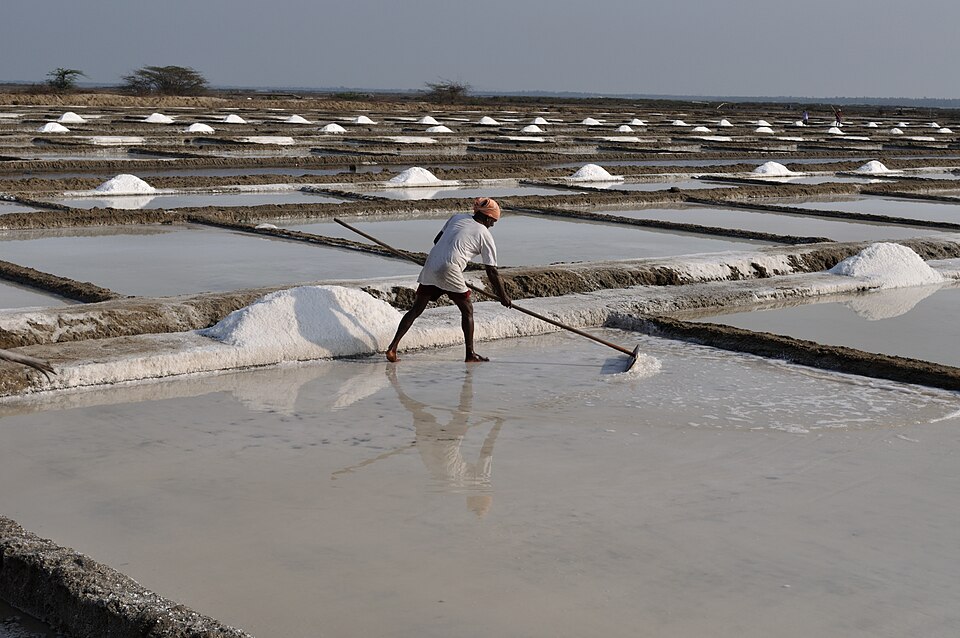
Taste the sea and you notice the other big difference: it is salty. Rivers carry small amounts of dissolved minerals from rocks into the sea, and when sea water evaporates, the water leaves but the salt stays. Over hundreds of millions of years, salt has built up to the level we see today, and undersea volcanic vents add more.
Temperature and salinity together decide how heavy, or dense, sea water is. Density in turn decides which water sinks and which floats, and that drives the slow circulation of the deep ocean.
Why it matters. Ocean temperature fuels cyclones and the monsoon, and controls where fish and corals live. Salinity and temperature together steer ocean circulation, which carries heat around the world.
What controls the temperature of the sea
The ocean is heated mainly by the Sun at its surface. Water needs much more heat than land to warm by the same amount, sunlight penetrates several metres down, and waves and currents mix the heat through a deep layer. That is why the ocean's daily and annual range of temperature is far smaller than that of land.
Four factors control ocean temperature. Latitude comes first: the Sun is high in the tropics, so surface water is warmest there and becomes colder towards the poles. Land and water matter next, because enclosed seas in hot regions, such as the Red Sea and the Persian Gulf, get much warmer than the open ocean.
Prevailing winds blowing off the land push warm surface water away from the coast, and cold water rises from below to replace it, a process called upwelling. Ocean currents carry warm water poleward and cold water towards the equator; the warm Gulf Stream keeps north-western Europe mild, while cold currents chill the west coasts of the subtropical continents.
On average, surface temperature falls by roughly half a degree Celsius for each degree of latitude from the equator. The warmest waters lie slightly north of the equator, and northern-hemisphere oceans are a little warmer than southern ones, because the north has more land, which heats the nearby seas.
The oceans are now warming. They have absorbed the great majority of the extra heat trapped by greenhouse gases since the mid-twentieth century, which has so far protected the land from even faster warming. The price is warmer surface water, longer and more frequent marine heatwaves, and stronger storms. The Indian Ocean has been among the fastest-warming tropical oceans.
Why it matters. Warm seas above about 26–27 °C are needed for tropical cyclones, which is why the Bay of Bengal and Arabian Sea are cyclone breeding grounds; see tropical cyclones. Upwelling of cold water brings nutrients that support the richest fisheries.
Temperature with depth: three layers
Sunlight warms only the top of the ocean, so temperature falls with depth. In the tropics and mid-latitudes, the ocean can be pictured as three layers.
At the top is the warm mixed layer, stirred by waves and wind so that its temperature is fairly even. It may be from a few tens of metres to a few hundred metres thick, and in the tropics its temperature is often 20–30 °C.
Below it lies the thermocline, a zone in which temperature drops rapidly with depth, typically down to about 1,000 m. The thermocline acts like a lid, because warm, light water above does not mix easily with cold, dense water below. Under it is the deep layer, which fills most of the ocean's volume and stays cold, mostly between about 0 and 4 °C, right down to the sea floor.
In polar seas there is little or no thermocline, because the surface water is already about as cold as the deep water. That is why cold water can sink there and feed the deep ocean.
Why it matters. The depth of the warm layer controls how much energy is available to cyclones and how strongly El Niño develops. Because the deep ocean is cold and nutrient-rich, wherever it is brought to the surface, life flourishes.
What salinity is and what changes it
Salinity is the total amount of salt dissolved in sea water. It is measured as grams of salt in one kilogram (1,000 g) of sea water and written in parts per thousand (‰). The average salinity of the open ocean is about 35‰, meaning a kilogram of sea water holds about 35 g of salt.
The most common salt by far is sodium chloride, ordinary table salt, which makes up about 78% of all dissolved salts. Magnesium chloride, magnesium sulphate, calcium sulphate and potassium salts make up most of the rest. Remarkably, the proportions of these salts are almost the same everywhere in the open ocean, even though the total amount varies.
Several processes change salinity. Evaporation removes fresh water and leaves salt behind, so salinity rises in hot, dry, sunny regions. Rainfall, river inflow and melting ice add fresh water and lower it.
When sea water freezes, the ice formed is mostly fresh, so the salt left in the remaining water raises its salinity. Winds and currents move water of different salinity from place to place, for example carrying salty subtropical water poleward.
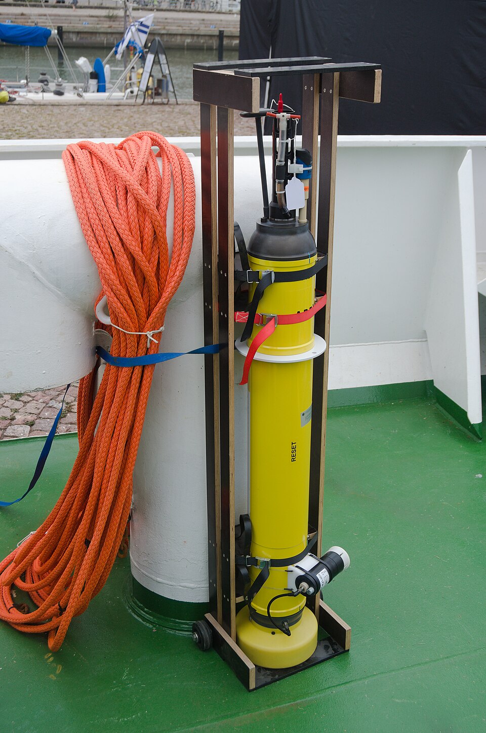
Today salinity is measured not by boiling off water but by how well sea water conducts electricity, since more salt means better conduction. Thousands of free-drifting robotic Argo floats, to which India also contributes, dive to about 2,000 m and rise again, recording temperature and salinity across the world ocean. Satellites add maps of surface salinity from space.
Why it matters. Salinity affects the density and freezing point of sea water, the movement of deep currents and the life that can survive in coastal waters. Salt pans along India's coasts rely on high evaporation to produce salt.
Where the sea is saltiest
You might expect the equator, the hottest place, to be the saltiest. In fact surface salinity is highest in the subtropics, around 20° to 30° north and south. There, sinking dry air brings clear skies, strong evaporation and little rain, so salinity often rises above 36‰.
At the equator, salinity is slightly lower, because heavy daily rain dilutes the surface water. Towards the poles, salinity is lowest, since evaporation is weak and melting ice and rivers add fresh water.
Enclosed seas show the extremes. The Red Sea and the Persian Gulf, surrounded by deserts and with little river inflow, are among the saltiest seas, and the Mediterranean is also saltier than the open Atlantic. The Baltic Sea and the Black Sea, fed by many rivers in cool climates, are much less salty.
India's two seas are a good contrast. The Arabian Sea is saltier, because it lies next to dry lands and gets relatively little river water. The Bay of Bengal is much fresher at the surface, because the Ganga, Brahmaputra, Mahanadi, Godavari and Krishna pour huge volumes of fresh water into it, especially in the monsoon.
The highest salinity of all is found in inland lakes with no outlet, where water escapes only by evaporation. Lake Van in Turkey has about 330‰, the Dead Sea about 238‰ and the Great Salt Lake in the USA about 220‰. Below the surface, a halocline, a layer in which salinity changes sharply with depth, often separates fresher surface water from saltier water underneath.
Why it matters. The fresh surface layer of the Bay of Bengal keeps the sea surface warm and helps cyclones intensify, so salinity is part of cyclone forecasting. Salinity maps also help track rainfall, river discharge and climate change over the oceans.
Quick revision
- Water heats and cools slowly → small ocean temperature range; oceans moderate climate.
- Controls on temperature: latitude, land and water, winds (upwelling), currents.
- Surface temperature falls about 0.5 °C per degree of latitude; warmest just north of the equator.
- Layers: warm mixed layer → thermocline (to about 1,000 m) → cold deep layer (about 0–4 °C).
- Salinity in ‰ (g per kg); average about 35‰; sodium chloride about 78% of salts.
- Highest in the subtropics; lower at the equator; lowest at the poles. Red Sea, Persian Gulf high; Baltic, Black Sea low.
- Arabian Sea saltier than the Bay of Bengal (river inflow). Lake Van about 330‰, Dead Sea about 238‰, Great Salt Lake about 220‰.
- Colder and saltier = denser → thermohaline circulation; sea water freezes near −2 °C.