

Module 2 · 18 min read · Free chapter
ಭಾರತದ ಜೀವವೈವಿಧ್ಯ: ಹತ್ತು ವಲಯಗಳು, ನಾಲ್ಕು ಹಾಟ್ಸ್ಪಾಟ್ಗಳು ಮತ್ತು ಎಂಡೆಮಿಕ್ ಜೀವಿಗಳ ನಾಡು
India has about 2.4 percent of the world's land but 7 to 8 percent of its recorded species, making it a megadiverse country. It is divided into ten biogeographic zones, from the Trans-Himalaya to the coasts and islands. Parts of four global hotspots lie in India: the Himalaya, Indo-Burma, the Western Ghats with Sri Lanka, and Sundaland, which includes the Nicobar Islands.
Start from zero: a small share of land, a big share of life
Imagine dividing the world's land into a hundred equal pieces. India would get less than two and a half of them, about 2.4% of the world's land. Yet on that small share live 7–8% of all the species that scientists have recorded. India counts more than 45,000 species of plants and more than 91,000 species of animals.
In other words, India holds about three times more species than its size alone would suggest. Few countries match this, and India is counted among the world's megadiverse countries. These are the handful of countries, mostly tropical, that between them hold most of the planet's species.
This chapter asks three questions. Why is India so rich in life? How is that life spread across the country? And which parts are both the richest and the most at risk?
The answers matter for policy. A country that holds so much of the world's biodiversity carries a special responsibility in global talks. It also faces a hard balance at home, because many of its richest areas are also the ones being opened up for roads, mines, dams and farms.
Why is India so rich in life?
A meeting point of worlds. Biologists divide the world into large realms, each with its own family of plants and animals that evolved over millions of years. India sits where two great realms meet: the Palaearctic realm of cold and temperate Europe and Asia to the north, and the Indo-Malayan realm of tropical Asia to the south and east. In the dry west, many plants and animals also show links with Africa and West Asia. Species from all these sources mix within one country.
Every kind of land and climate. Within its borders, India runs from the world's highest mountains to sea level, and from one of the wettest places on Earth to hot and cold deserts. It has snowfields, alpine meadows, rainforests, dry thorn forests, grasslands, mangroves, coral reefs and island chains. Each of these offers different niches, so each supports different species. India has three major biomes: tropical humid forests, tropical deciduous forests and warm deserts and semi-deserts.
A cradle of crops. India is one of the world's centres of origin of cultivated plants, the places where people first tamed wild plants into crops. Rice, many pulses, mango, banana, sugarcane, black pepper and many others have wild relatives growing here. This makes India's genetic diversity of crops especially valuable for food security.
Why this matters. These reasons explain why protecting a few famous parks is not enough. India's biodiversity is spread across very different landscapes, and each landscape holds species found in no other. Losing one landscape, such as the grasslands or the wetlands, cannot be made up by protecting more forest.
Ten zones: reading India as a biologist would
A political map divides India into states. A biologist's map divides it by the kind of life each area holds. In 1988, the Wildlife Institute of India divided the country into ten biogeographic zones, and this classification is still widely followed. It was first made to plan a network of protected areas, so that every major kind of habitat would have some protection.
Each zone has its own mix of physical features, climate and history, and so its own groups of species. Two zones can sit side by side and still be utterly different, like the Himalaya and the Gangetic Plain.
| No. | Zone | In one line |
|---|---|---|
| 1 | Trans-Himalaya | Cold, high desert behind the main Himalaya, such as Ladakh and Lahaul-Spiti |
| 2 | Himalaya | Mountain forests from foothills to alpine meadows, over 2,000 km long |
| 3 | Indian Desert | The Thar of west Rajasthan and west Gujarat |
| 4 | Semi-Arid | Dry grasslands and scrub between the desert and the Deccan |
| 5 | Western Ghats | Wet mountain chain along the west coast, rich in endemics |
| 6 | Deccan Peninsula | The largest zone, about 43% of the land, mostly deciduous forest and scrub |
| 7 | Gangetic Plain | Fertile, densely farmed river plains |
| 8 | North-East India | A crossroads of Indian, Indo-Malayan and Indo-Chinese life |
| 9 | Islands | Andaman and Nicobar, and Lakshadweep |
| 10 | Coasts | Mangroves, beaches, mud flats and rocky and coral shores |
Why this matters. The zones turn a vague goal, "protect India's biodiversity", into a checklist. A protected-area network that covers forests well but leaves out grasslands, deserts or coasts is incomplete. Answers on conservation gaps can use the zones to show which landscapes are under-protected.
The cold and dry zones: Trans-Himalaya, Himalaya, Desert and Semi-Arid
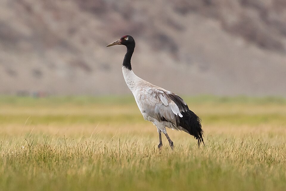
Zone 1: Trans-Himalaya. This is the cold, high desert behind the main Himalayan wall, mainly Ladakh and Lahaul-Spiti, lying largely between 4,500 and 6,000 m. Its harsh climate makes the ecosystem very fragile, and the vegetation is a sparse alpine steppe. Yet together with neighbouring Tibet and Pakistan, it holds the richest wild sheep and goat communities in the world. Wild yak, Tibetan antelope, Tibetan gazelle, ibex, snow leopard and the migratory black-necked crane are its signature animals.
Zone 2: Himalaya. The Himalaya stretches for over 2,000 km and is one of India's richest zones in habitats and species. Going uphill, the forests change from mixed deciduous foothills to chir pine and oak, then to temperate maples, walnuts and conifers such as blue pine, fir and spruce, and finally to birch and rhododendron scrub below alpine meadows. The west is drier, with deodar; the east is wetter, with a higher tree line, orchids and the Mishmi takin. Endemism is high across almost all groups, and herbivores such as the hangul and markhor have declined sharply.
Zone 3: Indian Desert. The Thar covers west Rajasthan and west Gujarat; parts of Punjab and Haryana were once desert too, before canal irrigation changed them. Its wildlife is special not for numbers but for remarkable adaptations to heat and drought. The Houbara bustard, desert fox and desert cat are restricted here, and the khejri tree (Prosopis cineraria) is a key plant.
Zone 4: Semi-Arid. This belt of dry grassland and scrub lies between the desert and the Deccan and covers about 15% of the country. Its grasses and palatable shrubs support herds of blackbuck, nilgai, chowsingha and gazelle, along with the lesser florican and sloth bear. Many of its plants, such as the Acacias, show African links.
The heartland zones: Western Ghats, Deccan and the Gangetic Plain
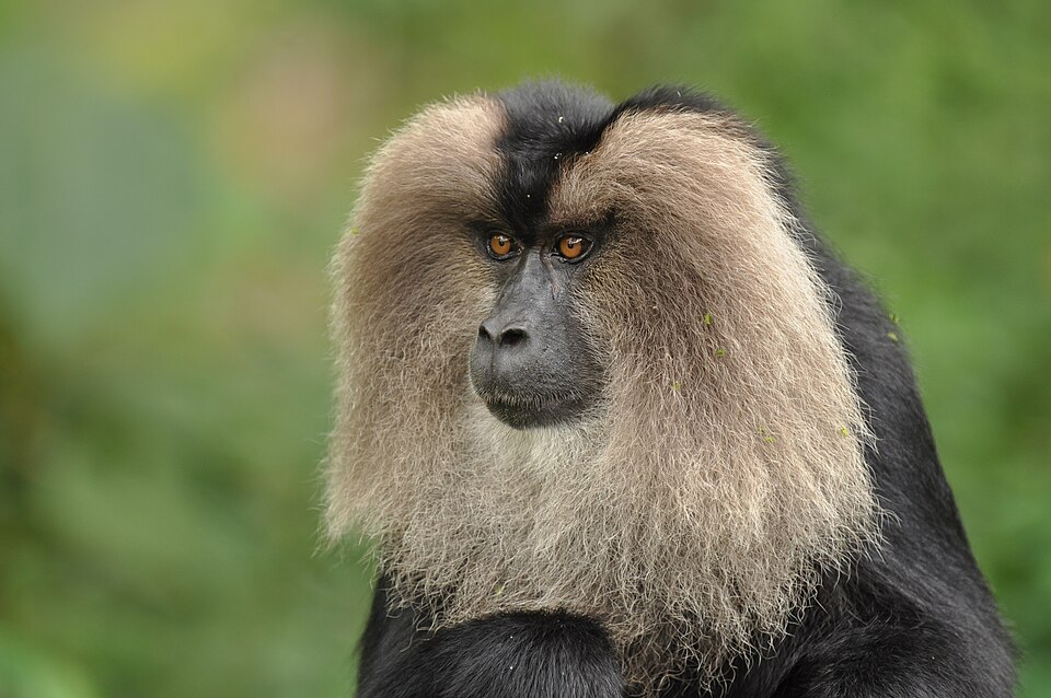
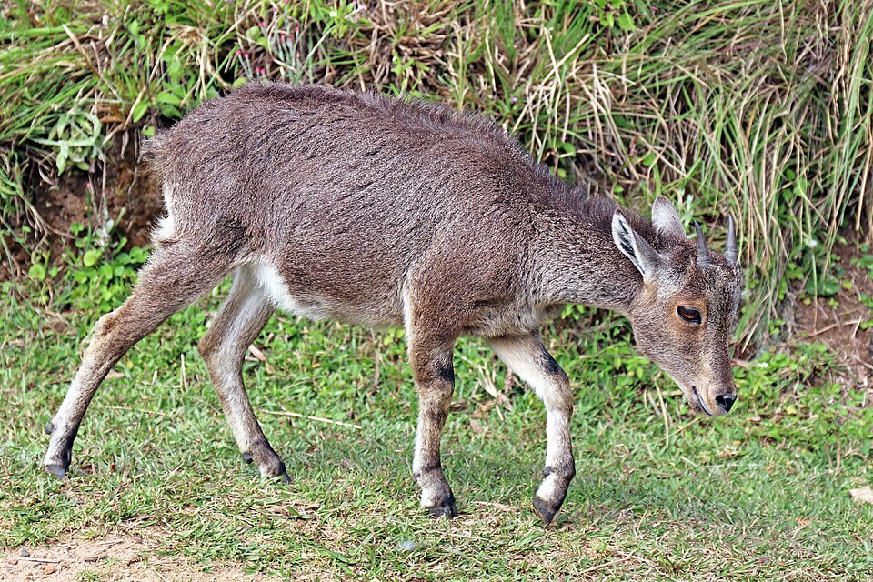
Zone 5: Western Ghats. This chain of hills along the west coast covers about 160,000 sq km and is one of India's main tropical evergreen forest regions. It holds a very large share of India's endemic plants, and its forests also feed the rivers that water much of the peninsula. Animals found only here include the lion-tailed macaque, the Nilgiri langur, the Nilgiri tahr, the Malabar grey hornbill and the Malabar civet. Large areas of forest have been lost, which makes this zone a top conservation concern.
Zone 6: Deccan Peninsula. This is the largest zone, about 43% of India's land. It is mostly deciduous forest, thorn forest and degraded scrub, with small patches of semi-evergreen forest in the Eastern Ghats. Chital, sambar, nilgai, chowsingha, barking deer and gaur are widespread. Much of it has been changed by people, and some species survive only in small relict pockets, such as wild buffalo in a small area of central India.
Zone 7: Gangetic Plain. This is one of the most fertile regions on Earth and supports a dense population. Most of its natural vegetation has given way to farms, so wild animals survive in fragments: nilgai, blackbuck and chinkara among the fields in the west. Its rivers and wetlands hold the gharial, the mugger crocodile, the Gangetic river dolphin and more than 20 species of freshwater turtle.
Why this matters. These three zones show three different conservation problems. The Western Ghats faces loss of a rare, irreplaceable forest; the Deccan faces slow degradation of very large areas; and the Gangetic Plain shows wildlife squeezed into rivers and field edges. Each needs a different answer: strict protection, landscape restoration, and river and wetland protection respectively.
The edges: North-East, Islands and Coasts
Zone 8: North-East India. The north-east is a crossroads: here the Indian, Indo-Malayan and Indo-Chinese regions meet, and the Himalaya meets peninsular India. That mixing makes it one of the richest zones in the subcontinent. The Brahmaputra valley's swamps, grasslands and riverside forests hold the one-horned rhinoceros, wild buffalo, swamp deer, hog deer, the tiny pygmy hog and the hispid hare. The zone has large elephant populations and lies on a flyway for water birds travelling to summer grounds in Siberia and China.
Zone 9: Islands. This zone includes the Andaman and Nicobar chain in the Bay of Bengal, a long north-south line of 348 islands, and Lakshadweep in the Arabian Sea. Because they are isolated and small, the islands have relatively few kinds of mammals. But they show a high degree of endemism, since species that arrived long ago evolved on their own. Around 2,200 of India's flowering plant species are found on the Andaman and Nicobar Islands.
Zone 10: Coasts. India's long coastline holds five main kinds of coastal communities: mangroves in estuaries, lagoons and deltas; sandy beaches with their own plants; mud flats; rocky shores; and raised coral shores. Coastal wildlife includes the dugong, the humpback dolphin, the saltwater crocodile, and the olive ridley, green, hawksbill, leatherback and loggerhead sea turtles. The mangroves of the Sundarbans also shelter deer, monitor lizards and monkeys.
Why this matters. These edge zones are especially fragile. The north-east faces rapid forest change, the islands lose species quickly because small populations cannot recover, and coasts are squeezed by ports, tourism and rising seas. In answers, these zones support arguments for coastal regulation, careful island development and cross-border cooperation in the north-east.
Hotspots: rich, unique and under threat
The idea. With limited money, where should conservation start? In 1988, the British ecologist Norman Myers suggested focusing on places that are both extremely rich in species found nowhere else and under heavy threat. He called them biodiversity hotspots. His first list was short, and the idea was later carried forward by Conservation International.
Two tests. Today a region qualifies as a hotspot only if it passes two tests. First, it must have at least 1,500 species of vascular plants that are endemic, found nowhere else. Second, it must have lost at least 70% of its original natural vegetation. So a hotspot is not simply a rich place; it is an irreplaceable place in danger.
How small, how important. The global list grew over time and now has 36 hotspots. When the list had 34, those hotspots covered only about 1.4% of the Earth's land, yet held about 44% of all vascular plant species and 35% of land vertebrates. That concentration is the whole point: protecting a small area can save a very large share of life.
India's four. Parts of four hotspots reach into India. The Himalaya, the Indo-Burma region covering the north-east, the Western Ghats and Sri Lanka, and Sundaland, which includes the Nicobar Islands. All four extend beyond India's borders, so protecting them needs cooperation with neighbours.
Why this matters. Hotspots help set priorities, but they also have critics. Because the tests rely on plants, rich animal areas or species-poor but unique places, such as deserts and grasslands, can be overlooked. A sound answer uses hotspots as one tool alongside biogeographic zones, not as the only guide.
Endemism: found here and nowhere else
An endemic species is restricted to a particular area and is found naturally nowhere else. The Nilgiri tahr lives only in the hills of the southern Western Ghats; if it disappears there, it disappears from the Earth. That is why endemics carry special weight in conservation.
Why endemism arises. Endemics evolve where populations are cut off for a long time. Islands, isolated mountain tops, old hill ranges and lakes act like natural laboratories. Species that arrive there stop mixing with relatives elsewhere and slowly become new species. This explains why the Western Ghats, the north-east hills and the Andaman and Nicobar Islands are so rich in endemics.
Islands: fewer species, more endemics. Small, remote islands usually have fewer species than a similar area of mainland, because few species manage to reach them. But a large share of those that do become endemic. Mauritius, for example, has 878 native higher plant species, of which 329 are found nowhere else.
India's endemic wealth. India has many recognised centres of plant endemism, which together are home to a large share of its flowering plants. Endemism is especially high among amphibians, reptiles and plants of the Western Ghats and the north-east. Many of these species have tiny ranges, sometimes a single hill or stream.
Why this matters. A species with a tiny range has no back-up population. One dam, mine, road or invasive species in that spot can end it. This is why environmental impact assessment in places like the Western Ghats must look carefully for endemics, and why a project that seems small in area can carry a large biodiversity cost.
Mains lens: India's biodiversity in answers
India's biodiversity appears in GS1 (geography), GS3 (environment) and the Essay paper. Four arguments are especially useful.
1. Responsibility and leverage. Holding 7–8% of recorded species on 2.4% of the land gives India both a duty and a voice in global biodiversity talks. Use this when writing about benefit-sharing, biopiracy and India's role in international agreements.
2. Gaps in protection. The ten zones show that conservation has favoured forests, while grasslands, deserts, coasts and rivers have received less attention. The Semi-Arid zone, the Thar and the Gangetic rivers hold some of India's most threatened species. Use the zones to argue for a balanced protected-area network.
3. Development in fragile places. Many of India's richest areas, such as the Western Ghats, the north-east and the islands, are also places of new roads, dams, mines and ports. Endemic species with tiny ranges make these trade-offs sharp. Strong impact assessment, avoiding the most sensitive sites and local participation are the way forward.
4. Cross-border conservation. All four hotspots extend beyond India. Cooperation with neighbours on corridors, river flows and trade in wildlife is therefore not optional. This supports answers on regional diplomacy and transboundary protected areas.
Mains practice: six questions, six angles
These are practice questions written by us, not past papers. Past questions from each exam appear in the PYQ panel of this module.
| Angle | Question | Key points to cover |
|---|---|---|
| Causes | Why is India counted among the megadiverse countries of the world? | Give the 2.4% land and 7–8% species figures. Then explain the meeting of realms, the range of relief and climate, the three biomes, crop origins and the four hotspots. |
| Zones | Describe the biogeographic zones of India and their significance for conservation planning. | List the 10 zones with one signature species each and note that the Deccan is the largest. Then explain how the zones reveal gaps such as grasslands, deserts and coasts. |
| Hotspots | What is a biodiversity hotspot? Discuss the hotspots found in India and the threats they face. | Give the two tests, 1,500 endemic plants and 70% loss, and the global count of 36. Then name India's four with one threat each, such as forest loss, roads, dams and ports. |
| Endemism | Why are the Western Ghats and island ecosystems rich in endemic species? What does this mean for development projects? | Explain isolation and speciation, and give the island pattern of fewer species but more endemics. Then argue for careful impact assessment and avoiding sites where endemics have tiny ranges. |
| Critique | Is the hotspot approach sufficient to guide conservation in India? Critically examine. | Give the strengths: priority-setting and the concentration of species. Then give the limits: the plant-based tests and overlooked grasslands, deserts and rivers. Conclude by combining hotspots with biogeographic zones. |
| Way forward | Suggest measures to protect India's biodiversity in zones that are poorly covered by protected areas. | Name the under-protected zones: the semi-arid grasslands, the desert, the rivers and the coasts. Then suggest community reserves, river-flow protection, coastal regulation and corridors, and end with local livelihoods. |
How to use this table: each answer should first explain the what, then give the why from this chapter, and end with a way forward.
Quick revision
- India has about 2.4% of the world's land and 7–8% of recorded species: over 45,000 plants and 91,000 animals.
- India's richness comes from the meeting of the Palaearctic and Indo-Malayan realms, its varied relief and climate, three biomes and its role as a centre of crop origin.
- There are 10 biogeographic zones (1988); the Deccan Peninsula is the largest at about 43%.
- A hotspot needs at least 1,500 endemic vascular plants and at least 70% habitat loss; the idea is from Myers, 1988, and the world now has 36.
- India has parts of 4 hotspots: the Himalaya, Indo-Burma, the Western Ghats and Sri Lanka, and Sundaland (Nicobar).
- Endemic means found only in one area; isolation on islands and mountains raises endemism.
- Signature species: black-necked crane (Trans-Himalaya), Houbara bustard (desert), lion-tailed macaque (Western Ghats), gharial (Gangetic Plain), pygmy hog (north-east), olive ridley (coasts).