

BPSC Stenographer in BPSC · Module 23 · basic depth · 16 min
Humidity, clouds and rainfall
What BPSC Stenographer in BPSC asks from this chapter
Syllabus lines this chapter covers:
- Written: GS 50, General Science and Mathematics 50, Mental Ability 50 · General science: physics, chemistry, biology, geography
BPSC Stenographer in BPSC questions from this module are being sorted into our bank.
Cut to basic depth for BPSC Stenographer in BPSC. 13 deeper paragraphs are in the full chapter.
Start from zero: where is the water in the air?
Take a glass of cold water out of the fridge on a humid day and set it on the table. Within minutes its outside is covered with tiny drops of water. That water did not leak through the glass; it came out of the air.
The air around us always carries some water in the form of an invisible gas called water vapour. When warm, moist air touches the cold glass, it cools down and can no longer hold all its vapour. The extra vapour turns back into liquid water and sticks to the glass as droplets.
This small kitchen experiment is the whole story of rain in miniature. Water evaporates from seas, rivers, soil and plants and joins the air as vapour. When that air cools, the vapour turns back into tiny drops that make clouds, and when the drops grow heavy enough, they fall as rain.
Keep three questions in mind as you read: How do we measure the water in the air? How does it turn into dew, fog and clouds? And why does rain fall heavily in some places and hardly at all in others?
Why it matters. Every drop of water in our wells, rivers and reservoirs once travelled through the air as vapour. Farming, drinking water and hydropower all depend on how much moisture the air carries and where it falls. For a country whose economy still rises and falls with its rain, this chapter is about far more than clouds.
Humidity: measuring the water in the air
The water vapour present in the air is called humidity. The simplest way to measure it is to ask how much vapour is actually present in a given amount of air. This is the absolute humidity, usually given in grams of water vapour per cubic metre of air.
But there is a catch. Warm air can hold much more water vapour than cold air, like a big bucket compared with a small one. So the same amount of vapour can make warm air feel dry and cold air feel damp.
To capture this, we use relative humidity. It tells us what percentage of the air's full capacity, at that temperature, is actually filled with vapour. Air at 50% relative humidity holds half the vapour it could hold, while air at 100% is completely full.
Because capacity depends on temperature, relative humidity changes even when the amount of vapour stays the same. On a cool night, the air's "bucket" shrinks, so relative humidity rises. On a hot afternoon, the bucket grows, so relative humidity falls, even if no water has been added or removed.
When air holds all the vapour it can, it is said to be saturated. The temperature at which air becomes saturated, if it is cooled without adding or removing vapour, is called the dew point. Cool the air below its dew point and the extra vapour must turn into water.
Why it matters. Relative humidity is why a humid 35°C day in Chennai or Kolkata can feel worse than a dry 40°C day elsewhere. When the air is nearly saturated, sweat cannot evaporate easily, so the body cannot cool itself. This is why humid heat is especially dangerous for health and why weather reports now speak of how hot it "feels".
Condensation: dew, frost, fog and mist
When air cools to its dew point, water vapour starts to turn back into liquid water. This change is called condensation. It is the opposite of evaporation, and it releases heat, the same heat that was used to turn the water into vapour in the first place.
Condensation needs two things: air that has cooled enough, and tiny particles of dust, salt or smoke for the vapour to gather on. Depending on where and how the air cools, condensation takes different forms. Near the ground, the most common are dew, frost, fog and mist.
Dew forms on clear, calm nights when the ground and grass cool quickly and the air touching them reaches its dew point. Tiny drops of water then appear on leaves and car windows by morning. Dew forms when the dew point is above freezing.
When the dew point is below freezing, the vapour turns directly into ice crystals instead of drops, and we get frost. Frost can damage tender crops and vegetables, which is why farmers in north India watch for clear, still winter nights.

When a large mass of air near the ground cools below its dew point, countless tiny droplets hang in the air and we cannot see far. This is fog, which is really a cloud at or near the ground. When fog mixes with smoke and pollution, it becomes smog, and mist is similar to fog but holds more moisture and is usually lighter.
Why it matters. Dew and frost affect crops, while fog and smog affect transport and health. In north India, winter fog regularly delays trains and flights and causes road accidents, and smog makes it worse by trapping pollution. Forecasting these events helps farmers, transport agencies and health services prepare in advance.
Clouds and precipitation
Clouds form when condensation happens high above the ground, usually as rising air cools. A cloud is a huge mass of tiny water droplets or ice crystals, each so small that it floats in the air. Clouds are grouped into four basic types, based on their shape and height.
Cirrus clouds are high, thin and feathery, at about 8,000 to 12,000 m. They are made of ice crystals and look like white streaks across a blue sky. Cumulus clouds look like heaps of cotton wool, usually at about 4,000 to 7,000 m, and they are common on fine summer days.
Stratus clouds spread in flat, grey layers that can cover the whole sky. Nimbus clouds are dark, thick rain clouds close to the ground, so dense that sunlight cannot pass through them. These basic types often combine, for example cumulonimbus, the towering thunder cloud of hot afternoons.
A cloud does not always give rain. Its droplets are tiny and must grow, by joining together, until they are heavy enough to fall. When moisture finally falls from a cloud, it is called precipitation, and it can reach the ground in different forms.
When the air is warm enough, precipitation falls as rain. When it is below freezing, it falls as snow, and when rain freezes on the way down, it becomes sleet. Hail forms in tall, violent storm clouds, where strong upward winds toss frozen drops up and down, adding layer after layer of ice until the hailstones are heavy enough to fall.
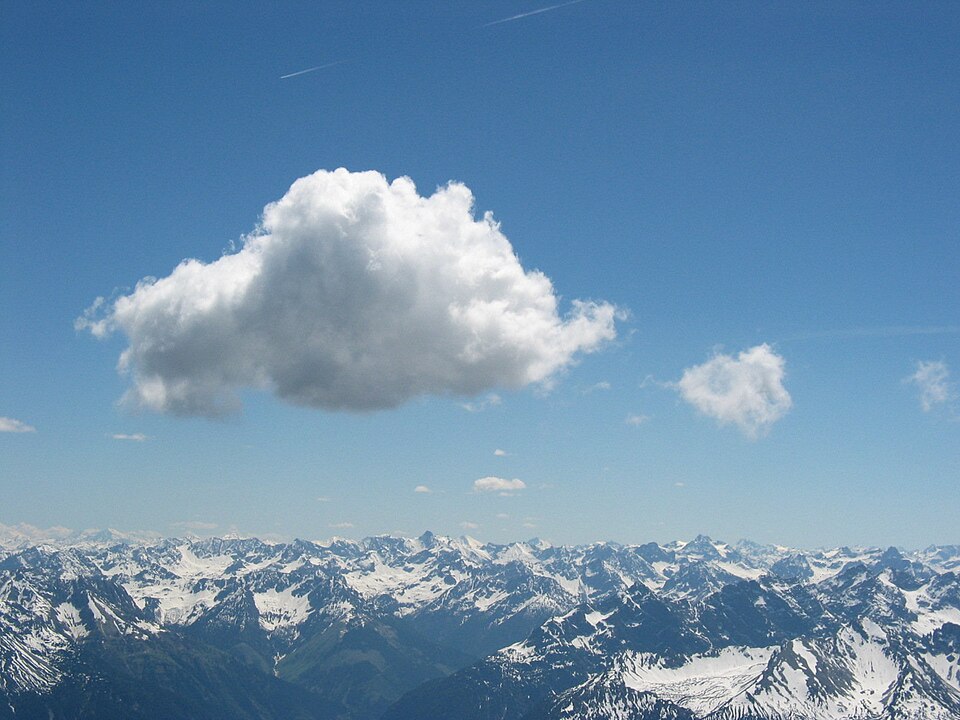
Why it matters. Clouds affect both rain and temperature. By day, thick clouds block sunlight and keep the ground cooler, while at night they act as a blanket and keep it warmer. Hail, meanwhile, can flatten standing crops in minutes, which is why hailstorms in spring are a serious worry for farmers growing wheat, fruit and vegetables.
Three ways to make rain
For rain to fall, moist air must rise, because rising air cools and cooling brings condensation. So the real question is: what lifts the air? There are three main ways, and they give us the three types of rainfall.
The first is convectional rain. When the ground is strongly heated, the air above it warms, becomes light and rises in strong currents. As it rises, it cools, its vapour condenses into tall clouds, and heavy showers fall, often with thunder and lightning.
Convectional rain is common in equatorial regions, where the sun heats the ground strongly every day. There, mornings are often bright, clouds build up by noon, and heavy rain falls in the afternoon. In India, many pre-monsoon thunderstorms are also convectional.
The second is orographic or relief rain. When moist wind blowing from the sea meets a mountain, it is forced to climb the slope. As it rises it cools, and heavy rain falls on the side facing the wind, called the windward side.
By the time the air crosses the top and descends on the other side, called the leeward side, it has lost most of its moisture. Descending air also warms up, so clouds dissolve. This drier leeward area is called a rain-shadow area.
The third is cyclonic or frontal rain. Inside a cyclone, or along a front where a warm air mass meets a cold one, the warm air is forced to rise over the cold air. As it rises, it cools and gives rain, which can last for hours and spread over a large area.
Rising air cools for a simple reason. As it rises, the pressure around it falls, so it expands, and expanding uses up its own energy. It cools without giving heat to anything around it, which is called adiabatic cooling. Dry air cools by about 9.8°C for every kilometre it rises, while saturated air cools more slowly, about 5 to 9°C per kilometre, because condensation releases latent heat inside it.
This gap decides whether clouds grow tall. If the surrounding air cools faster with height than a rising parcel does, the parcel stays warmer and lighter and keeps climbing, so the air is unstable and towering storm clouds form. If the surrounding air cools slowly, or even warms with height as in an inversion, the parcel soon becomes heavier and sinks back, so the air is stable and skies stay clear. Sinking air warms in the same way, which is why air coming down a mountain is warm and dry.
Why it matters. These three mechanisms explain most of the rain on Earth, including India's. The monsoon brings much of its rain where winds climb hills, cyclones bring heavy coastal rain, and afternoon storms bring local showers. Knowing which mechanism dominates a region helps explain why some places flood and others face drought.
Where rain falls: the world and India
Rain is not spread evenly across the Earth. In general, rainfall decreases from the equator towards the poles. The equatorial belt, with strong heating and rising air almost every day, is the wettest part of the planet.
Rainfall also changes from the coast to the interior. Coastal areas usually receive more rain than the interiors of continents, because moist winds from the sea drop much of their water before they travel far inland. This is why the centres of large continents, such as Central Asia, tend to be dry.
Mountains add their own pattern. Slopes that face moist winds are wet, while the land behind them is dry. In the middle latitudes, where westerly winds blow from the ocean, the western coasts of continents are often wetter, while in the tropics, where winds blow from the east, eastern coasts are often wetter.
India shows these patterns clearly. During the monsoon, moist winds from the Arabian Sea strike the Western Ghats. Their windward western slopes receive very heavy rain, while the Deccan plateau to the east lies in a rain shadow and receives much less.
In the north-east, moist winds funnelled into the hills of Meghalaya produce some of the heaviest rainfall on Earth. In contrast, the Thar desert in the north-west lies far from the main moisture paths and receives very little. Within one country, the rainfall can therefore range from extremely wet to desert-dry.
Why it matters. The map of rain explains the map of human activity in India. Rice and dense populations follow heavy rain, while millets, pastoralism and irrigation projects follow scarce rain. Rain-shadow regions like parts of the Deccan are among the most drought-prone in the country, which shapes policies on watershed development, crop choice and water storage.
Quick revision
- Absolute humidity is the actual water vapour in a volume of air, while relative humidity is the percentage of the air's capacity that is filled at that temperature.
- Air that is full of vapour is saturated, and the temperature at which this happens is the dew point.
- Condensation turns vapour into water when air cools to its dew point, and it releases latent heat.
- Dew forms when the dew point is above freezing and frost when it is below, while fog is a cloud near the ground and fog with smoke is smog.
- The four basic clouds are cirrus (high, feathery), cumulus (cotton-like), stratus (layered) and nimbus (dark rain clouds).
- Precipitation falls as rain, snow, sleet or hail, and hail forms in tall storm clouds.
- The three types of rain are convectional (rising heated air), orographic (air forced up mountains, with a rain shadow on the leeward side) and cyclonic or frontal.
- Rising air cools adiabatically: dry air about 9.8°C per km, saturated air about 5–9°C per km; fast cooling of the surrounding air means unstable air and storm clouds.
- Rain generally decreases from the equator to the poles and from coasts to interiors, and in India the Western Ghats are wet while the Deccan lies in a rain shadow.