

HPSC HCS · Module 31 · Mains depth · 14 min
North and South America: cordilleras, great rivers and resources
What HPSC HCS asks from this chapter
Syllabus lines this chapter covers:
- Prelims Paper I: General Studies · Indian and world geography
- Mains · GS I: culture, modern and world history, society, geography, Haryana issues
HPSC HCS has asked 1 question from this chapter (2023); 2 from its whole module.
Read at full depth: basics, the standard layer and the Mains analysis.
Start from zero: two continents on one plan
North America and South America are joined by the narrow land bridge of Central America, now cut by the Panama Canal. Together they stretch from the Arctic almost to Antarctica, so they cover every climate from ice cap to rainforest.
Both continents follow a common plan. Along the west run young, high fold mountains: the Rockies in the north and the Andes in the south, raised where Pacific plates push against the continents. In the east lie old, worn-down highlands: the Appalachians in North America and the Guiana and Brazilian highlands in South America.
Between these lie vast plains drained by great rivers: the Mississippi–Missouri in the north and the Amazon, Orinoco and Paraná in the south. Because the high mountains lie in the far west, most of the rivers flow east or south to the Atlantic and the Gulf of Mexico, and only short rivers reach the Pacific.
Why it matters. This simple plan helps you place almost every feature on the map. It also explains why the west coasts face earthquakes and volcanoes, while the eastern plains became great farming and industrial regions.
North America: shields, plains and lakes
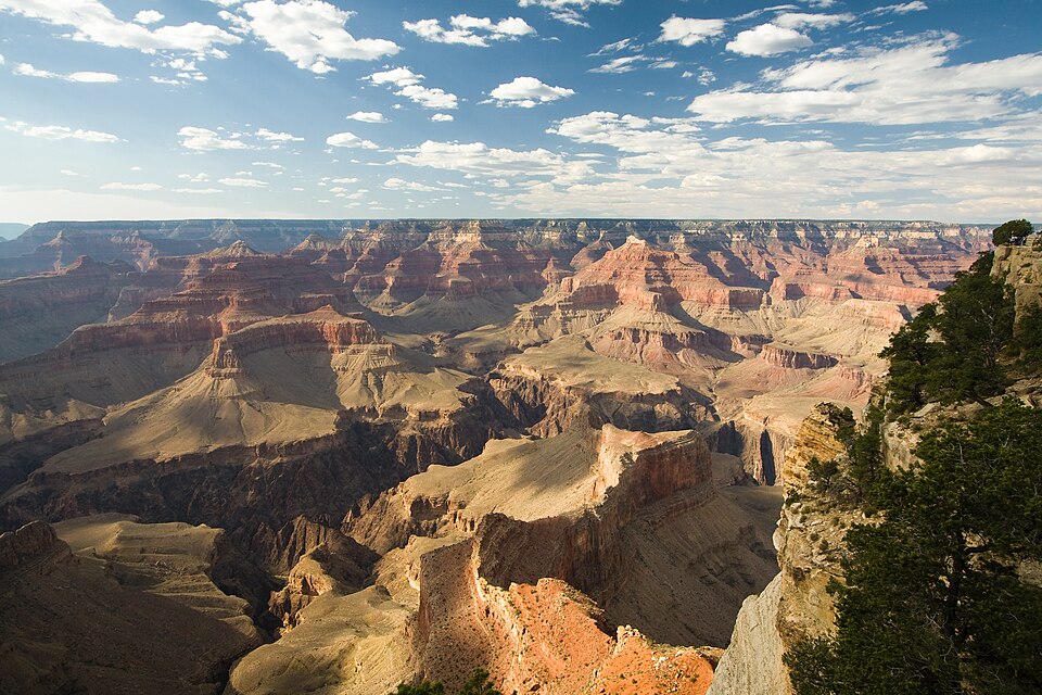
In the far west, the Rockies and the Coast Ranges enclose high plateaus and basins, such as the dry Great Basin and the Colorado Plateau, where the Colorado river has cut the deep Grand Canyon. The San Andreas Fault in California, where two plates slide past each other, causes frequent earthquakes.
East of the Rockies spread the Great Plains and the Prairies, sloping gently towards the centre. North of them lies the Canadian Shield, a huge block of ancient rock around Hudson Bay, scraped by Ice Age glaciers into a land of thin soils, forests, lakes and minerals.
The ice also carved the five Great Lakes: Superior, Michigan, Huron, Erie and Ontario. Lake Superior is the largest freshwater lake in the world by area. Between Lake Erie and Lake Ontario, the water plunges over Niagara Falls, and the St Lawrence river carries it to the Atlantic. With locks and canals, the Great Lakes–St Lawrence Seaway lets ocean ships sail deep into the continent.
The Mississippi, joined by the Missouri and the Ohio, drains the central plains into the Gulf of Mexico, building a large bird's-foot delta near New Orleans. In the north, the Mackenzie flows to the Arctic and the Yukon to the Bering Sea. To the north-east lies Greenland, the largest island in the world, part of North America by geography but an autonomous territory of Denmark, and mostly buried under an ice sheet.
Why it matters. The Great Lakes and the Mississippi gave North America cheap water transport. This helped make the central plains and the lake shores into one of the world's great farming and industrial regions.
South America: the Andes and the Amazon
The Andes run for about 7,000 km along the whole western edge of South America, making them the longest continental mountain range in the world. They rise where the oceanic Nazca plate sinks beneath the South American plate, so they have many volcanoes and frequent earthquakes. Aconcagua in Argentina is the highest peak of the Americas and of the Southern Hemisphere.
Between the ranges in Peru and Bolivia lies the Altiplano, a high, cold plateau. It holds Lake Titicaca, one of the highest navigable lakes in the world, shared by Peru and Bolivia.
East of the Andes lies the Amazon basin, the largest river basin in the world. The Amazon carries more water than any other river, roughly a fifth of all the fresh water that rivers pour into the oceans. Its basin holds the largest tropical rainforest on Earth, which stores vast amounts of carbon and countless species.
To the north, the Orinoco drains the Llanos grasslands of Venezuela and Colombia, and on a tributary in the Guiana Highlands, Angel Falls in Venezuela is the highest waterfall in the world. To the south, the Paraná–Paraguay system drains to the Río de la Plata estuary, and the spectacular Iguazu Falls lie on the Argentina–Brazil border.
On the west coast of Chile, the Atacama Desert is one of the driest places on Earth. The cold Humboldt (Peru) Current offshore chills the air so it cannot rise and make rain, the Andes block moist air from the east, and the subtropical high pressure keeps the sky clear. Further south lie the dry plateau of Patagonia and, at the tip of the continent, Cape Horn and the Strait of Magellan.
Why it matters. Amazon deforestation affects the global climate and biodiversity. The cold Humboldt Current also feeds one of the world's richest fisheries off Peru, which collapses in El Niño years.
Farming, minerals and industry
The temperate grasslands of the Americas became some of the world's great granaries. The Prairies of the United States and Canada grow huge amounts of wheat, maize and soybeans on extensive, highly mechanised farms. The Pampas of Argentina and Uruguay, with deep fertile soils, are famous for wheat and beef cattle, exported through Buenos Aires.
Brazil has become a farming giant, the world's leading exporter of soybeans, coffee, sugar and beef. Much of this expansion has come by clearing the Cerrado savanna and the edges of the Amazon, which raises serious environmental concerns.
The Americas are rich in minerals. Chile is the world's largest producer of copper, and Peru is another major producer. Brazil mines vast amounts of iron ore at Carajás in the Amazon and in Minas Gerais. Oil comes from the Gulf of Mexico and Texas, Alaska, Venezuela, which has very large reserves, and the oil sands of Alberta in Canada.
The salt flats of Chile, Argentina and Bolivia form the "lithium triangle", holding much of the world's lithium, vital for batteries.
North America's manufacturing belt grew in the north-eastern United States and around the Great Lakes, using Appalachian coal, iron ore from near Lake Superior and cheap lake transport. Detroit became the centre of the car industry and Pittsburgh of steel. Later, newer industries such as aerospace, oil and electronics grew in the South and on the Pacific coast, including Silicon Valley in California.
Why it matters. The Americas are major suppliers of food, energy and critical minerals to the world. India buys oil, copper and lithium and is exploring lithium partnerships with Argentina, Chile and Bolivia.
Central America, the Caribbean and the Panama Canal
Central America is a narrow, mountainous land bridge between Mexico and Colombia, lined with volcanoes and shaken by earthquakes. To its east lies the Caribbean Sea, dotted with island chains such as Cuba, Jamaica, Hispaniola and the Lesser Antilles, many of them volcanic or coral. The region is often struck by hurricanes forming over the warm Atlantic in late summer.
At its narrowest point, in Panama, the Panama Canal, opened in 1914, links the Atlantic and Pacific oceans. Before it, ships between the two coasts of the Americas had to sail around Cape Horn at the stormy southern tip of South America.
The canal uses locks to lift ships up to the level of the artificial Gatun Lake and lower them again on the other side. Because each passage uses large amounts of fresh water from the lake, severe droughts have forced limits on the number of ships, showing how climate can disrupt world trade.
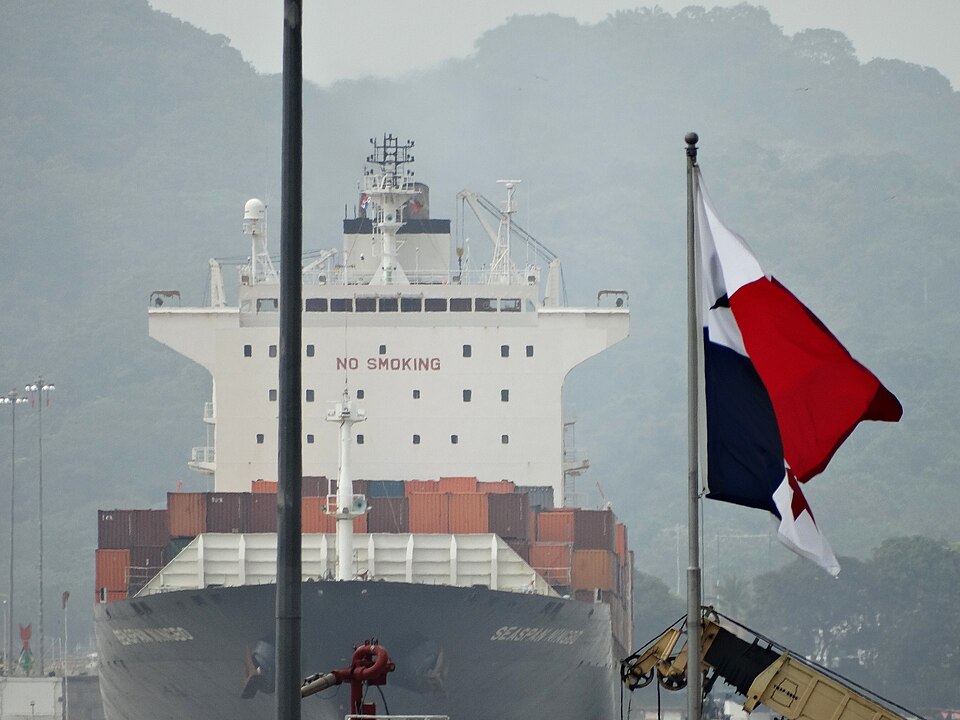
Why it matters. The Panama Canal is a key link in world shipping, alongside Suez. Comparing the two canals, sea-level Suez and lock-based Panama, is a common exam point.
Climate and people of the Americas
Because the Americas stretch across almost every latitude, they have every climate type. North America ranges from tundra in northern Canada and Alaska, through taiga and the temperate east, to hot deserts in the south-west and a Mediterranean climate in California. South America is mostly tropical: equatorial rainforest in the Amazon, savanna in the Llanos and Brazilian highlands, and temperate grasslands and deserts further south.
The western mountains strongly affect climate. Moist Pacific winds drop heavy rain on the coasts of British Columbia and southern Chile, but leave dry rain shadows inland, such as the Great Basin and Patagonia. In North America, the lack of an east–west mountain barrier lets cold Arctic air sweep south and warm Gulf air sweep north, producing violent tornadoes on the plains.
Most people in the Americas live near the coasts and in the eastern lowlands. The United States and Canada are highly urbanised and wealthy, while Latin America is also highly urbanised but has wide inequality and large informal settlements around cities such as São Paulo and Mexico City. Indigenous peoples, European settlers, Africans brought as enslaved labour, and later migrants, including from India, have shaped a diverse population.
Why it matters. The Americas show how mountains and the absence of barriers shape weather extremes. Their large Indian diaspora and trade links make them important partners for India.
Mains lens: what, why, where and so what
This chapter supports GS Paper I (world physical geography, ocean currents, distribution of resources) and links to GS Paper III (environment, critical minerals). Here are four angles.
1. Common plan. Western fold mountains, eastern shields, central plains.
2. Rivers and forests. The Amazon basin and its global role.
3. Currents and deserts. Humboldt Current, Atacama and El Niño.
4. Resources and routes. Copper, lithium, oil and the Panama Canal.
Mains lens: practice questions and answer plans
Now turn this understanding into written answers. The four questions below are written in the UPSC style, but they are our own practice questions, not previous-year questions. The real previous-year questions of your exam appear in the "Previous year questions" box once we have matched them with the official papers.
Q1. "Explain why the Atacama is one of the driest deserts on Earth." (150 words)
- Cold current, rain shadow and subtropical high.
- Mention its minerals (copper, lithium, nitrates).
Q2. "The Amazon rainforest is called the lungs of the planet. Examine its global importance and the threats it faces." (150 words)
- Carbon store, biodiversity, rainfall recycling.
- Cattle, soy, mining and fire.
Q3. "Compare the Prairies and the Pampas as grassland agricultural regions." (250 words)
- Introduction: Locate both.
- Body: Climate, soils, crops, mechanisation, exports.
- Conclusion: Their role in world food security.
Q4. "Discuss the importance of the 'lithium triangle' for the clean energy transition and India." (150 words)
- Location in salt flats of three countries.
- Batteries, supply security and India's partnerships.
Useful keywords: common plan, Rockies, Andes, Appalachians, Canadian Shield, Great Plains, Prairies, Grand Canyon, San Andreas Fault, Great Lakes, Lake Superior, Niagara, St Lawrence Seaway, Mississippi–Missouri, Greenland, Aconcagua, Nazca plate, Altiplano, Titicaca, Amazon, Orinoco, Angel Falls, Paraná, Iguazu, Atacama, Humboldt Current, Patagonia, Cape Horn, Pampas, Cerrado, Carajás, copper, lithium triangle, oil sands, manufacturing belt, Silicon Valley, Panama Canal, Gatun Lake, hurricanes, tornadoes.
Quick revision
- Common plan: western young fold mountains (Rockies, Andes), eastern old highlands (Appalachians, Guiana, Brazilian), central plains.
- Andes: longest continental range; Aconcagua highest in Americas; Altiplano with Lake Titicaca.
- Amazon: largest discharge and basin, largest tropical rainforest.
- Mississippi–Missouri → Gulf of Mexico; Great Lakes + St Lawrence → Atlantic; Superior largest freshwater lake by area.
- Atacama: cold Humboldt Current + rain shadow + subtropical high.
- Prairies and Pampas: wheat and cattle.
- Panama Canal 1914: lock canal, Gatun Lake, avoids Cape Horn.
- Copper (Chile, Peru), iron ore (Brazil), oil (Venezuela, Gulf, oil sands), lithium triangle.
- Angel Falls (Venezuela): highest waterfall. Niagara: between Erie and Ontario. Greenland: largest island, Denmark.
HPSC HCS questions from this chapter
Match List I with List II List I a. Angel Falls b. Yosemite Falls c. Niagra Falls d. Victoria Falls List II i. Venezuela ii. California iii. South Africa iv. USA and Canada Choose the correct answer from the options given below:
- (a) a-i, b-ii, c-iv, d-iii
- (b) a-ii, b-i, c-iii, d-iv
- (c) a-iii, b-iv, c-ii, d-i
- (d) a-iv, b-iii, c-i, d-ii
Show answer
(a) a-i, b-ii, c-iv, d-iii · our answer; official key awaited